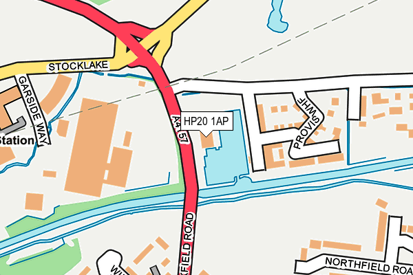
HP20 1AP is located in the Aylesbury East electoral ward, within the unitary authority of Buckinghamshire and the English Parliamentary constituency of Buckingham. The Sub Integrated Care Board (ICB) Location is NHS Buckinghamshire, Oxfordshire and Berkshire West ICB - 14Y and the police force is Thames Valley. This postcode has been in use since August 2013.


GetTheData
Source: OS OpenMap – Local (Ordnance Survey)
Source: OS VectorMap District (Ordnance Survey)
Licence: Open Government Licence (requires attribution)
| Easting | 483538 |
| Northing | 214181 |
| Latitude | 51.820028 |
| Longitude | -0.789391 |
GetTheData
Source: Open Postcode Geo
Licence: Open Government Licence
| Country | England |
| Postcode District | HP20 |
➜ See where HP20 is on a map ➜ Where is Aylesbury? | |
GetTheData
Source: Land Registry Price Paid Data
Licence: Open Government Licence
Elevation or altitude of HP20 1AP as distance above sea level:
| Metres | Feet | |
|---|---|---|
| Elevation | 80m | 262ft |
Elevation is measured from the approximate centre of the postcode, to the nearest point on an OS contour line from OS Terrain 50, which has contour spacing of ten vertical metres.
➜ How high above sea level am I? Find the elevation of your current position using your device's GPS.
GetTheData
Source: Open Postcode Elevation
Licence: Open Government Licence
| Ward | Aylesbury East |
| Constituency | Buckingham |
GetTheData
Source: ONS Postcode Database
Licence: Open Government Licence
| Narbeth Drive | Aylesbury | 299m |
| Narbeth Drive | Aylesbury | 305m |
| Meadow Way | Aylesbury | 355m |
| Wingate Walk (Oakfield Road) | Aylesbury | 357m |
| Fieldway | Aylesbury | 382m |
| Aylesbury Station | 1.9km |
| Stoke Mandeville Station | 3.6km |
| Aylesbury Vale Parkway Station | 5km |
GetTheData
Source: NaPTAN
Licence: Open Government Licence
GetTheData
Source: ONS Postcode Database
Licence: Open Government Licence


➜ Get more ratings from the Food Standards Agency
GetTheData
Source: Food Standards Agency
Licence: FSA terms & conditions
| Last Collection | |||
|---|---|---|---|
| Location | Mon-Fri | Sat | Distance |
| Narbeth Drive | 17:15 | 12:00 | 287m |
| Douglas Road | 17:15 | 12:00 | 408m |
| Walton Way | 17:30 | 12:00 | 593m |
GetTheData
Source: Dracos
Licence: Creative Commons Attribution-ShareAlike
| Risk of HP20 1AP flooding from rivers and sea | Low |
| ➜ HP20 1AP flood map | |
GetTheData
Source: Open Flood Risk by Postcode
Licence: Open Government Licence
The below table lists the International Territorial Level (ITL) codes (formerly Nomenclature of Territorial Units for Statistics (NUTS) codes) and Local Administrative Units (LAU) codes for HP20 1AP:
| ITL 1 Code | Name |
|---|---|
| TLJ | South East (England) |
| ITL 2 Code | Name |
| TLJ1 | Berkshire, Buckinghamshire and Oxfordshire |
| ITL 3 Code | Name |
| TLJ13 | Buckinghamshire |
| LAU 1 Code | Name |
| E06000060 | Buckinghamshire |
GetTheData
Source: ONS Postcode Directory
Licence: Open Government Licence
The below table lists the Census Output Area (OA), Lower Layer Super Output Area (LSOA), and Middle Layer Super Output Area (MSOA) for HP20 1AP:
| Code | Name | |
|---|---|---|
| OA | E00089046 | |
| LSOA | E01017641 | Aylesbury Vale 007A |
| MSOA | E02003658 | Aylesbury Vale 007 |
GetTheData
Source: ONS Postcode Directory
Licence: Open Government Licence
| HP20 1AQ | Provis Wharf | 105m |
| HP20 1LN | Wingate Walk | 234m |
| HP20 1NS | Narbeth Drive | 242m |
| HP20 1LH | Oakfield Road | 251m |
| HP20 1PD | Northfield Road | 256m |
| HP20 1QH | Northfield Road | 265m |
| HP20 1XL | The Pastures | 305m |
| HP20 1LW | Denby Walk | 306m |
| HP20 1NT | Narbeth Drive | 306m |
| HP20 1XE | Grasslands | 317m |
GetTheData
Source: Open Postcode Geo; Land Registry Price Paid Data
Licence: Open Government Licence