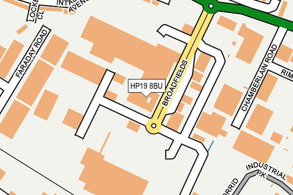
HP19 8BU is located in the Aylesbury North West electoral ward, within the unitary authority of Buckinghamshire and the English Parliamentary constituency of Aylesbury. The Sub Integrated Care Board (ICB) Location is NHS Buckinghamshire, Oxfordshire and Berkshire West ICB - 14Y and the police force is Thames Valley. This postcode has been in use since June 2000.


GetTheData
Source: OS OpenMap – Local (Ordnance Survey)
Source: OS VectorMap District (Ordnance Survey)
Licence: Open Government Licence (requires attribution)
| Easting | 480332 |
| Northing | 214447 |
| Latitude | 51.822888 |
| Longitude | -0.835833 |
GetTheData
Source: Open Postcode Geo
Licence: Open Government Licence
| Country | England |
| Postcode District | HP19 |
| ➜ HP19 open data dashboard ➜ See where HP19 is on a map ➜ Where is Aylesbury? | |
GetTheData
Source: Land Registry Price Paid Data
Licence: Open Government Licence
Elevation or altitude of HP19 8BU as distance above sea level:
| Metres | Feet | |
|---|---|---|
| Elevation | 80m | 262ft |
Elevation is measured from the approximate centre of the postcode, to the nearest point on an OS contour line from OS Terrain 50, which has contour spacing of ten vertical metres.
➜ How high above sea level am I? Find the elevation of your current position using your device's GPS.
GetTheData
Source: Open Postcode Elevation
Licence: Open Government Licence
| Ward | Aylesbury North West |
| Constituency | Aylesbury |
GetTheData
Source: ONS Postcode Database
Licence: Open Government Licence
| January 2024 | Vehicle crime | On or near Hanover Close | 377m |
| November 2023 | Drugs | On or near Hanover Close | 377m |
| October 2023 | Violence and sexual offences | On or near Hanover Close | 377m |
| ➜ Get more crime data in our Crime section | |||
GetTheData
Source: data.police.uk
Licence: Open Government Licence
| Tesco Broadfields (Broadfields) | Aylesbury | 108m |
| Broadfields Roundabout (Bicester Road) | Quarrendon Estate | 281m |
| Devereux Place (Bicester Road) | Quarrendon Estate | 301m |
| Devereux Place (Bicester Road) | Quarrendon Estate | 308m |
| Brunel Park (Smeaton Close) | Aylesbury | 345m |
| Aylesbury Station | 1.7km |
| Aylesbury Vale Parkway Station | 1.9km |
| Stoke Mandeville Station | 5.3km |
GetTheData
Source: NaPTAN
Licence: Open Government Licence
GetTheData
Source: ONS Postcode Database
Licence: Open Government Licence


➜ Get more ratings from the Food Standards Agency
GetTheData
Source: Food Standards Agency
Licence: FSA terms & conditions
| Last Collection | |||
|---|---|---|---|
| Location | Mon-Fri | Sat | Distance |
| Tesco | 17:00 | 12:00 | 146m |
| Devereaux Place | 17:15 | 12:00 | 308m |
| Meadowcroft P.o. | 17:15 | 12:00 | 349m |
GetTheData
Source: Dracos
Licence: Creative Commons Attribution-ShareAlike
| Facility | Distance |
|---|---|
| Nuffield Health (Aylesbury) Trenchard Street, Aylesbury Swimming Pool, Health and Fitness Gym, Studio | 563m |
| St Marys Church Of England School Keen Close, Aylesbury Sports Hall, Grass Pitches | 597m |
| Thomas Hickman School Belgrave Road, Aylesbury Grass Pitches | 626m |
GetTheData
Source: Active Places
Licence: Open Government Licence
| School | Phase of Education | Distance |
|---|---|---|
| St Mary's Church of England School Keen Close, Fairford Leys, Aylesbury, HP19 7WF | Primary | 617m |
| Thomas Hickman School Belgrave Road, Aylesbury, HP19 9HP | Primary | 627m |
| The Pace Centre Coventon Road, Coventon Road, Aylesbury, HP19 9JL | Not applicable | 630m |
GetTheData
Source: Edubase
Licence: Open Government Licence
The below table lists the International Territorial Level (ITL) codes (formerly Nomenclature of Territorial Units for Statistics (NUTS) codes) and Local Administrative Units (LAU) codes for HP19 8BU:
| ITL 1 Code | Name |
|---|---|
| TLJ | South East (England) |
| ITL 2 Code | Name |
| TLJ1 | Berkshire, Buckinghamshire and Oxfordshire |
| ITL 3 Code | Name |
| TLJ13 | Buckinghamshire |
| LAU 1 Code | Name |
| E06000060 | Buckinghamshire |
GetTheData
Source: ONS Postcode Directory
Licence: Open Government Licence
The below table lists the Census Output Area (OA), Lower Layer Super Output Area (LSOA), and Middle Layer Super Output Area (MSOA) for HP19 8BU:
| Code | Name | |
|---|---|---|
| OA | E00089350 | |
| LSOA | E01017708 | Aylesbury Vale 012D |
| MSOA | E02003663 | Aylesbury Vale 012 |
GetTheData
Source: ONS Postcode Directory
Licence: Open Government Licence
| HP19 8EW | Chamberlain Road | 181m |
| HP19 8DY | Chamberlain Road | 227m |
| HP19 8HE | Intalbury Avenue | 231m |
| HP19 8HA | Devereux Place | 233m |
| HP19 9LE | Monmouth Close | 259m |
| HP19 8HB | Intalbury Avenue | 287m |
| HP19 8UZ | Locke Close | 290m |
| HP19 8HD | Intalbury Avenue | 307m |
| HP19 9LD | Monmouth Close | 313m |
| HP19 8FN | Philips Road | 326m |
GetTheData
Source: Open Postcode Geo; Land Registry Price Paid Data
Licence: Open Government Licence