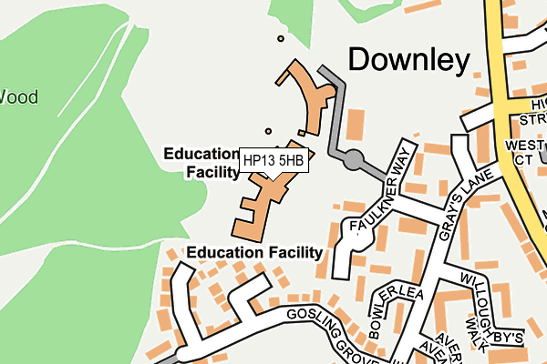
HP13 5HB is located in the Downley electoral ward, within the unitary authority of Buckinghamshire and the English Parliamentary constituency of Wycombe. The Sub Integrated Care Board (ICB) Location is NHS Buckinghamshire, Oxfordshire and Berkshire West ICB - 14Y and the police force is Thames Valley. This postcode has been in use since June 2002.


GetTheData
Source: OS OpenMap – Local (Ordnance Survey)
Source: OS VectorMap District (Ordnance Survey)
Licence: Open Government Licence (requires attribution)
| Easting | 484535 |
| Northing | 195066 |
| Latitude | 51.648045 |
| Longitude | -0.779589 |
GetTheData
Source: Open Postcode Geo
Licence: Open Government Licence
| Country | England |
| Postcode District | HP13 |
| ➜ HP13 open data dashboard ➜ See where HP13 is on a map ➜ Where is Downley? | |
GetTheData
Source: Land Registry Price Paid Data
Licence: Open Government Licence
Elevation or altitude of HP13 5HB as distance above sea level:
| Metres | Feet | |
|---|---|---|
| Elevation | 160m | 525ft |
Elevation is measured from the approximate centre of the postcode, to the nearest point on an OS contour line from OS Terrain 50, which has contour spacing of ten vertical metres.
➜ How high above sea level am I? Find the elevation of your current position using your device's GPS.
GetTheData
Source: Open Postcode Elevation
Licence: Open Government Licence
| Ward | Downley |
| Constituency | Wycombe |
GetTheData
Source: ONS Postcode Database
Licence: Open Government Licence
| June 2022 | Criminal damage and arson | On or near Faulkner Way | 134m |
| June 2022 | Violence and sexual offences | On or near Plomer Green Lane | 278m |
| June 2022 | Violence and sexual offences | On or near Mines Close | 321m |
| ➜ Get more crime data in our Crime section | |||
GetTheData
Source: data.police.uk
Licence: Open Government Licence
| Taylors Turn (Grays Lane) | Downley | 196m |
| Grays Lane | Downley | 261m |
| South View (Grays Lane) | Downley | 332m |
| Memorial Hall (High Street) | Downley | 370m |
| Cross Court Shops (Plomer Green Avenue) | Downley | 380m |
| High Wycombe Station | 3.1km |
| Saunderton Station | 4.4km |
GetTheData
Source: NaPTAN
Licence: Open Government Licence
GetTheData
Source: ONS Postcode Database
Licence: Open Government Licence


➜ Get more ratings from the Food Standards Agency
GetTheData
Source: Food Standards Agency
Licence: FSA terms & conditions
| Last Collection | |||
|---|---|---|---|
| Location | Mon-Fri | Sat | Distance |
| Downley P.o. | 16:45 | 12:00 | 279m |
| Plomer Green Avenue | 16:45 | 12:00 | 581m |
| Rosemary Close | 16:30 | 12:00 | 965m |
GetTheData
Source: Dracos
Licence: Creative Commons Attribution-ShareAlike
| Facility | Distance |
|---|---|
| Chiltern Wood School (Downley Site) Faulkner Way, Downley, High Wycombe Sports Hall, Swimming Pool | 0m |
| Downley War Memorial Hall High Street, Downley, High Wycombe Sports Hall | 346m |
| Downley Common Downley Common, Downley, High Wycombe Grass Pitches | 682m |
GetTheData
Source: Active Places
Licence: Open Government Licence
| School | Phase of Education | Distance |
|---|---|---|
| The Downley School Faulkner Way, Downley, High Wycombe, HP13 5AL | Primary | 111m |
| Millbrook Combined School Mill End Road, High Wycombe, HP12 4BA | Primary | 1.1km |
| The Disraeli School The Pastures, High Wycombe, HP13 5JS | Primary | 1.4km |
GetTheData
Source: Edubase
Licence: Open Government Licence
The below table lists the International Territorial Level (ITL) codes (formerly Nomenclature of Territorial Units for Statistics (NUTS) codes) and Local Administrative Units (LAU) codes for HP13 5HB:
| ITL 1 Code | Name |
|---|---|
| TLJ | South East (England) |
| ITL 2 Code | Name |
| TLJ1 | Berkshire, Buckinghamshire and Oxfordshire |
| ITL 3 Code | Name |
| TLJ13 | Buckinghamshire |
| LAU 1 Code | Name |
| E06000060 | Buckinghamshire |
GetTheData
Source: ONS Postcode Directory
Licence: Open Government Licence
The below table lists the Census Output Area (OA), Lower Layer Super Output Area (LSOA), and Middle Layer Super Output Area (MSOA) for HP13 5HB:
| Code | Name | |
|---|---|---|
| OA | E00090127 | |
| LSOA | E01017861 | Wycombe 006E |
| MSOA | E02003701 | Wycombe 006 |
GetTheData
Source: ONS Postcode Directory
Licence: Open Government Licence
| HP13 5UA | Faulkner Way | 129m |
| HP13 5UD | Bowler Lea | 148m |
| HP13 5YS | Gosling Grove | 174m |
| HP13 5TY | Taylors Turn | 179m |
| HP13 5UF | Gosling Grove | 184m |
| HP13 5TZ | Grays Lane | 185m |
| HP13 5TU | Plomer Green Lane | 233m |
| HP13 5UB | Willoughbys Walk | 291m |
| HP13 5TG | West Court | 306m |
| HP13 5TT | Plomer Green Lane | 311m |
GetTheData
Source: Open Postcode Geo; Land Registry Price Paid Data
Licence: Open Government Licence