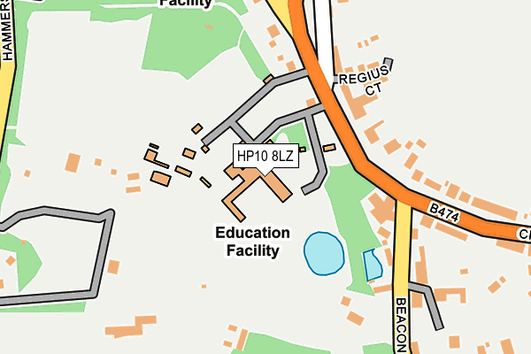
HP10 8LZ is located in the Tylers Green and Loudwater electoral ward, within the unitary authority of Buckinghamshire and the English Parliamentary constituency of Wycombe. The Sub Integrated Care Board (ICB) Location is NHS Buckinghamshire, Oxfordshire and Berkshire West ICB - 14Y and the police force is Thames Valley. This postcode has been in use since January 1980.


GetTheData
Source: OS OpenMap – Local (Ordnance Survey)
Source: OS VectorMap District (Ordnance Survey)
Licence: Open Government Licence (requires attribution)
| Easting | 490670 |
| Northing | 193437 |
| Latitude | 51.632447 |
| Longitude | -0.691364 |
GetTheData
Source: Open Postcode Geo
Licence: Open Government Licence
| Country | England |
| Postcode District | HP10 |
| ➜ HP10 open data dashboard ➜ See where HP10 is on a map ➜ Where is Penn? | |
GetTheData
Source: Land Registry Price Paid Data
Licence: Open Government Licence
Elevation or altitude of HP10 8LZ as distance above sea level:
| Metres | Feet | |
|---|---|---|
| Elevation | 160m | 525ft |
Elevation is measured from the approximate centre of the postcode, to the nearest point on an OS contour line from OS Terrain 50, which has contour spacing of ten vertical metres.
➜ How high above sea level am I? Find the elevation of your current position using your device's GPS.
GetTheData
Source: Open Postcode Elevation
Licence: Open Government Licence
| Ward | Tylers Green And Loudwater |
| Constituency | Wycombe |
GetTheData
Source: ONS Postcode Database
Licence: Open Government Licence
| June 2022 | Public order | On or near Elm Road | 195m |
| June 2022 | Violence and sexual offences | On or near St Margaret'S Close | 341m |
| April 2022 | Other theft | On or near St Margaret'S Close | 341m |
| ➜ Get more crime data in our Crime section | |||
GetTheData
Source: data.police.uk
Licence: Open Government Licence
| The Pond (School Road) | Penn | 262m |
| The Pond (School Road) | Penn | 274m |
| The Red Lion (Elm Road) | Penn | 278m |
| The Red Lion (Elm Road) | Penn | 282m |
| School Road | Penn | 390m |
| High Wycombe Station | 3.8km |
| Beaconsfield Station | 4km |
GetTheData
Source: NaPTAN
Licence: Open Government Licence
Estimated total energy consumption in HP10 8LZ by fuel type, 2015.
| Consumption (kWh) | 195,745 |
|---|---|
| Meter count | 6 |
| Mean (kWh/meter) | 32,624 |
| Median (kWh/meter) | 28,328 |
GetTheData
Source: Postcode level gas estimates: 2015 (experimental)
Source: Postcode level electricity estimates: 2015 (experimental)
Licence: Open Government Licence


➜ Get more ratings from the Food Standards Agency
GetTheData
Source: Food Standards Agency
Licence: FSA terms & conditions
| Last Collection | |||
|---|---|---|---|
| Location | Mon-Fri | Sat | Distance |
| Penn P.o. | 16:15 | 11:45 | 456m |
| Beacon Hill | 15:15 | 09:30 | 477m |
| Penn Church | 15:30 | 09:30 | 867m |
GetTheData
Source: Dracos
Licence: Creative Commons Attribution-ShareAlike
| Facility | Distance |
|---|---|
| Penn School (Closed) Church Road, Penn, High Wycombe Grass Pitches, Sports Hall | 1m |
| Penn & Tylers Green Cricket Club Elm Road, Penn, High Wycombe Grass Pitches | 510m |
| French School Meadow Elm Road, Penn Grass Pitches, Outdoor Tennis Courts | 513m |
GetTheData
Source: Active Places
Licence: Open Government Licence
| School | Phase of Education | Distance |
|---|---|---|
| Tylers Green First School School Road, Penn, High Wycombe, HP10 8EF | Primary | 315m |
| Tylers Green Middle School Cock Lane, Tylers Green, High Wycombe, HP10 8DS | Primary | 812m |
| Ash Hill Primary School Herbert Road, High Wycombe, HP13 7HT | Primary | 1.2km |
GetTheData
Source: Edubase
Licence: Open Government Licence
The below table lists the International Territorial Level (ITL) codes (formerly Nomenclature of Territorial Units for Statistics (NUTS) codes) and Local Administrative Units (LAU) codes for HP10 8LZ:
| ITL 1 Code | Name |
|---|---|
| TLJ | South East (England) |
| ITL 2 Code | Name |
| TLJ1 | Berkshire, Buckinghamshire and Oxfordshire |
| ITL 3 Code | Name |
| TLJ13 | Buckinghamshire |
| LAU 1 Code | Name |
| E06000060 | Buckinghamshire |
GetTheData
Source: ONS Postcode Directory
Licence: Open Government Licence
The below table lists the Census Output Area (OA), Lower Layer Super Output Area (LSOA), and Middle Layer Super Output Area (MSOA) for HP10 8LZ:
| Code | Name | |
|---|---|---|
| OA | E00090499 | |
| LSOA | E01017937 | Wycombe 009A |
| MSOA | E02003704 | Wycombe 009 |
GetTheData
Source: ONS Postcode Directory
Licence: Open Government Licence
| HP10 8LY | Church Road | 98m |
| HP10 8LB | Elm Road | 202m |
| HP10 8LU | School Road | 208m |
| HP10 8LX | School Road | 234m |
| HP10 8LD | Red Lion Cottages | 256m |
| HP10 8NE | Fairview | 273m |
| HP10 8EZ | St Margarets Close | 329m |
| HP10 8HB | Hammersley Lane | 340m |
| HP10 8EF | School Road | 356m |
| HP10 8LF | Elm Road | 366m |
GetTheData
Source: Open Postcode Geo; Land Registry Price Paid Data
Licence: Open Government Licence