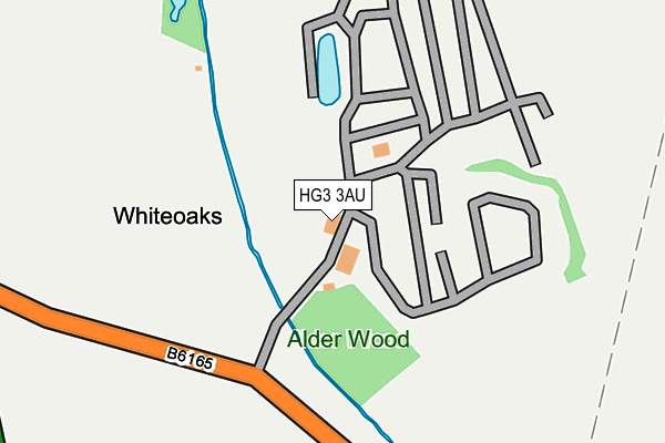
HG3 3AU is located in the Masham & Fountains electoral ward, within the unitary authority of North Yorkshire and the English Parliamentary constituency of Harrogate and Knaresborough. The Sub Integrated Care Board (ICB) Location is NHS Humber and North Yorkshire ICB - 42D and the police force is North Yorkshire. This postcode has been in use since April 1985.


GetTheData
Source: OS OpenMap – Local (Ordnance Survey)
Source: OS VectorMap District (Ordnance Survey)
Licence: Open Government Licence (requires attribution)
| Easting | 428966 |
| Northing | 460226 |
| Latitude | 54.037221 |
| Longitude | -1.559220 |
GetTheData
Source: Open Postcode Geo
Licence: Open Government Licence
| Country | England |
| Postcode District | HG3 |
| ➜ HG3 open data dashboard ➜ See where HG3 is on a map | |
GetTheData
Source: Land Registry Price Paid Data
Licence: Open Government Licence
Elevation or altitude of HG3 3AU as distance above sea level:
| Metres | Feet | |
|---|---|---|
| Elevation | 70m | 230ft |
Elevation is measured from the approximate centre of the postcode, to the nearest point on an OS contour line from OS Terrain 50, which has contour spacing of ten vertical metres.
➜ How high above sea level am I? Find the elevation of your current position using your device's GPS.
GetTheData
Source: Open Postcode Elevation
Licence: Open Government Licence
| Ward | Masham & Fountains |
| Constituency | Harrogate And Knaresborough |
GetTheData
Source: ONS Postcode Database
Licence: Open Government Licence
| Ripley Roundabout (Ripon Road) | Ripley | 378m |
| Ripley Roundabout (Ripon Road) | Ripley | 401m |
| Nidd Bridge (Ripon Road) | Ripley | 457m |
| Nidd Bridge (Ripon Road) | Ripley | 458m |
| Cross (Orchard Lane) | Ripley | 624m |
| Harrogate Station | 5.1km |
| Starbeck Station | 5.7km |
GetTheData
Source: NaPTAN
Licence: Open Government Licence
GetTheData
Source: ONS Postcode Database
Licence: Open Government Licence


➜ Get more ratings from the Food Standards Agency
GetTheData
Source: Food Standards Agency
Licence: FSA terms & conditions
| Last Collection | |||
|---|---|---|---|
| Location | Mon-Fri | Sat | Distance |
| Ripley P.o. | 17:00 | 12:15 | 622m |
| Nidd Bridge Station | 16:30 | 09:45 | 1,045m |
| Nidd Village | 16:30 | 09:45 | 1,330m |
GetTheData
Source: Dracos
Licence: Creative Commons Attribution-ShareAlike
| Facility | Distance |
|---|---|
| Ripley Cricket Club Ripley, Harrogate Grass Pitches | 589m |
| Ripley Star Club Ripley, Harrogate Sports Hall | 615m |
| Nidd Hall Leisure Club Nidd, Harrogate Swimming Pool, Health and Fitness Gym, Studio, Outdoor Tennis Courts | 1.3km |
GetTheData
Source: Active Places
Licence: Open Government Licence
| School | Phase of Education | Distance |
|---|---|---|
| Ripley Endowed Church of England School Main Street, Ripley, Ripley Endowed C Of E School, HARROGATE, HG3 3AY | Primary | 669m |
| Killinghall Church of England Primary School Otley Road, Killinghall, Harrogate, HG3 2DW | Primary | 2km |
| Hampsthwaite Church of England Primary School Church Lane, Hampsthwaite, Harrogate, HG3 2EZ | Primary | 3.3km |
GetTheData
Source: Edubase
Licence: Open Government Licence
The below table lists the International Territorial Level (ITL) codes (formerly Nomenclature of Territorial Units for Statistics (NUTS) codes) and Local Administrative Units (LAU) codes for HG3 3AU:
| ITL 1 Code | Name |
|---|---|
| TLE | Yorkshire and The Humber |
| ITL 2 Code | Name |
| TLE2 | North Yorkshire |
| ITL 3 Code | Name |
| TLE22 | North Yorkshire CC |
| LAU 1 Code | Name |
| E07000165 | Harrogate |
GetTheData
Source: ONS Postcode Directory
Licence: Open Government Licence
The below table lists the Census Output Area (OA), Lower Layer Super Output Area (LSOA), and Middle Layer Super Output Area (MSOA) for HG3 3AU:
| Code | Name | |
|---|---|---|
| OA | E00140892 | |
| LSOA | E01027665 | Harrogate 008C |
| MSOA | E02005768 | Harrogate 008 |
GetTheData
Source: ONS Postcode Directory
Licence: Open Government Licence
| HG3 3AZ | South View | 542m |
| HG3 3AT | Orchard Lane | 572m |
| HG3 2BA | Ripon Road | 602m |
| HG3 3AX | Town Hall Cottages | 616m |
| HG3 3BA | 627m | |
| HG3 3AY | 677m | |
| HG3 3AD | Chantry Court | 707m |
| HG3 3AE | Back Lane | 714m |
| HG3 3BQ | 1015m | |
| HG3 3BG | Station Cottages | 1028m |
GetTheData
Source: Open Postcode Geo; Land Registry Price Paid Data
Licence: Open Government Licence