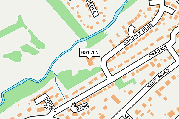
HG1 2LN is located in the Coppice Valley & Duchy electoral ward, within the unitary authority of North Yorkshire and the English Parliamentary constituency of Harrogate and Knaresborough. The Sub Integrated Care Board (ICB) Location is NHS Humber and North Yorkshire ICB - 42D and the police force is North Yorkshire. This postcode has been in use since January 1980.


GetTheData
Source: OS OpenMap – Local (Ordnance Survey)
Source: OS VectorMap District (Ordnance Survey)
Licence: Open Government Licence (requires attribution)
| Easting | 429167 |
| Northing | 455875 |
| Latitude | 53.998091 |
| Longitude | -1.556561 |
GetTheData
Source: Open Postcode Geo
Licence: Open Government Licence
| Country | England |
| Postcode District | HG1 |
| ➜ HG1 open data dashboard ➜ See where HG1 is on a map ➜ Where is Harrogate? | |
GetTheData
Source: Land Registry Price Paid Data
Licence: Open Government Licence
Elevation or altitude of HG1 2LN as distance above sea level:
| Metres | Feet | |
|---|---|---|
| Elevation | 90m | 295ft |
Elevation is measured from the approximate centre of the postcode, to the nearest point on an OS contour line from OS Terrain 50, which has contour spacing of ten vertical metres.
➜ How high above sea level am I? Find the elevation of your current position using your device's GPS.
GetTheData
Source: Open Postcode Elevation
Licence: Open Government Licence
| Ward | Coppice Valley & Duchy |
| Constituency | Harrogate And Knaresborough |
GetTheData
Source: ONS Postcode Database
Licence: Open Government Licence
| January 2024 | Violence and sexual offences | On or near Hartwith Close | 362m |
| December 2023 | Theft from the person | On or near Hartwith Close | 362m |
| December 2023 | Violence and sexual offences | On or near Wood View | 442m |
| ➜ Get more crime data in our Crime section | |||
GetTheData
Source: data.police.uk
Licence: Open Government Licence
| Clarence Drive (Duchy Road) | Harlow Moor | 345m |
| Clarence Drive (Duchy Road) | Harlow Moor | 351m |
| Wood View (Duchy Road) | West Park | 479m |
| Wood View (Duchy Road) | West Park | 481m |
| Hydro (Jenny Field Drive) | New Park | 487m |
| Harrogate Station | 1.4km |
| Hornbeam Park Station | 2.8km |
| Starbeck Station | 3.6km |
GetTheData
Source: NaPTAN
Licence: Open Government Licence
GetTheData
Source: ONS Postcode Database
Licence: Open Government Licence


➜ Get more ratings from the Food Standards Agency
GetTheData
Source: Food Standards Agency
Licence: FSA terms & conditions
| Last Collection | |||
|---|---|---|---|
| Location | Mon-Fri | Sat | Distance |
| Duchy Road East | 17:45 | 13:30 | 391m |
| York Rd/Clarence Drive | 18:15 | 13:15 | 603m |
| Saltergate Drive | 16:00 | 10:30 | 859m |
GetTheData
Source: Dracos
Licence: Creative Commons Attribution-ShareAlike
| Facility | Distance |
|---|---|
| Oakdale Golf Club Oakdale, Harrogate Golf | 0m |
| David Lloyd (Harrogate) Norwood Grove, Harrogate Swimming Pool, Health and Fitness Gym, Indoor Tennis Centre, Studio, Outdoor Tennis Courts | 264m |
| Harrogate Ladies College Clarence Drive, Harrogate Grass Pitches, Sports Hall, Swimming Pool, Squash Courts, Health and Fitness Gym, Outdoor Tennis Courts | 422m |
GetTheData
Source: Active Places
Licence: Open Government Licence
| School | Phase of Education | Distance |
|---|---|---|
| Harrogate Ladies' College Clarence Drive, Harrogate, HG1 2QG | Not applicable | 417m |
| Harrogate Language Academy 8a Royal Parade, Harrogate, HG1 2SZ | Not applicable | 860m |
| Brackenfield School 128 Duchy Road, Harrogate, HG1 2HE | Not applicable | 932m |
GetTheData
Source: Edubase
Licence: Open Government Licence
The below table lists the International Territorial Level (ITL) codes (formerly Nomenclature of Territorial Units for Statistics (NUTS) codes) and Local Administrative Units (LAU) codes for HG1 2LN:
| ITL 1 Code | Name |
|---|---|
| TLE | Yorkshire and The Humber |
| ITL 2 Code | Name |
| TLE2 | North Yorkshire |
| ITL 3 Code | Name |
| TLE22 | North Yorkshire CC |
| LAU 1 Code | Name |
| E07000165 | Harrogate |
GetTheData
Source: ONS Postcode Directory
Licence: Open Government Licence
The below table lists the Census Output Area (OA), Lower Layer Super Output Area (LSOA), and Middle Layer Super Output Area (MSOA) for HG1 2LN:
| Code | Name | |
|---|---|---|
| OA | E00140825 | |
| LSOA | E01027654 | Harrogate 020B |
| MSOA | E02005780 | Harrogate 020 |
GetTheData
Source: ONS Postcode Directory
Licence: Open Government Licence
| HG1 2LW | Oakdale | 126m |
| HG1 2LL | Oakdale | 149m |
| HG1 2LP | Dale Bank | 183m |
| HG3 2XL | Norwood Grove | 186m |
| HG1 2LR | Dorset Close | 209m |
| HG1 2ET | Kent Road | 212m |
| HG1 2LJ | Kent Road | 212m |
| HG1 2EX | Kent Road North | 222m |
| HG1 2JY | Oakdale Glen | 237m |
| HG1 2LS | Oakdale | 264m |
GetTheData
Source: Open Postcode Geo; Land Registry Price Paid Data
Licence: Open Government Licence