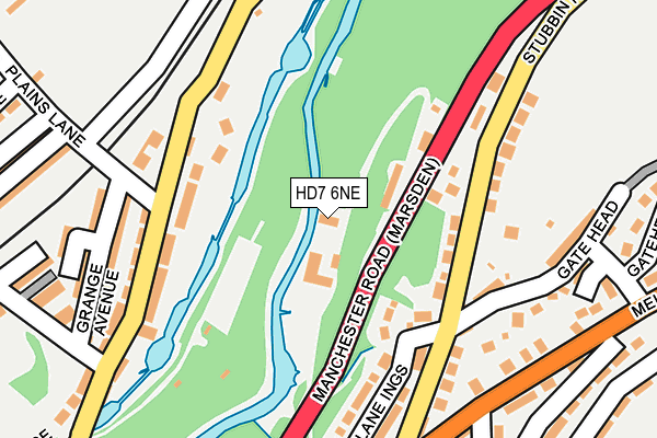
HD7 6NE is located in the Colne Valley electoral ward, within the metropolitan district of Kirklees and the English Parliamentary constituency of Colne Valley. The Sub Integrated Care Board (ICB) Location is NHS West Yorkshire ICB - X2C4Y and the police force is West Yorkshire. This postcode has been in use since January 1980.


GetTheData
Source: OS OpenMap – Local (Ordnance Survey)
Source: OS VectorMap District (Ordnance Survey)
Licence: Open Government Licence (requires attribution)
| Easting | 405379 |
| Northing | 412035 |
| Latitude | 53.604850 |
| Longitude | -1.920183 |
GetTheData
Source: Open Postcode Geo
Licence: Open Government Licence
| Country | England |
| Postcode District | HD7 |
| ➜ HD7 open data dashboard ➜ See where HD7 is on a map ➜ Where is Marsden? | |
GetTheData
Source: Land Registry Price Paid Data
Licence: Open Government Licence
Elevation or altitude of HD7 6NE as distance above sea level:
| Metres | Feet | |
|---|---|---|
| Elevation | 170m | 558ft |
Elevation is measured from the approximate centre of the postcode, to the nearest point on an OS contour line from OS Terrain 50, which has contour spacing of ten vertical metres.
➜ How high above sea level am I? Find the elevation of your current position using your device's GPS.
GetTheData
Source: Open Postcode Elevation
Licence: Open Government Licence
| Ward | Colne Valley |
| Constituency | Colne Valley |
GetTheData
Source: ONS Postcode Database
Licence: Open Government Licence
| December 2023 | Vehicle crime | On or near Warehouse Hill Road | 455m |
| August 2023 | Criminal damage and arson | On or near Carrs Side Street No 1 | 329m |
| August 2023 | Burglary | On or near Warehouse Hill Road | 455m |
| ➜ Get more crime data in our Crime section | |||
GetTheData
Source: data.police.uk
Licence: Open Government Licence
| Manchester Rd Stubbin Road (Manchester Road) | Marsden | 105m |
| Manchester Rd Stubbin Road (Manchester Road) | Marsden | 109m |
| Marsden Lane | Marsden | 150m |
| Marsden Lane | Marsden | 169m |
| Manchester Rd Brougham Road (Manchester Road) | Marsden | 171m |
| Marsden Station | 0.7km |
| Slaithwaite Station | 3.3km |
GetTheData
Source: NaPTAN
Licence: Open Government Licence
| Percentage of properties with Next Generation Access | 100.0% |
| Percentage of properties with Superfast Broadband | 100.0% |
| Percentage of properties with Ultrafast Broadband | 0.0% |
| Percentage of properties with Full Fibre Broadband | 0.0% |
Superfast Broadband is between 30Mbps and 300Mbps
Ultrafast Broadband is > 300Mbps
| Percentage of properties unable to receive 2Mbps | 0.0% |
| Percentage of properties unable to receive 5Mbps | 0.0% |
| Percentage of properties unable to receive 10Mbps | 0.0% |
| Percentage of properties unable to receive 30Mbps | 0.0% |
GetTheData
Source: Ofcom
Licence: Ofcom Terms of Use (requires attribution)
GetTheData
Source: ONS Postcode Database
Licence: Open Government Licence


➜ Get more ratings from the Food Standards Agency
GetTheData
Source: Food Standards Agency
Licence: FSA terms & conditions
| Last Collection | |||
|---|---|---|---|
| Location | Mon-Fri | Sat | Distance |
| Smithy Holme | 17:15 | 12:00 | 170m |
| 2 Peel Street | 17:15 | 12:00 | 630m |
| Ottiwells | 17:00 | 12:00 | 699m |
GetTheData
Source: Dracos
Licence: Creative Commons Attribution-ShareAlike
| Facility | Distance |
|---|---|
| Marsden Football Club (Fall Lane) Fall Lane, Marsden, Huddersfield Grass Pitches | 810m |
| Marsden Football Club (Hemplow Pitch) Mount Road, Marsden, Huddersfield Grass Pitches | 1.8km |
| Marsden Cricket And Bowling Club Mount Road, Marsden, Huddersfield Grass Pitches, Outdoor Tennis Courts | 1.8km |
GetTheData
Source: Active Places
Licence: Open Government Licence
| School | Phase of Education | Distance |
|---|---|---|
| Marsden Junior School Manchester Road, Marsden, Huddersfield, HD7 6EP | Primary | 508m |
| Marsden Infant and Nursery School Brougham Road, Marsden, Huddersfield, HD7 6BN | Primary | 570m |
| Slaithwaite Church of England Voluntary Controlled Junior and Infant School Holme Lane, Slaithwaite, Slaithwaite Ce Holme Lane, Huddersfield, HD7 5UG | Primary | 2.7km |
GetTheData
Source: Edubase
Licence: Open Government Licence
The below table lists the International Territorial Level (ITL) codes (formerly Nomenclature of Territorial Units for Statistics (NUTS) codes) and Local Administrative Units (LAU) codes for HD7 6NE:
| ITL 1 Code | Name |
|---|---|
| TLE | Yorkshire and The Humber |
| ITL 2 Code | Name |
| TLE4 | West Yorkshire |
| ITL 3 Code | Name |
| TLE44 | Calderdale and Kirklees |
| LAU 1 Code | Name |
| E08000034 | Kirklees |
GetTheData
Source: ONS Postcode Directory
Licence: Open Government Licence
The below table lists the Census Output Area (OA), Lower Layer Super Output Area (LSOA), and Middle Layer Super Output Area (MSOA) for HD7 6NE:
| Code | Name | |
|---|---|---|
| OA | E00055811 | |
| LSOA | E01011075 | Kirklees 052C |
| MSOA | E02002322 | Kirklees 052 |
GetTheData
Source: ONS Postcode Directory
Licence: Open Government Licence
| HD7 6ND | Manchester Road | 109m |
| HD7 6JS | Stubbin Road | 113m |
| HD7 6AF | Marsden Lane | 160m |
| HD7 6JR | Gate Head | 164m |
| HD7 6AQ | Grange Avenue | 198m |
| HD7 6JP | Lane Ings | 200m |
| HD7 6LJ | Bouldergate | 231m |
| HD7 6AH | Grange Terrace | 242m |
| HD7 6AJ | Grange Cottages | 268m |
| HD7 6JW | Rose Hill | 287m |
GetTheData
Source: Open Postcode Geo; Land Registry Price Paid Data
Licence: Open Government Licence