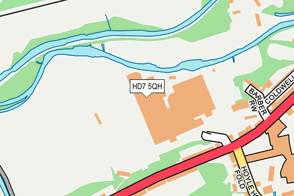
HD7 5QH is located in the Colne Valley electoral ward, within the metropolitan district of Kirklees and the English Parliamentary constituency of Colne Valley. The Sub Integrated Care Board (ICB) Location is NHS West Yorkshire ICB - X2C4Y and the police force is West Yorkshire. This postcode has been in use since January 1980.


GetTheData
Source: OS OpenMap – Local (Ordnance Survey)
Source: OS VectorMap District (Ordnance Survey)
Licence: Open Government Licence (requires attribution)
| Easting | 409321 |
| Northing | 414389 |
| Latitude | 53.625954 |
| Longitude | -1.860541 |
GetTheData
Source: Open Postcode Geo
Licence: Open Government Licence
| Country | England |
| Postcode District | HD7 |
| ➜ HD7 open data dashboard ➜ See where HD7 is on a map ➜ Where is Linthwaite? | |
GetTheData
Source: Land Registry Price Paid Data
Licence: Open Government Licence
Elevation or altitude of HD7 5QH as distance above sea level:
| Metres | Feet | |
|---|---|---|
| Elevation | 120m | 394ft |
Elevation is measured from the approximate centre of the postcode, to the nearest point on an OS contour line from OS Terrain 50, which has contour spacing of ten vertical metres.
➜ How high above sea level am I? Find the elevation of your current position using your device's GPS.
GetTheData
Source: Open Postcode Elevation
Licence: Open Government Licence
| Ward | Colne Valley |
| Constituency | Colne Valley |
GetTheData
Source: ONS Postcode Database
Licence: Open Government Licence
| July 2023 | Burglary | On or near Manchester Road (Linthwaite) | 159m |
| June 2022 | Violence and sexual offences | On or near Sports/Recreation Area | 192m |
| June 2022 | Vehicle crime | On or near Sports/Recreation Area | 192m |
| ➜ Get more crime data in our Crime section | |||
GetTheData
Source: data.police.uk
Licence: Open Government Licence
| Hoyle House Fold (Manchester Road Linthwaite) | Linthwaite | 174m |
| Manchester Rd Lee Mill Road (Manchester Road) | Linthwaite | 200m |
| Manchester Road Hoyle House Fold (Manchester Road) | Linthwaite | 237m |
| Manchester Road Barber Row (Manchester Road) | Linthwaite | 241m |
| Hoyle House Fold Chapel Hill (Hoyle House Fold) | Linthwaite | 272m |
| Slaithwaite Station | 1.4km |
| Lockwood Station | 4.1km |
| Berry Brow Station | 4.5km |
GetTheData
Source: NaPTAN
Licence: Open Government Licence
GetTheData
Source: ONS Postcode Database
Licence: Open Government Licence


➜ Get more ratings from the Food Standards Agency
GetTheData
Source: Food Standards Agency
Licence: FSA terms & conditions
| Last Collection | |||
|---|---|---|---|
| Location | Mon-Fri | Sat | Distance |
| West Street | 17:30 | 12:00 | 1,566m |
| Hill Top Slaithwaite | 17:00 | 11:45 | 1,647m |
| Taylor Street | 17:30 | 12:00 | 1,778m |
GetTheData
Source: Dracos
Licence: Creative Commons Attribution-ShareAlike
| Facility | Distance |
|---|---|
| Linthwaite Cricket & Bowling Club Hoyle House Fold, Linthwaite, Huddersfield Grass Pitches | 163m |
| Linthwaite Recreational Ground Manchester Road, Linthwaite, Huddersfield Grass Pitches | 181m |
| Linthwaite Methodist Tennis Club Stones Lane, Linthwaite, Huddersfield Outdoor Tennis Courts | 476m |
GetTheData
Source: Active Places
Licence: Open Government Licence
| School | Phase of Education | Distance |
|---|---|---|
| Linthwaite Clough J I & Early Years Unit Chapel Hill, Linthwaite, Huddersfield, HD7 5NJ | Primary | 364m |
| Wellhouse Junior and Infant School Lower Wellhouse, Golcar, Huddersfield, HD7 4ES | Primary | 781m |
| Colne Valley High School Gillroyd Lane, Linthwaite, Huddersfield, HD7 5SP | Secondary | 953m |
GetTheData
Source: Edubase
Licence: Open Government Licence
The below table lists the International Territorial Level (ITL) codes (formerly Nomenclature of Territorial Units for Statistics (NUTS) codes) and Local Administrative Units (LAU) codes for HD7 5QH:
| ITL 1 Code | Name |
|---|---|
| TLE | Yorkshire and The Humber |
| ITL 2 Code | Name |
| TLE4 | West Yorkshire |
| ITL 3 Code | Name |
| TLE44 | Calderdale and Kirklees |
| LAU 1 Code | Name |
| E08000034 | Kirklees |
GetTheData
Source: ONS Postcode Directory
Licence: Open Government Licence
The below table lists the Census Output Area (OA), Lower Layer Super Output Area (LSOA), and Middle Layer Super Output Area (MSOA) for HD7 5QH:
| Code | Name | |
|---|---|---|
| OA | E00055788 | |
| LSOA | E01011077 | Kirklees 045A |
| MSOA | E02002315 | Kirklees 045 |
GetTheData
Source: ONS Postcode Directory
Licence: Open Government Licence
| HD7 5NF | Manchester Road | 182m |
| HD7 5QJ | Holywell | 217m |
| HD7 5QL | Barber Row | 223m |
| HD7 5QQ | Manchester Road | 235m |
| HD7 5NB | Manchester Road | 236m |
| HD7 5QN | Coldwell Street | 274m |
| HD7 5NG | Hoylehouse Fold | 287m |
| HD7 5NQ | Hoyle House Fold | 287m |
| HD7 5QE | Lees Mill Lane | 376m |
| HD7 5NX | Holyoake Terrace | 402m |
GetTheData
Source: Open Postcode Geo; Land Registry Price Paid Data
Licence: Open Government Licence