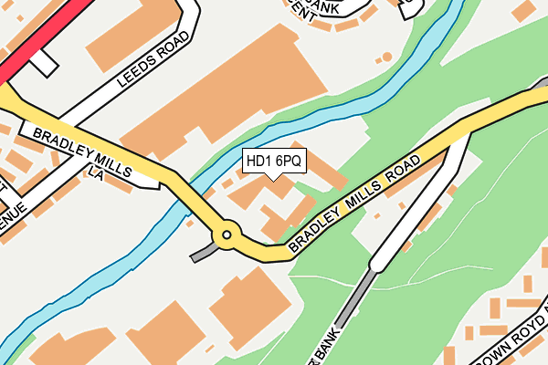
HD1 6PQ is located in the Dalton electoral ward, within the metropolitan district of Kirklees and the English Parliamentary constituency of Huddersfield. The Sub Integrated Care Board (ICB) Location is NHS West Yorkshire ICB - X2C4Y and the police force is West Yorkshire. This postcode has been in use since January 1980.


GetTheData
Source: OS OpenMap – Local (Ordnance Survey)
Source: OS VectorMap District (Ordnance Survey)
Licence: Open Government Licence (requires attribution)
| Easting | 415597 |
| Northing | 417767 |
| Latitude | 53.656183 |
| Longitude | -1.765482 |
GetTheData
Source: Open Postcode Geo
Licence: Open Government Licence
| Country | England |
| Postcode District | HD1 |
➜ See where HD1 is on a map ➜ Where is Huddersfield? | |
GetTheData
Source: Land Registry Price Paid Data
Licence: Open Government Licence
Elevation or altitude of HD1 6PQ as distance above sea level:
| Metres | Feet | |
|---|---|---|
| Elevation | 60m | 197ft |
Elevation is measured from the approximate centre of the postcode, to the nearest point on an OS contour line from OS Terrain 50, which has contour spacing of ten vertical metres.
➜ How high above sea level am I? Find the elevation of your current position using your device's GPS.
GetTheData
Source: Open Postcode Elevation
Licence: Open Government Licence
| Ward | Dalton |
| Constituency | Huddersfield |
GetTheData
Source: ONS Postcode Database
Licence: Open Government Licence
| Sports Stadium (Bradley Mills Road) | Bradley Mills | 36m |
| Leeds Rd Retail Park (Bradley Mills Road) | Bradley Mills | 213m |
| Leeds Rd Barr Street (Leeds Road) | Bradley Mills | 303m |
| Brown Royd Ave Edge Hill Close (Brown Royd Avenue) | Rawthorpe | 305m |
| Brown Royd Avenue Community Centre (Brown Royd Avenue) | Rawthorpe | 315m |
| Huddersfield Station | 1.5km |
| Deighton Station | 1.6km |
| Lockwood Station | 3.3km |
GetTheData
Source: NaPTAN
Licence: Open Government Licence
| Median download speed | 58.9Mbps |
| Average download speed | 49.5Mbps |
| Maximum download speed | 80.00Mbps |
| Median upload speed | 11.9Mbps |
| Average upload speed | 10.8Mbps |
| Maximum upload speed | 20.00Mbps |
GetTheData
Source: Ofcom
Licence: Ofcom Terms of Use (requires attribution)
GetTheData
Source: ONS Postcode Database
Licence: Open Government Licence


➜ Get more ratings from the Food Standards Agency
GetTheData
Source: Food Standards Agency
Licence: FSA terms & conditions
| Last Collection | |||
|---|---|---|---|
| Location | Mon-Fri | Sat | Distance |
| 313-315 Leeds Road | 18:30 | 11:45 | 713m |
| Hillhouse | 18:30 | 11:45 | 713m |
| 1 Moorfield Road | 18:30 | 11:45 | 880m |
GetTheData
Source: Dracos
Licence: Creative Commons Attribution-ShareAlike
| Risk of HD1 6PQ flooding from rivers and sea | Medium |
| ➜ HD1 6PQ flood map | |
GetTheData
Source: Open Flood Risk by Postcode
Licence: Open Government Licence
The below table lists the International Territorial Level (ITL) codes (formerly Nomenclature of Territorial Units for Statistics (NUTS) codes) and Local Administrative Units (LAU) codes for HD1 6PQ:
| ITL 1 Code | Name |
|---|---|
| TLE | Yorkshire and The Humber |
| ITL 2 Code | Name |
| TLE4 | West Yorkshire |
| ITL 3 Code | Name |
| TLE44 | Calderdale and Kirklees |
| LAU 1 Code | Name |
| E08000034 | Kirklees |
GetTheData
Source: ONS Postcode Directory
Licence: Open Government Licence
The below table lists the Census Output Area (OA), Lower Layer Super Output Area (LSOA), and Middle Layer Super Output Area (MSOA) for HD1 6PQ:
| Code | Name | |
|---|---|---|
| OA | E00055979 | |
| LSOA | E01011106 | Kirklees 029C |
| MSOA | E02002299 | Kirklees 029 |
GetTheData
Source: ONS Postcode Directory
Licence: Open Government Licence
| HD5 9PT | Bradley Mills Road | 173m |
| HD5 9PS | Kilner Bank | 175m |
| HD2 1XY | Springbank Crescent | 219m |
| HD1 6PJ | Town Avenue | 234m |
| HD5 9QE | Brown Royd Avenue | 254m |
| HD5 9QB | Brown Royd Avenue | 300m |
| HD2 1XX | Springbank Road | 312m |
| HD2 1XZ | Leeds Road | 324m |
| HD1 6PN | Town Avenue | 326m |
| HD2 1YB | Leeds Road | 332m |
GetTheData
Source: Open Postcode Geo; Land Registry Price Paid Data
Licence: Open Government Licence