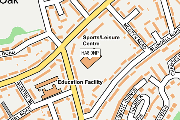
HA8 0NP is located in the Burnt Oak electoral ward, within the London borough of Barnet and the English Parliamentary constituency of Hendon. The Sub Integrated Care Board (ICB) Location is NHS North Central London ICB - 93C and the police force is Metropolitan Police. This postcode has been in use since June 2004.


GetTheData
Source: OS OpenMap – Local (Ordnance Survey)
Source: OS VectorMap District (Ordnance Survey)
Licence: Open Government Licence (requires attribution)
| Easting | 520917 |
| Northing | 191014 |
| Latitude | 51.604990 |
| Longitude | -0.255371 |
GetTheData
Source: Open Postcode Geo
Licence: Open Government Licence
| Country | England |
| Postcode District | HA8 |
| ➜ HA8 open data dashboard ➜ See where HA8 is on a map ➜ Where is London? | |
GetTheData
Source: Land Registry Price Paid Data
Licence: Open Government Licence
Elevation or altitude of HA8 0NP as distance above sea level:
| Metres | Feet | |
|---|---|---|
| Elevation | 50m | 164ft |
Elevation is measured from the approximate centre of the postcode, to the nearest point on an OS contour line from OS Terrain 50, which has contour spacing of ten vertical metres.
➜ How high above sea level am I? Find the elevation of your current position using your device's GPS.
GetTheData
Source: Open Postcode Elevation
Licence: Open Government Licence
| Ward | Burnt Oak |
| Constituency | Hendon |
GetTheData
Source: ONS Postcode Database
Licence: Open Government Licence
| January 2024 | Other crime | On or near Trevor Road | 281m |
| January 2024 | Public order | On or near Trevor Road | 281m |
| January 2024 | Vehicle crime | On or near Trevor Road | 281m |
| ➜ Get more crime data in our Crime section | |||
GetTheData
Source: data.police.uk
Licence: Open Government Licence
| Cressingham Road (Montrose Avenue) | Burnt Oak | 77m |
| Burnt Oak Leisure Centre | Burnt Oak | 106m |
| Burnt Oak Leisure Centre | Burnt Oak | 130m |
| Angus Gardens (Lanacre Avenue) | Burnt Oak | 269m |
| Goldbeaters Grove | Burnt Oak | 322m |
| Burnt Oak Underground Station | Burnt Oak | 650m |
| Colindale Underground Station | Colindale | 1,129m |
| Edgware Underground Station | Edgware | 1,662m |
| Mill Hill Broadway Station | 1km |
| Hendon Station | 3km |
| Kenton Station | 5km |
GetTheData
Source: NaPTAN
Licence: Open Government Licence
GetTheData
Source: ONS Postcode Database
Licence: Open Government Licence


➜ Get more ratings from the Food Standards Agency
GetTheData
Source: Food Standards Agency
Licence: FSA terms & conditions
| Last Collection | |||
|---|---|---|---|
| Location | Mon-Fri | Sat | Distance |
| Watling Avenue | 17:45 | 12:00 | 109m |
| Mostyn Road | 17:30 | 12:00 | 179m |
| Watling Avenue | 17:45 | 12:00 | 429m |
GetTheData
Source: Dracos
Licence: Creative Commons Attribution-ShareAlike
| Facility | Distance |
|---|---|
| Barnet Burnt Oak Leisure Centre Watling Avenue, Edgware Sports Hall, Health and Fitness Gym, Grass Pitches, Studio, Artificial Grass Pitch | 0m |
| Watling Park Cressingham Road, Edgware Grass Pitches | 329m |
| Unitas Youth Zone Montrose Avenue, Edgware Artificial Grass Pitch, Sports Hall, Studio, Health and Fitness Gym | 608m |
GetTheData
Source: Active Places
Licence: Open Government Licence
| School | Phase of Education | Distance |
|---|---|---|
| Goldbeaters Primary School Thirleby Road, Burnt Oak, Edgware, HA8 0HA | Primary | 163m |
| The Annunciation Catholic Infant School Thirleby Road, Edgware, HA8 0HQ | Primary | 414m |
| Woodcroft Primary School Goldbeaters Grove, EDGWARE, HA8 0QF | Primary | 441m |
GetTheData
Source: Edubase
Licence: Open Government Licence
The below table lists the International Territorial Level (ITL) codes (formerly Nomenclature of Territorial Units for Statistics (NUTS) codes) and Local Administrative Units (LAU) codes for HA8 0NP:
| ITL 1 Code | Name |
|---|---|
| TLI | London |
| ITL 2 Code | Name |
| TLI7 | Outer London - West and North West |
| ITL 3 Code | Name |
| TLI71 | Barnet |
| LAU 1 Code | Name |
| E09000003 | Barnet |
GetTheData
Source: ONS Postcode Directory
Licence: Open Government Licence
The below table lists the Census Output Area (OA), Lower Layer Super Output Area (LSOA), and Middle Layer Super Output Area (MSOA) for HA8 0NP:
| Code | Name | |
|---|---|---|
| OA | E00000654 | |
| LSOA | E01000130 | Barnet 021A |
| MSOA | E02000044 | Barnet 021 |
GetTheData
Source: ONS Postcode Directory
Licence: Open Government Licence
| HA8 0EA | Montrose Avenue | 72m |
| HA8 0JA | Blundell Road | 90m |
| HA8 0NJ | Watling Avenue | 102m |
| HA8 0EB | Montrose Avenue | 104m |
| HA8 0NB | Watling Avenue | 127m |
| HA8 0HZ | Blundell Road | 130m |
| HA8 0JB | Mostyn Road | 146m |
| HA8 0RH | Cressingham Road | 156m |
| NW9 5LQ | Pageant Avenue | 166m |
| HA8 0NL | Watling Avenue | 167m |
GetTheData
Source: Open Postcode Geo; Land Registry Price Paid Data
Licence: Open Government Licence