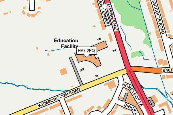
HA7 2EQ is located in the Belmont electoral ward, within the London borough of Harrow and the English Parliamentary constituency of Harrow East. The Sub Integrated Care Board (ICB) Location is NHS North West London ICB - W2U3Z and the police force is Metropolitan Police. This postcode has been in use since August 1992.


GetTheData
Source: OS OpenMap – Local (Ordnance Survey)
Source: OS VectorMap District (Ordnance Survey)
Licence: Open Government Licence (requires attribution)
| Easting | 517557 |
| Northing | 191303 |
| Latitude | 51.608301 |
| Longitude | -0.303745 |
GetTheData
Source: Open Postcode Geo
Licence: Open Government Licence
| Country | England |
| Postcode District | HA7 |
| ➜ HA7 open data dashboard ➜ See where HA7 is on a map ➜ Where is Stanmore? | |
GetTheData
Source: Land Registry Price Paid Data
Licence: Open Government Licence
Elevation or altitude of HA7 2EQ as distance above sea level:
| Metres | Feet | |
|---|---|---|
| Elevation | 70m | 230ft |
Elevation is measured from the approximate centre of the postcode, to the nearest point on an OS contour line from OS Terrain 50, which has contour spacing of ten vertical metres.
➜ How high above sea level am I? Find the elevation of your current position using your device's GPS.
GetTheData
Source: Open Postcode Elevation
Licence: Open Government Licence
| Ward | Belmont |
| Constituency | Harrow East |
GetTheData
Source: ONS Postcode Database
Licence: Open Government Licence
| December 2023 | Shoplifting | On or near Brick Lane | 314m |
| December 2023 | Public order | On or near Brick Lane | 314m |
| December 2023 | Vehicle crime | On or near Barn Crescent | 479m |
| ➜ Get more crime data in our Crime section | |||
GetTheData
Source: data.police.uk
Licence: Open Government Licence
| Marsh Lane (Whitchurch Lane) | Canons Park | 281m |
| Marsh Lane (Whitchurch Lane) | Canons Park | 281m |
| Abercorn Road Canons Park (Wemborough Road) | Canons Park | 307m |
| Wemborough Road (Honeypot Lane) | Canons Park | 331m |
| Abercorn Road Canons Park (Wemborough Road) | Canons Park | 341m |
| Canons Park Underground Station | Canons Park | 632m |
| Stanmore Underground Station | Stanmore | 1,284m |
| Harrow & Wealdstone Station | 2.8km |
| Kenton Station | 3.1km |
| Headstone Lane Station | 3.8km |
GetTheData
Source: NaPTAN
Licence: Open Government Licence
GetTheData
Source: ONS Postcode Database
Licence: Open Government Licence


➜ Get more ratings from the Food Standards Agency
GetTheData
Source: Food Standards Agency
Licence: FSA terms & conditions
| Last Collection | |||
|---|---|---|---|
| Location | Mon-Fri | Sat | Distance |
| Marsh Lane | 18:00 | 12:45 | 237m |
| Honeypot Lane Post Office | 18:45 | 12:30 | 345m |
| St Andrews Drive | 18:15 | 12:45 | 399m |
GetTheData
Source: Dracos
Licence: Creative Commons Attribution-ShareAlike
| Facility | Distance |
|---|---|
| Avanti House Secondary School Wemborough Road, Stanmore Sports Hall, Studio, Artificial Grass Pitch, Outdoor Tennis Courts | 0m |
| Whitchurch Playing Fields Wemborough Road, Stanmore Grass Pitches | 313m |
| Stanburn Primary School Abercorn Road, Stanmore Grass Pitches | 411m |
GetTheData
Source: Active Places
Licence: Open Government Licence
| School | Phase of Education | Distance |
|---|---|---|
| Avanti House School Wemborough Road, Stanmore, HA7 2EQ | Secondary | 0m |
| Whitchurch Primary School & Nursery Wemborough Road, Stanmore, HA7 2EQ | Primary | 74m |
| Stanburn Primary School Abercorn Road, Stanmore, HA7 2PJ | Primary | 411m |
GetTheData
Source: Edubase
Licence: Open Government Licence
The below table lists the International Territorial Level (ITL) codes (formerly Nomenclature of Territorial Units for Statistics (NUTS) codes) and Local Administrative Units (LAU) codes for HA7 2EQ:
| ITL 1 Code | Name |
|---|---|
| TLI | London |
| ITL 2 Code | Name |
| TLI7 | Outer London - West and North West |
| ITL 3 Code | Name |
| TLI74 | Harrow and Hillingdon |
| LAU 1 Code | Name |
| E09000015 | Harrow |
GetTheData
Source: ONS Postcode Directory
Licence: Open Government Licence
The below table lists the Census Output Area (OA), Lower Layer Super Output Area (LSOA), and Middle Layer Super Output Area (MSOA) for HA7 2EQ:
| Code | Name | |
|---|---|---|
| OA | E00010592 | |
| LSOA | E01002109 | Harrow 008C |
| MSOA | E02000440 | Harrow 008 |
GetTheData
Source: ONS Postcode Directory
Licence: Open Government Licence
| HA7 2SN | Green Verges | 135m |
| HA7 2RS | Cranmer Close | 173m |
| HA7 2RR | Old Church Lane | 198m |
| HA7 2DU | Wemborough Road | 201m |
| HA7 2SL | Marsh Lane | 245m |
| HA7 1AJ | Bromefield | 246m |
| HA7 1AB | Bromefield | 247m |
| HA7 1AL | Bromefield | 257m |
| HA7 2RT | Old Church Lane | 267m |
| HA8 6RR | Longcrofte Road | 278m |
GetTheData
Source: Open Postcode Geo; Land Registry Price Paid Data
Licence: Open Government Licence