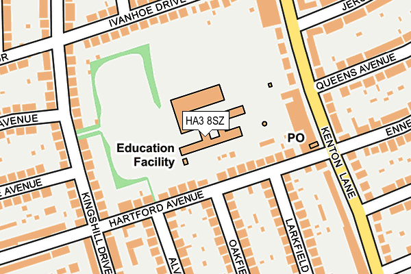
HA3 8SZ is located in the Kenton West electoral ward, within the London borough of Harrow and the English Parliamentary constituency of Harrow East. The Sub Integrated Care Board (ICB) Location is NHS North West London ICB - W2U3Z and the police force is Metropolitan Police. This postcode has been in use since January 1980.


GetTheData
Source: OS OpenMap – Local (Ordnance Survey)
Source: OS VectorMap District (Ordnance Survey)
Licence: Open Government Licence (requires attribution)
| Easting | 516781 |
| Northing | 189925 |
| Latitude | 51.596077 |
| Longitude | -0.315405 |
GetTheData
Source: Open Postcode Geo
Licence: Open Government Licence
| Country | England |
| Postcode District | HA3 |
| ➜ HA3 open data dashboard ➜ See where HA3 is on a map ➜ Where is Kenton? | |
GetTheData
Source: Land Registry Price Paid Data
Licence: Open Government Licence
Elevation or altitude of HA3 8SZ as distance above sea level:
| Metres | Feet | |
|---|---|---|
| Elevation | 50m | 164ft |
Elevation is measured from the approximate centre of the postcode, to the nearest point on an OS contour line from OS Terrain 50, which has contour spacing of ten vertical metres.
➜ How high above sea level am I? Find the elevation of your current position using your device's GPS.
GetTheData
Source: Open Postcode Elevation
Licence: Open Government Licence
| Ward | Kenton West |
| Constituency | Harrow East |
GetTheData
Source: ONS Postcode Database
Licence: Open Government Licence
| January 2024 | Violence and sexual offences | On or near Parking Area | 476m |
| January 2024 | Shoplifting | On or near Parking Area | 476m |
| January 2024 | Public order | On or near Parking Area | 476m |
| ➜ Get more crime data in our Crime section | |||
GetTheData
Source: data.police.uk
Licence: Open Government Licence
| Queens Avenue (Ha7) (Kenton Lane) | Belmont | 177m |
| Queens Avenue (Ha7) (Kenton Lane) | Belmont | 200m |
| Clifton Avenue (Ha7) (Kenton Lane) | Belmont | 347m |
| Clifton Avenue (Ha7) | Belmont | 376m |
| Kenton Library (Kenton Lane) | Kenton | 415m |
| Harrow & Wealdstone Underground Station | Harrow & Wealdstone | 1,435m |
| Canons Park Underground Station | Canons Park | 1,933m |
| Harrow & Wealdstone Station | 1.4km |
| Kenton Station | 1.6km |
| Harrow-on-the-Hill Station | 2.4km |
GetTheData
Source: NaPTAN
Licence: Open Government Licence
GetTheData
Source: ONS Postcode Database
Licence: Open Government Licence


➜ Get more ratings from the Food Standards Agency
GetTheData
Source: Food Standards Agency
Licence: FSA terms & conditions
| Last Collection | |||
|---|---|---|---|
| Location | Mon-Fri | Sat | Distance |
| Hartford Avenue | 18:00 | 12:45 | 199m |
| Kenton Lane Post Office | 17:00 | 12:30 | 207m |
| Oakfield Avenue | 18:00 | 12:45 | 401m |
GetTheData
Source: Dracos
Licence: Creative Commons Attribution-ShareAlike
| Facility | Distance |
|---|---|
| Priestmead School Hartford Avenue, Harrow Grass Pitches | 59m |
| Byron Recreation Ground Peel Road, Wealdstone, Harrow Grass Pitches, Outdoor Tennis Courts | 716m |
| Centenary Park Culver Grove, Stanmore Outdoor Tennis Courts | 803m |
GetTheData
Source: Active Places
Licence: Open Government Licence
| School | Phase of Education | Distance |
|---|---|---|
| Priestmead Primary School and Nursery Hartford Avenue, Kenton, Harrow, HA3 8SZ | Primary | 59m |
| St Joseph's Catholic Primary School Dobbin Close, Belmont Circle, Harrow, HA3 7LP | Primary | 549m |
| Belmont School Hibbert Road, Harrow Weald, Harrow, HA3 7JT | Primary | 926m |
GetTheData
Source: Edubase
Licence: Open Government Licence
The below table lists the International Territorial Level (ITL) codes (formerly Nomenclature of Territorial Units for Statistics (NUTS) codes) and Local Administrative Units (LAU) codes for HA3 8SZ:
| ITL 1 Code | Name |
|---|---|
| TLI | London |
| ITL 2 Code | Name |
| TLI7 | Outer London - West and North West |
| ITL 3 Code | Name |
| TLI74 | Harrow and Hillingdon |
| LAU 1 Code | Name |
| E09000015 | Harrow |
GetTheData
Source: ONS Postcode Directory
Licence: Open Government Licence
The below table lists the Census Output Area (OA), Lower Layer Super Output Area (LSOA), and Middle Layer Super Output Area (MSOA) for HA3 8SZ:
| Code | Name | |
|---|---|---|
| OA | E00010888 | |
| LSOA | E01002177 | Harrow 033H |
| MSOA | E02006882 | Harrow 033 |
GetTheData
Source: ONS Postcode Directory
Licence: Open Government Licence
| HA3 8SY | Hartford Avenue | 120m |
| HA3 8QR | Ivanhoe Drive | 129m |
| HA3 8QB | Kingshill Drive | 160m |
| HA3 8QP | Ivanhoe Drive | 163m |
| HA3 8RR | Kenton Lane | 179m |
| HA3 8RP | Kenton Lane | 179m |
| HA3 8QF | Kingshill Drive | 192m |
| HA3 8QQ | Kingshill Drive | 199m |
| HA3 8RN | Kenton Lane | 204m |
| HA3 8RW | Kenton Lane | 213m |
GetTheData
Source: Open Postcode Geo; Land Registry Price Paid Data
Licence: Open Government Licence