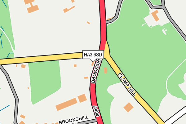
HA3 6SD lies on Brookshill in Harrow. HA3 6SD is located in the Harrow Weald electoral ward, within the London borough of Harrow and the English Parliamentary constituency of Harrow East. The Sub Integrated Care Board (ICB) Location is NHS North West London ICB - W2U3Z and the police force is Metropolitan Police. This postcode has been in use since January 1980.


GetTheData
Source: OS OpenMap – Local (Ordnance Survey)
Source: OS VectorMap District (Ordnance Survey)
Licence: Open Government Licence (requires attribution)
| Easting | 514810 |
| Northing | 192606 |
| Latitude | 51.620576 |
| Longitude | -0.342994 |
GetTheData
Source: Open Postcode Geo
Licence: Open Government Licence
| Street | Brookshill |
| Town/City | Harrow |
| Country | England |
| Postcode District | HA3 |
| ➜ HA3 open data dashboard ➜ See where HA3 is on a map ➜ Where is London? | |
GetTheData
Source: Land Registry Price Paid Data
Licence: Open Government Licence
Elevation or altitude of HA3 6SD as distance above sea level:
| Metres | Feet | |
|---|---|---|
| Elevation | 140m | 459ft |
Elevation is measured from the approximate centre of the postcode, to the nearest point on an OS contour line from OS Terrain 50, which has contour spacing of ten vertical metres.
➜ How high above sea level am I? Find the elevation of your current position using your device's GPS.
GetTheData
Source: Open Postcode Elevation
Licence: Open Government Licence
| Ward | Harrow Weald |
| Constituency | Harrow East |
GetTheData
Source: ONS Postcode Database
Licence: Open Government Licence
| June 2022 | Public order | On or near Park/Open Space | 399m |
| May 2022 | Burglary | On or near Brookshill Avenue | 406m |
| April 2022 | Public order | On or near Brookshill Drive | 230m |
| ➜ Brookshill crime map and outcomes | |||
GetTheData
Source: data.police.uk
Licence: Open Government Licence
| Clamp Hill | Harrow Weald | 27m |
| Clamp Hill | Harrow Weald | 108m |
| Brookshill Gate (Brookshill) | Harrow Weald | 476m |
| Priory Close | Stanmore | 480m |
| Priory Close (Common Road) | Stanmore | 524m |
| Hatch End Station | 2.2km |
| Headstone Lane Station | 2.2km |
| Carpenders Park Station | 3.1km |
GetTheData
Source: NaPTAN
Licence: Open Government Licence
GetTheData
Source: ONS Postcode Database
Licence: Open Government Licence


➜ Get more ratings from the Food Standards Agency
GetTheData
Source: Food Standards Agency
Licence: FSA terms & conditions
| Last Collection | |||
|---|---|---|---|
| Location | Mon-Fri | Sat | Distance |
| The Viewpoint | 17:45 | 12:45 | 525m |
| 45 Sitwell Grove | 17:45 | 11:45 | 994m |
| The Common | 18:00 | 13:00 | 1,238m |
GetTheData
Source: Dracos
Licence: Creative Commons Attribution-ShareAlike
| Facility | Distance |
|---|---|
| Bentley Wood High School For Girls Binyon Crescent, Stanmore Sports Hall, Grass Pitches, Studio | 844m |
| Harrow College (Harrow Weald Campus) Brookshill, Harrow Grass Pitches | 886m |
| Avanti House (Primary Phase) Common Road, Stanmore Sports Hall | 925m |
GetTheData
Source: Active Places
Licence: Open Government Licence
| School | Phase of Education | Distance |
|---|---|---|
| Bentley Wood High School Clamp Hill, Stanmore, HA7 3JW | Secondary | 820m |
| Avanti House Primary School Common Road, Stanmore, HA7 3JB | Primary | 822m |
| Hujjat Primary School Brookshill, Harrow Weald, Harrow, HA3 6RR | Primary | 886m |
GetTheData
Source: Edubase
Licence: Open Government Licence
The below table lists the International Territorial Level (ITL) codes (formerly Nomenclature of Territorial Units for Statistics (NUTS) codes) and Local Administrative Units (LAU) codes for HA3 6SD:
| ITL 1 Code | Name |
|---|---|
| TLI | London |
| ITL 2 Code | Name |
| TLI7 | Outer London - West and North West |
| ITL 3 Code | Name |
| TLI74 | Harrow and Hillingdon |
| LAU 1 Code | Name |
| E09000015 | Harrow |
GetTheData
Source: ONS Postcode Directory
Licence: Open Government Licence
The below table lists the Census Output Area (OA), Lower Layer Super Output Area (LSOA), and Middle Layer Super Output Area (MSOA) for HA3 6SD:
| Code | Name | |
|---|---|---|
| OA | E00010743 | |
| LSOA | E01002144 | Harrow 004A |
| MSOA | E02000436 | Harrow 004 |
GetTheData
Source: ONS Postcode Directory
Licence: Open Government Licence
| HA3 6SH | Old Redding | 153m |
| HA7 3JF | Common Road | 191m |
| HA3 6SA | Brookshill | 212m |
| HA3 6SB | Brookshill Drive | 273m |
| HA3 6SE | Old Redding | 333m |
| HA7 3JQ | Clamp Hill | 373m |
| HA7 3JL | Clamp Hill | 412m |
| HA3 6RZ | Brookshill Avenue | 423m |
| HA3 6RT | Brookshill | 438m |
| HA3 6RY | Brookshill | 505m |
GetTheData
Source: Open Postcode Geo; Land Registry Price Paid Data
Licence: Open Government Licence