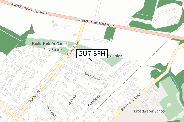
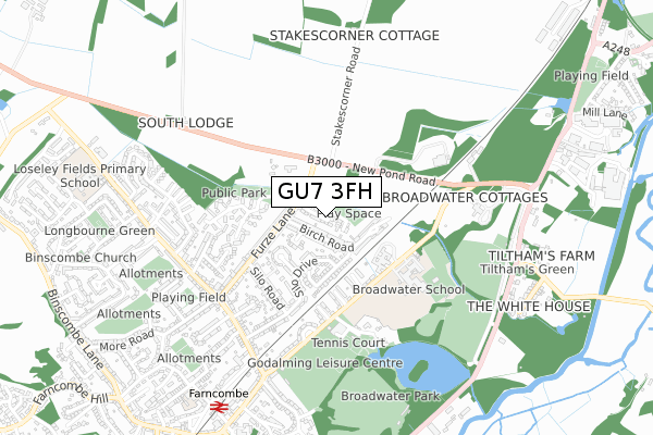
GU7 3FH is located in the Godalming Binscombe & Charterhouse electoral ward, within the local authority district of Waverley and the English Parliamentary constituency of South West Surrey. The Sub Integrated Care Board (ICB) Location is NHS Surrey Heartlands ICB - 92A and the police force is Surrey. This postcode has been in use since January 2018.


GetTheData
Source: OS Open Zoomstack (Ordnance Survey)
Licence: Open Government Licence (requires attribution)
Attribution: Contains OS data © Crown copyright and database right 2024
Source: Open Postcode Geo
Licence: Open Government Licence (requires attribution)
Attribution: Contains OS data © Crown copyright and database right 2024; Contains Royal Mail data © Royal Mail copyright and database right 2024; Source: Office for National Statistics licensed under the Open Government Licence v.3.0
| Easting | 498014 |
| Northing | 145854 |
| Latitude | 51.203496 |
| Longitude | -0.598410 |
GetTheData
Source: Open Postcode Geo
Licence: Open Government Licence
| Country | England |
| Postcode District | GU7 |
| ➜ GU7 open data dashboard ➜ See where GU7 is on a map ➜ Where is Farncombe? | |
GetTheData
Source: Land Registry Price Paid Data
Licence: Open Government Licence
| Ward | Godalming Binscombe & Charterhouse |
| Constituency | South West Surrey |
GetTheData
Source: ONS Postcode Database
Licence: Open Government Licence
27, GREENSAND PLACE, GODALMING, GU7 3FH 2024 8 FEB £585,000 |
27, GREENSAND PLACE, GODALMING, GU7 3FH 2024 25 JAN £585,000 |
2023 22 FEB £617,500 |
2022 18 NOV £620,000 |
2022 14 OCT £600,000 |
2022 19 AUG £615,000 |
2022 15 MAR £595,250 |
33, GREENSAND PLACE, GODALMING, GU7 3FH 2019 20 JUN £590,000 |
24, GREENSAND PLACE, GODALMING, GU7 3FH 2019 8 MAR £596,000 |
34, GREENSAND PLACE, GODALMING, GU7 3FH 2018 18 DEC £660,000 |
GetTheData
Source: HM Land Registry Price Paid Data
Licence: Contains HM Land Registry data © Crown copyright and database right 2024. This data is licensed under the Open Government Licence v3.0.
| June 2022 | Burglary | On or near Birch Road | 97m |
| June 2022 | Vehicle crime | On or near Birch Road | 97m |
| June 2022 | Other theft | On or near Furze Lane | 269m |
| ➜ Get more crime data in our Crime section | |||
GetTheData
Source: data.police.uk
Licence: Open Government Licence
| Birch Circle (Birch Road) | Farncombe | 68m |
| Birch Circle (Birch Road) | Farncombe | 81m |
| Furze Lane | Farncombe | 127m |
| Birch Road (Furze Lane) | Farncombe | 128m |
| Furze Lane | Farncombe | 137m |
| Farncombe Station | 0.8km |
| Godalming Station | 2.4km |
| Shalford (Surrey) Station | 2.5km |
GetTheData
Source: NaPTAN
Licence: Open Government Licence
➜ Broadband speed and availability dashboard for GU7 3FH
| Percentage of properties with Next Generation Access | 100.0% |
| Percentage of properties with Superfast Broadband | 100.0% |
| Percentage of properties with Ultrafast Broadband | 0.0% |
| Percentage of properties with Full Fibre Broadband | 0.0% |
Superfast Broadband is between 30Mbps and 300Mbps
Ultrafast Broadband is > 300Mbps
| Median download speed | 39.1Mbps |
| Average download speed | 39.4Mbps |
| Maximum download speed | 73.67Mbps |
| Median upload speed | 9.8Mbps |
| Average upload speed | 10.2Mbps |
| Maximum upload speed | 20.00Mbps |
| Percentage of properties unable to receive 2Mbps | 0.0% |
| Percentage of properties unable to receive 5Mbps | 0.0% |
| Percentage of properties unable to receive 10Mbps | 0.0% |
| Percentage of properties unable to receive 30Mbps | 0.0% |
➜ Broadband speed and availability dashboard for GU7 3FH
GetTheData
Source: Ofcom
Licence: Ofcom Terms of Use (requires attribution)
GetTheData
Source: ONS Postcode Database
Licence: Open Government Licence


➜ Get more ratings from the Food Standards Agency
GetTheData
Source: Food Standards Agency
Licence: FSA terms & conditions
| Last Collection | |||
|---|---|---|---|
| Location | Mon-Fri | Sat | Distance |
| Northbourne | 16:15 | 11:45 | 236m |
| Silo Road | 16:15 | 12:00 | 379m |
| Bourne Road | 16:15 | 12:00 | 521m |
GetTheData
Source: Dracos
Licence: Creative Commons Attribution-ShareAlike
| Facility | Distance |
|---|---|
| Broadwater School Summers Road, Godalming Health and Fitness Gym, Grass Pitches, Artificial Grass Pitch, Sports Hall, Outdoor Tennis Courts, Studio | 397m |
| Godalming Lawn Tennis Club Summers Road, Godalming Outdoor Tennis Courts | 492m |
| Godalming Leisure Centre (Closed) Summers Road, Godalming Swimming Pool, Health and Fitness Gym, Studio, Squash Courts | 511m |
GetTheData
Source: Active Places
Licence: Open Government Licence
| School | Phase of Education | Distance |
|---|---|---|
| Broadwater School Summers Road, Farncombe, Godalming, GU7 3BW | Secondary | 444m |
| Farncombe Church of England Infant School Grays Road, Farncombe, Godalming, GU7 3LT | Primary | 852m |
| Loseley Fields Primary School Green Lane, Binscombe, Godalming, GU7 3TB | Primary | 895m |
GetTheData
Source: Edubase
Licence: Open Government Licence
| Risk of GU7 3FH flooding from rivers and sea | Medium |
| ➜ GU7 3FH flood map | |
GetTheData
Source: Open Flood Risk by Postcode
Licence: Open Government Licence
The below table lists the International Territorial Level (ITL) codes (formerly Nomenclature of Territorial Units for Statistics (NUTS) codes) and Local Administrative Units (LAU) codes for GU7 3FH:
| ITL 1 Code | Name |
|---|---|
| TLJ | South East (England) |
| ITL 2 Code | Name |
| TLJ2 | Surrey, East and West Sussex |
| ITL 3 Code | Name |
| TLJ25 | West Surrey |
| LAU 1 Code | Name |
| E07000216 | Waverley |
GetTheData
Source: ONS Postcode Directory
Licence: Open Government Licence
The below table lists the Census Output Area (OA), Lower Layer Super Output Area (LSOA), and Middle Layer Super Output Area (MSOA) for GU7 3FH:
| Code | Name | |
|---|---|---|
| OA | E00157596 | |
| LSOA | E01030913 | Waverley 005C |
| MSOA | E02006443 | Waverley 005 |
GetTheData
Source: ONS Postcode Directory
Licence: Open Government Licence
| GU7 3NT | Birch Road | 103m |
| GU7 3NR | Birch Road | 132m |
| GU7 3NX | Silo Drive | 154m |
| GU7 3NS | Birch Circle | 168m |
| GU7 3NU | Birch Road | 195m |
| GU7 3NY | Silo Close | 210m |
| GU7 3PH | Cornfields | 216m |
| GU7 3NP | Furze Lane | 236m |
| GU7 3BN | Brookfield | 263m |
| GU3 1HY | New Pond Road | 278m |
GetTheData
Source: Open Postcode Geo; Land Registry Price Paid Data
Licence: Open Government Licence