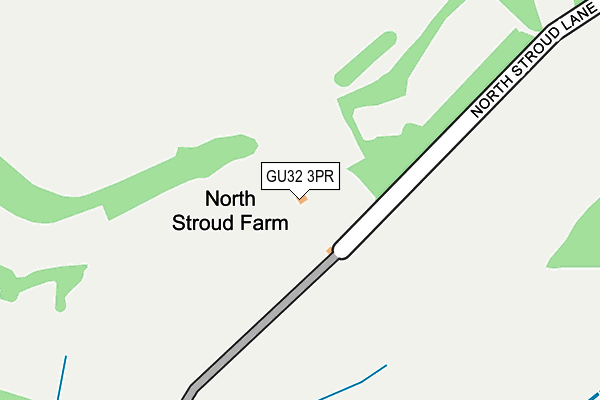
GU32 3PR is located in the Buriton & East Meon electoral ward, within the local authority district of East Hampshire and the English Parliamentary constituency of East Hampshire. The Sub Integrated Care Board (ICB) Location is NHS Hampshire and Isle of Wight ICB - D9Y0V and the police force is Hampshire. This postcode has been in use since January 1980.


GetTheData
Source: OS OpenMap – Local (Ordnance Survey)
Source: OS VectorMap District (Ordnance Survey)
Licence: Open Government Licence (requires attribution)
| Easting | 471326 |
| Northing | 123102 |
| Latitude | 51.002895 |
| Longitude | -0.984850 |
GetTheData
Source: Open Postcode Geo
Licence: Open Government Licence
| Country | England |
| Postcode District | GU32 |
| ➜ GU32 open data dashboard ➜ See where GU32 is on a map | |
GetTheData
Source: Land Registry Price Paid Data
Licence: Open Government Licence
Elevation or altitude of GU32 3PR as distance above sea level:
| Metres | Feet | |
|---|---|---|
| Elevation | 100m | 328ft |
Elevation is measured from the approximate centre of the postcode, to the nearest point on an OS contour line from OS Terrain 50, which has contour spacing of ten vertical metres.
➜ How high above sea level am I? Find the elevation of your current position using your device's GPS.
GetTheData
Source: Open Postcode Elevation
Licence: Open Government Licence
| Ward | Buriton & East Meon |
| Constituency | East Hampshire |
GetTheData
Source: ONS Postcode Database
Licence: Open Government Licence
| North Stroud Lane (A272 Winchester Road) | Stroud | 870m |
| Manor Farm (Winchester Road) | Langrish | 884m |
| Manor Farm (Winchester Road) | Langrish | 891m |
| North Stroud Lane (A272 Winchester Road) | Stroud | 896m |
| The Pillar Box (The Hyde) | Langrish | 1,053m |
| Petersfield Station | 3.1km |
GetTheData
Source: NaPTAN
Licence: Open Government Licence
GetTheData
Source: ONS Postcode Database
Licence: Open Government Licence


➜ Get more ratings from the Food Standards Agency
GetTheData
Source: Food Standards Agency
Licence: FSA terms & conditions
| Last Collection | |||
|---|---|---|---|
| Location | Mon-Fri | Sat | Distance |
| Langrish Hill | 16:00 | 09:00 | 891m |
| Langrish Old Post Office | 16:00 | 09:00 | 1,061m |
| Ramsdean | 16:00 | 08:15 | 1,135m |
GetTheData
Source: Dracos
Licence: Creative Commons Attribution-ShareAlike
| Facility | Distance |
|---|---|
| M E B S Leisure (Closed) Rushes Road, Petersfield Health and Fitness Gym | 2.8km |
| Petersfield School Cranford Road, Petersfield Sports Hall, Grass Pitches, Artificial Grass Pitch, Outdoor Tennis Courts | 3.1km |
| East Meon Cricket Club High Street, East Meon, Petersfield Grass Pitches | 3.2km |
GetTheData
Source: Active Places
Licence: Open Government Licence
| School | Phase of Education | Distance |
|---|---|---|
| Langrish Primary School Ramsdean Road, Stroud, Petersfield, GU32 3PJ | Primary | 961m |
| The Petersfield School Cranford Road, Petersfield, GU32 3LU | Secondary | 3.1km |
| Petersfield Infant School St Peter's Road, Petersfield, GU32 3HX | Primary | 3.4km |
GetTheData
Source: Edubase
Licence: Open Government Licence
The below table lists the International Territorial Level (ITL) codes (formerly Nomenclature of Territorial Units for Statistics (NUTS) codes) and Local Administrative Units (LAU) codes for GU32 3PR:
| ITL 1 Code | Name |
|---|---|
| TLJ | South East (England) |
| ITL 2 Code | Name |
| TLJ3 | Hampshire and Isle of Wight |
| ITL 3 Code | Name |
| TLJ36 | Central Hampshire |
| LAU 1 Code | Name |
| E07000085 | East Hampshire |
GetTheData
Source: ONS Postcode Directory
Licence: Open Government Licence
The below table lists the Census Output Area (OA), Lower Layer Super Output Area (LSOA), and Middle Layer Super Output Area (MSOA) for GU32 3PR:
| Code | Name | |
|---|---|---|
| OA | E00114858 | |
| LSOA | E01022592 | East Hampshire 011A |
| MSOA | E02004707 | East Hampshire 011 |
GetTheData
Source: ONS Postcode Directory
Licence: Open Government Licence
| GU32 3PH | Ramsdean Road | 760m |
| GU32 3PP | North Stroud Lane | 775m |
| GU32 1RB | 853m | |
| GU32 1RU | 855m | |
| GU32 3PS | Willowdale Close | 873m |
| GU32 1RF | 900m | |
| GU32 1RD | 912m | |
| GU32 3PL | Winchester Road | 927m |
| GU32 3PJ | Ramsdean Road | 960m |
| GU32 3PN | Winchester Road | 1005m |
GetTheData
Source: Open Postcode Geo; Land Registry Price Paid Data
Licence: Open Government Licence