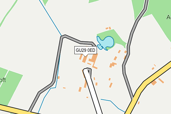
GU29 0ED is located in the Easebourne electoral ward, within the local authority district of Chichester and the English Parliamentary constituency of Chichester. The Sub Integrated Care Board (ICB) Location is NHS Sussex ICB - 70F and the police force is Sussex. This postcode has been in use since April 2003.


GetTheData
Source: OS OpenMap – Local (Ordnance Survey)
Source: OS VectorMap District (Ordnance Survey)
Licence: Open Government Licence (requires attribution)
| Easting | 489475 |
| Northing | 118807 |
| Latitude | 50.961750 |
| Longitude | -0.727311 |
GetTheData
Source: Open Postcode Geo
Licence: Open Government Licence
| Country | England |
| Postcode District | GU29 |
| ➜ GU29 open data dashboard ➜ See where GU29 is on a map ➜ Where is Heyshott Green? | |
GetTheData
Source: Land Registry Price Paid Data
Licence: Open Government Licence
Elevation or altitude of GU29 0ED as distance above sea level:
| Metres | Feet | |
|---|---|---|
| Elevation | 50m | 164ft |
Elevation is measured from the approximate centre of the postcode, to the nearest point on an OS contour line from OS Terrain 50, which has contour spacing of ten vertical metres.
➜ How high above sea level am I? Find the elevation of your current position using your device's GPS.
GetTheData
Source: Open Postcode Elevation
Licence: Open Government Licence
| Ward | Easebourne |
| Constituency | Chichester |
GetTheData
Source: ONS Postcode Database
Licence: Open Government Licence
| June 2022 | Other theft | On or near Sports/Recreation Area | 180m |
| March 2021 | Other theft | On or near Sports/Recreation Area | 180m |
| February 2021 | Burglary | On or near Sports/Recreation Area | 180m |
| ➜ Get more crime data in our Crime section | |||
GetTheData
Source: data.police.uk
Licence: Open Government Licence
| Green (Peace Road) | Heyshott | 252m |
| Mill Lane | Heyshott | 406m |
| Mill Lane | Heyshott | 410m |
| Blackhorse Cottages (Unnamed Road) | Heyshott | 743m |
| Blackhorse Cottages (Unnamed Road) | Heyshott | 747m |
GetTheData
Source: NaPTAN
Licence: Open Government Licence
GetTheData
Source: ONS Postcode Database
Licence: Open Government Licence


➜ Get more ratings from the Food Standards Agency
GetTheData
Source: Food Standards Agency
Licence: FSA terms & conditions
| Last Collection | |||
|---|---|---|---|
| Location | Mon-Fri | Sat | Distance |
| Bexmill | 16:30 | 09:15 | 775m |
| Heyshott Stores | 16:15 | 09:00 | 846m |
| Cocking Causeway | 16:45 | 09:15 | 1,491m |
GetTheData
Source: Dracos
Licence: Creative Commons Attribution-ShareAlike
| Facility | Distance |
|---|---|
| The Grange Community & Leisure Centre Bepton Road, Midhurst Sports Hall, Health and Fitness Gym, Squash Courts, Studio | 2.6km |
| Grange Centre (Midhurst) (Closed) Bepton Road, Midhurst Sports Hall, Health and Fitness Gym, Studio, Squash Courts | 2.7km |
| Spread Eagle Spa South Street, Midhurst Health and Fitness Gym, Swimming Pool | 2.7km |
GetTheData
Source: Active Places
Licence: Open Government Licence
| School | Phase of Education | Distance |
|---|---|---|
| Midhurst CofE Primary School Ashfield Road, Midhurst, GU29 9JX | Primary | 2.8km |
| Midhurst Rother College North Street, Midhurst, GU29 9DT | Secondary | 3.2km |
| Conifers School Egmont Road, Midhurst, GU29 9BG | Not applicable | 3.6km |
GetTheData
Source: Edubase
Licence: Open Government Licence
The below table lists the International Territorial Level (ITL) codes (formerly Nomenclature of Territorial Units for Statistics (NUTS) codes) and Local Administrative Units (LAU) codes for GU29 0ED:
| ITL 1 Code | Name |
|---|---|
| TLJ | South East (England) |
| ITL 2 Code | Name |
| TLJ2 | Surrey, East and West Sussex |
| ITL 3 Code | Name |
| TLJ27 | West Sussex (South West) |
| LAU 1 Code | Name |
| E07000225 | Chichester |
GetTheData
Source: ONS Postcode Directory
Licence: Open Government Licence
The below table lists the Census Output Area (OA), Lower Layer Super Output Area (LSOA), and Middle Layer Super Output Area (MSOA) for GU29 0ED:
| Code | Name | |
|---|---|---|
| OA | E00160835 | |
| LSOA | E01032717 | Chichester 004F |
| MSOA | E02006564 | Chichester 004 |
GetTheData
Source: ONS Postcode Directory
Licence: Open Government Licence
| GU29 0DF | Peace Road | 83m |
| GU29 0DE | 112m | |
| GU29 0DH | 508m | |
| GU29 0DG | 783m | |
| GU29 0DJ | Leggs Lane | 843m |
| GU29 0DL | 889m | |
| GU29 0DB | Foundry Cottages | 900m |
| GU29 0DQ | Bex Lane | 964m |
| GU29 0DA | 1110m | |
| GU29 0DN | Down Close | 1120m |
GetTheData
Source: Open Postcode Geo; Land Registry Price Paid Data
Licence: Open Government Licence