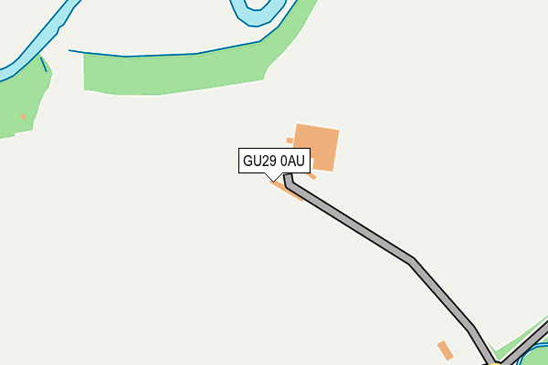
GU29 0AU is located in the Midhurst electoral ward, within the local authority district of Chichester and the English Parliamentary constituency of Chichester. The Sub Integrated Care Board (ICB) Location is NHS Sussex ICB - 70F and the police force is Sussex. This postcode has been in use since January 1980.


GetTheData
Source: OS OpenMap – Local (Ordnance Survey)
Source: OS VectorMap District (Ordnance Survey)
Licence: Open Government Licence (requires attribution)
| Easting | 489695 |
| Northing | 121316 |
| Latitude | 50.984266 |
| Longitude | -0.723541 |
GetTheData
Source: Open Postcode Geo
Licence: Open Government Licence
| Country | England |
| Postcode District | GU29 |
| ➜ GU29 open data dashboard ➜ See where GU29 is on a map | |
GetTheData
Source: Land Registry Price Paid Data
Licence: Open Government Licence
Elevation or altitude of GU29 0AU as distance above sea level:
| Metres | Feet | |
|---|---|---|
| Elevation | 20m | 66ft |
Elevation is measured from the approximate centre of the postcode, to the nearest point on an OS contour line from OS Terrain 50, which has contour spacing of ten vertical metres.
➜ How high above sea level am I? Find the elevation of your current position using your device's GPS.
GetTheData
Source: Open Postcode Elevation
Licence: Open Government Licence
| Ward | Midhurst |
| Constituency | Chichester |
GetTheData
Source: ONS Postcode Database
Licence: Open Government Licence
| The Wharf | Midhurst | 854m |
| Golf Course (A272) | Easebourne | 1,017m |
| Reservoir (A272) | Easebourne | 1,021m |
| Reservoir (A272) | Easebourne | 1,030m |
| Golf Course (A272) | Easebourne | 1,031m |
GetTheData
Source: NaPTAN
Licence: Open Government Licence
| Percentage of properties with Next Generation Access | 100.0% |
| Percentage of properties with Superfast Broadband | 33.3% |
| Percentage of properties with Ultrafast Broadband | 0.0% |
| Percentage of properties with Full Fibre Broadband | 0.0% |
Superfast Broadband is between 30Mbps and 300Mbps
Ultrafast Broadband is > 300Mbps
| Percentage of properties unable to receive 2Mbps | 66.7% |
| Percentage of properties unable to receive 5Mbps | 66.7% |
| Percentage of properties unable to receive 10Mbps | 66.7% |
| Percentage of properties unable to receive 30Mbps | 66.7% |
GetTheData
Source: Ofcom
Licence: Ofcom Terms of Use (requires attribution)
GetTheData
Source: ONS Postcode Database
Licence: Open Government Licence


➜ Get more ratings from the Food Standards Agency
GetTheData
Source: Food Standards Agency
Licence: FSA terms & conditions
| Last Collection | |||
|---|---|---|---|
| Location | Mon-Fri | Sat | Distance |
| West Lavington | 16:00 | 10:00 | 499m |
| Lutener Road | 17:00 | 11:30 | 1,093m |
| Midhurst Delivery Office | 18:00 | 12:30 | 1,109m |
GetTheData
Source: Dracos
Licence: Creative Commons Attribution-ShareAlike
| Facility | Distance |
|---|---|
| Cowdray Park Polo Club (The Lawns Polo Ground) Easebourne, Midhurst Grass Pitches | 620m |
| Midhurst Cricket & Rugby Football Club Cowdray Ruins, Easebourne, Midhurst Grass Pitches | 711m |
| Spread Eagle Spa South Street, Midhurst Health and Fitness Gym, Swimming Pool | 1km |
GetTheData
Source: Active Places
Licence: Open Government Licence
| School | Phase of Education | Distance |
|---|---|---|
| Conifers School Egmont Road, Midhurst, GU29 9BG | Not applicable | 1.2km |
| Midhurst Rother College North Street, Midhurst, GU29 9DT | Secondary | 1.2km |
| Easebourne CofE Primary School Wheelbarrow Castle, Easebourne, Midhurst, GU29 9AG | Primary | 1.5km |
GetTheData
Source: Edubase
Licence: Open Government Licence
The below table lists the International Territorial Level (ITL) codes (formerly Nomenclature of Territorial Units for Statistics (NUTS) codes) and Local Administrative Units (LAU) codes for GU29 0AU:
| ITL 1 Code | Name |
|---|---|
| TLJ | South East (England) |
| ITL 2 Code | Name |
| TLJ2 | Surrey, East and West Sussex |
| ITL 3 Code | Name |
| TLJ27 | West Sussex (South West) |
| LAU 1 Code | Name |
| E07000225 | Chichester |
GetTheData
Source: ONS Postcode Directory
Licence: Open Government Licence
The below table lists the Census Output Area (OA), Lower Layer Super Output Area (LSOA), and Middle Layer Super Output Area (MSOA) for GU29 0AU:
| Code | Name | |
|---|---|---|
| OA | E00160839 | |
| LSOA | E01032717 | Chichester 004F |
| MSOA | E02006564 | Chichester 004 |
GetTheData
Source: ONS Postcode Directory
Licence: Open Government Licence
| GU29 0EL | Oaklands Lane | 513m |
| GU29 0EN | 653m | |
| GU29 0EG | Selham Road | 674m |
| GU29 0EQ | 714m | |
| GU29 0EH | Church Road | 843m |
| GU29 9PX | The Wharf | 857m |
| GU29 0ET | Closewalks Wood | 887m |
| GU29 9NL | Edinburgh Square | 949m |
| GU29 9PT | St Annes Court | 951m |
| GU29 9PE | Chichester Road | 979m |
GetTheData
Source: Open Postcode Geo; Land Registry Price Paid Data
Licence: Open Government Licence