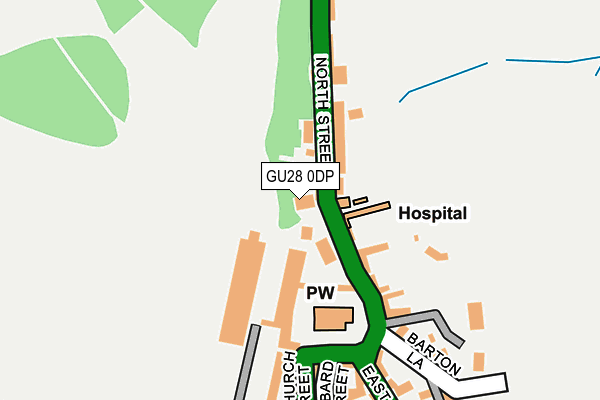
GU28 0DP is located in the Petworth electoral ward, within the local authority district of Chichester and the English Parliamentary constituency of Arundel and South Downs. The Sub Integrated Care Board (ICB) Location is NHS Sussex ICB - 70F and the police force is Sussex. This postcode has been in use since January 1980.


GetTheData
Source: OS OpenMap – Local (Ordnance Survey)
Source: OS VectorMap District (Ordnance Survey)
Licence: Open Government Licence (requires attribution)
| Easting | 497650 |
| Northing | 121984 |
| Latitude | 50.988984 |
| Longitude | -0.610087 |
GetTheData
Source: Open Postcode Geo
Licence: Open Government Licence
| Country | England |
| Postcode District | GU28 |
| ➜ GU28 open data dashboard ➜ See where GU28 is on a map ➜ Where is Petworth? | |
GetTheData
Source: Land Registry Price Paid Data
Licence: Open Government Licence
Elevation or altitude of GU28 0DP as distance above sea level:
| Metres | Feet | |
|---|---|---|
| Elevation | 60m | 197ft |
Elevation is measured from the approximate centre of the postcode, to the nearest point on an OS contour line from OS Terrain 50, which has contour spacing of ten vertical metres.
➜ How high above sea level am I? Find the elevation of your current position using your device's GPS.
GetTheData
Source: Open Postcode Elevation
Licence: Open Government Licence
| Ward | Petworth |
| Constituency | Arundel And South Downs |
GetTheData
Source: ONS Postcode Database
Licence: Open Government Licence
| June 2022 | Other theft | On or near New Street | 325m |
| June 2022 | Other theft | On or near Damer'S Bridge | 348m |
| June 2022 | Criminal damage and arson | On or near High Street | 386m |
| ➜ Get more crime data in our Crime section | |||
GetTheData
Source: data.police.uk
Licence: Open Government Licence
| Town Square (Church Street) | Petworth | 269m |
| Market Square | Petworth | 294m |
| Flexible Zone (Petworth) | Petworth | 399m |
| Sheepdown Drive (A283) | Petworth | 482m |
| Sheepdown Drive (A283) | Petworth | 493m |
GetTheData
Source: NaPTAN
Licence: Open Government Licence
| Percentage of properties with Next Generation Access | 100.0% |
| Percentage of properties with Superfast Broadband | 100.0% |
| Percentage of properties with Ultrafast Broadband | 0.0% |
| Percentage of properties with Full Fibre Broadband | 0.0% |
Superfast Broadband is between 30Mbps and 300Mbps
Ultrafast Broadband is > 300Mbps
| Percentage of properties unable to receive 2Mbps | 0.0% |
| Percentage of properties unable to receive 5Mbps | 0.0% |
| Percentage of properties unable to receive 10Mbps | 0.0% |
| Percentage of properties unable to receive 30Mbps | 0.0% |
GetTheData
Source: Ofcom
Licence: Ofcom Terms of Use (requires attribution)
GetTheData
Source: ONS Postcode Database
Licence: Open Government Licence


➜ Get more ratings from the Food Standards Agency
GetTheData
Source: Food Standards Agency
Licence: FSA terms & conditions
| Last Collection | |||
|---|---|---|---|
| Location | Mon-Fri | Sat | Distance |
| Royal Mail Delivery Office | 17:45 | 12:00 | 274m |
| Petworth Post Office | 17:00 | 11:00 | 282m |
| Sheepdown Drive | 17:15 | 11:00 | 514m |
GetTheData
Source: Dracos
Licence: Creative Commons Attribution-ShareAlike
| Facility | Distance |
|---|---|
| Hampers Green Community Centre North Street, Petworth Sports Hall | 563m |
| Petworth Park Sports Ground Tillington Road, Petworth Grass Pitches | 563m |
| Herbert Shiner School (Closed) South Grove, Petworth Sports Hall, Grass Pitches | 927m |
GetTheData
Source: Active Places
Licence: Open Government Licence
| School | Phase of Education | Distance |
|---|---|---|
| Petworth Cof E Primary School South Grove, Petworth, GU28 0EE | Primary | 927m |
| Fittleworth CofE Village School School Lane, Fittleworth, RH20 1JB | Primary | 4.6km |
| Duncton CofE Junior School Willett Close, Duncton, Petworth, GU28 0LB | Primary | 5.2km |
GetTheData
Source: Edubase
Licence: Open Government Licence
The below table lists the International Territorial Level (ITL) codes (formerly Nomenclature of Territorial Units for Statistics (NUTS) codes) and Local Administrative Units (LAU) codes for GU28 0DP:
| ITL 1 Code | Name |
|---|---|
| TLJ | South East (England) |
| ITL 2 Code | Name |
| TLJ2 | Surrey, East and West Sussex |
| ITL 3 Code | Name |
| TLJ27 | West Sussex (South West) |
| LAU 1 Code | Name |
| E07000225 | Chichester |
GetTheData
Source: ONS Postcode Directory
Licence: Open Government Licence
The below table lists the Census Output Area (OA), Lower Layer Super Output Area (LSOA), and Middle Layer Super Output Area (MSOA) for GU28 0DP:
| Code | Name | |
|---|---|---|
| OA | E00160731 | |
| LSOA | E01031515 | Chichester 005E |
| MSOA | E02006565 | Chichester 005 |
GetTheData
Source: ONS Postcode Directory
Licence: Open Government Licence
| GU28 0DQ | North Street | 43m |
| GU28 0DG | North Street | 51m |
| GU28 0DH | Glebe Villas | 52m |
| GU28 0DJ | North Street | 72m |
| GU28 0DE | North Street | 75m |
| GU28 0DF | North Street | 123m |
| GU28 0DB | Rectory Lane | 152m |
| GU28 0AD | Church Street | 165m |
| GU28 0DA | Bartons Lane | 231m |
| GU28 0AG | Lombard Street | 234m |
GetTheData
Source: Open Postcode Geo; Land Registry Price Paid Data
Licence: Open Government Licence