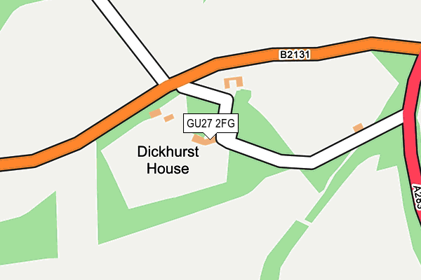
GU27 2FG lies on Cripplecrutch Hill in Haslemere. GU27 2FG is located in the Fernhurst electoral ward, within the local authority district of Chichester and the English Parliamentary constituency of Chichester. The Sub Integrated Care Board (ICB) Location is NHS Sussex ICB - 70F and the police force is Sussex. This postcode has been in use since October 2008.


GetTheData
Source: OS OpenMap – Local (Ordnance Survey)
Source: OS VectorMap District (Ordnance Survey)
Licence: Open Government Licence (requires attribution)
| Easting | 494341 |
| Northing | 132315 |
| Latitude | 51.082404 |
| Longitude | -0.654511 |
GetTheData
Source: Open Postcode Geo
Licence: Open Government Licence
| Street | Cripplecrutch Hill |
| Town/City | Haslemere |
| Country | England |
| Postcode District | GU27 |
| ➜ GU27 open data dashboard ➜ See where GU27 is on a map | |
GetTheData
Source: Land Registry Price Paid Data
Licence: Open Government Licence
Elevation or altitude of GU27 2FG as distance above sea level:
| Metres | Feet | |
|---|---|---|
| Elevation | 100m | 328ft |
Elevation is measured from the approximate centre of the postcode, to the nearest point on an OS contour line from OS Terrain 50, which has contour spacing of ten vertical metres.
➜ How high above sea level am I? Find the elevation of your current position using your device's GPS.
GetTheData
Source: Open Postcode Elevation
Licence: Open Government Licence
| Ward | Fernhurst |
| Constituency | Chichester |
GetTheData
Source: ONS Postcode Database
Licence: Open Government Licence
| June 2022 | Anti-social behaviour | On or near Rodgate Lane | 106m |
| June 2022 | Public order | On or near Cripplecrutch Hill | 421m |
| September 2021 | Burglary | On or near Cripplecrutch Hill | 421m |
| ➜ Cripplecrutch Hill crime map and outcomes | |||
GetTheData
Source: data.police.uk
Licence: Open Government Licence
| Rodgate Lane | Ansteadbrook | 91m |
| Rodgate Lane | Ansteadbrook | 110m |
| Cross Roads (A283) | Gospel Green | 776m |
| The Creamery (Gospel Green Crossroads) | Gospel Green | 867m |
| The Creamery (Gospel Green Crossroads) | Gospel Green | 887m |
| Haslemere Station | 4.6km |
GetTheData
Source: NaPTAN
Licence: Open Government Licence
| Percentage of properties with Next Generation Access | 100.0% |
| Percentage of properties with Superfast Broadband | 50.0% |
| Percentage of properties with Ultrafast Broadband | 50.0% |
| Percentage of properties with Full Fibre Broadband | 50.0% |
Superfast Broadband is between 30Mbps and 300Mbps
Ultrafast Broadband is > 300Mbps
| Percentage of properties unable to receive 2Mbps | 0.0% |
| Percentage of properties unable to receive 5Mbps | 50.0% |
| Percentage of properties unable to receive 10Mbps | 50.0% |
| Percentage of properties unable to receive 30Mbps | 50.0% |
GetTheData
Source: Ofcom
Licence: Ofcom Terms of Use (requires attribution)
GetTheData
Source: ONS Postcode Database
Licence: Open Government Licence


➜ Get more ratings from the Food Standards Agency
GetTheData
Source: Food Standards Agency
Licence: FSA terms & conditions
| Last Collection | |||
|---|---|---|---|
| Location | Mon-Fri | Sat | Distance |
| Ramsnest Common | 16:15 | 07:45 | 964m |
| Fisher Street | 16:30 | 07:30 | 1,229m |
| Killinghurst Lane | 16:45 | 07:00 | 1,358m |
GetTheData
Source: Dracos
Licence: Creative Commons Attribution-ShareAlike
| Facility | Distance |
|---|---|
| Amarna Spa Petworth Road, Haslemere Swimming Pool, Health and Fitness Gym, Outdoor Tennis Courts, Studio | 1.9km |
| Chiddingfold Golf Club Petworth Road, Chiddingfold, Godalming Golf | 2.5km |
| Northchapel Village Green Pipers Lane, Northchapel, Petworth Grass Pitches | 2.9km |
GetTheData
Source: Active Places
Licence: Open Government Licence
| School | Phase of Education | Distance |
|---|---|---|
| Northchapel Community Primary School Pipers Lane, Northchapel, Petworth, GU28 9JA | Primary | 3km |
| St Ives School Three Gates Lane, Haslemere, GU27 2ES | Not applicable | 3.3km |
| Grayswood Church of England (Aided) Primary School Lower Road, Grayswood, Haslemere, GU27 2DR | Primary | 3.4km |
GetTheData
Source: Edubase
Licence: Open Government Licence
The below table lists the International Territorial Level (ITL) codes (formerly Nomenclature of Territorial Units for Statistics (NUTS) codes) and Local Administrative Units (LAU) codes for GU27 2FG:
| ITL 1 Code | Name |
|---|---|
| TLJ | South East (England) |
| ITL 2 Code | Name |
| TLJ2 | Surrey, East and West Sussex |
| ITL 3 Code | Name |
| TLJ27 | West Sussex (South West) |
| LAU 1 Code | Name |
| E07000225 | Chichester |
GetTheData
Source: ONS Postcode Directory
Licence: Open Government Licence
The below table lists the Census Output Area (OA), Lower Layer Super Output Area (LSOA), and Middle Layer Super Output Area (MSOA) for GU27 2FG:
| Code | Name | |
|---|---|---|
| OA | E00160746 | |
| LSOA | E01031519 | Chichester 001D |
| MSOA | E02006561 | Chichester 001 |
GetTheData
Source: ONS Postcode Directory
Licence: Open Government Licence
| GU27 2EW | Rodgate Lane | 368m |
| GU8 4SU | Petworth Road | 530m |
| GU8 4ST | Petworth Road | 763m |
| GU27 3BH | Gospel Green | 829m |
| GU8 4SS | Petworth Road | 900m |
| GU8 4SP | Petworth Road | 965m |
| GU27 3BG | Petworth Road | 1037m |
| GU28 9EL | Fisher Street | 1069m |
| GU8 4SW | Killinghurst Lane | 1084m |
| GU8 4SR | Gostrode Lane | 1084m |
GetTheData
Source: Open Postcode Geo; Land Registry Price Paid Data
Licence: Open Government Licence