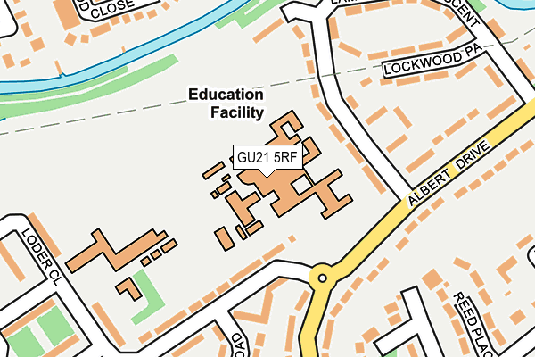
GU21 5RF is located in the Canalside electoral ward, within the local authority district of Woking and the English Parliamentary constituency of Woking. The Sub Integrated Care Board (ICB) Location is NHS Surrey Heartlands ICB - 92A and the police force is Surrey. This postcode has been in use since July 1983.


GetTheData
Source: OS OpenMap – Local (Ordnance Survey)
Source: OS VectorMap District (Ordnance Survey)
Licence: Open Government Licence (requires attribution)
| Easting | 502865 |
| Northing | 160677 |
| Latitude | 51.335889 |
| Longitude | -0.524758 |
GetTheData
Source: Open Postcode Geo
Licence: Open Government Licence
| Country | England |
| Postcode District | GU21 |
| ➜ GU21 open data dashboard ➜ See where GU21 is on a map ➜ Where is Sheerwater? | |
GetTheData
Source: Land Registry Price Paid Data
Licence: Open Government Licence
Elevation or altitude of GU21 5RF as distance above sea level:
| Metres | Feet | |
|---|---|---|
| Elevation | 30m | 98ft |
Elevation is measured from the approximate centre of the postcode, to the nearest point on an OS contour line from OS Terrain 50, which has contour spacing of ten vertical metres.
➜ How high above sea level am I? Find the elevation of your current position using your device's GPS.
GetTheData
Source: Open Postcode Elevation
Licence: Open Government Licence
| Ward | Canalside |
| Constituency | Woking |
GetTheData
Source: ONS Postcode Database
Licence: Open Government Licence
| January 2024 | Anti-social behaviour | On or near Devonshire Avenue | 265m |
| January 2024 | Public order | On or near Devonshire Avenue | 265m |
| January 2024 | Public order | On or near Devonshire Avenue | 265m |
| ➜ Get more crime data in our Crime section | |||
GetTheData
Source: data.police.uk
Licence: Open Government Licence
| Bishop David Brown School (Albert Drive) | Sheerwater | 127m |
| Bishop David Brown School (Albert Drive) | Sheerwater | 137m |
| Lambourne Crescent (Albert Drive) | Sheerwater | 271m |
| Lambourne Crescent (Albert Drive) | Sheerwater | 294m |
| Priory Close (Woodham Lane) | Sheerwater | 358m |
| West Byfleet Station | 1.4km |
| Woking Station | 3km |
| Byfleet & New Haw Station | 3.4km |
GetTheData
Source: NaPTAN
Licence: Open Government Licence
GetTheData
Source: ONS Postcode Database
Licence: Open Government Licence


➜ Get more ratings from the Food Standards Agency
GetTheData
Source: Food Standards Agency
Licence: FSA terms & conditions
| Last Collection | |||
|---|---|---|---|
| Location | Mon-Fri | Sat | Distance |
| Lambourne Crescent | 17:00 | 12:00 | 231m |
| Sheerwater Post Office | 17:30 | 12:15 | 387m |
| Laurel Crescent | 17:00 | 12:00 | 509m |
GetTheData
Source: Dracos
Licence: Creative Commons Attribution-ShareAlike
| Facility | Distance |
|---|---|
| The Bishop David Brown School (Closed) Albert Drive, Woking Sports Hall, Outdoor Tennis Courts, Studio | 29m |
| Eastwood Leisure Centre Albert Drive, Albert Drive, Woking Grass Pitches, Health and Fitness Gym, Sports Hall, Artificial Grass Pitch, Swimming Pool, Studio, Outdoor Tennis Courts | 45m |
| Sheerwater Athletics Track (Closed) Blackmore Crescent, Woking Athletics | 487m |
GetTheData
Source: Active Places
Licence: Open Government Licence
| School | Phase of Education | Distance |
|---|---|---|
| The Bishop David Brown School Albert Drive, Woking, GU21 5RF | Secondary | 26m |
| Broadmere Primary Academy Devonshire Avenue, Sheerwater, Woking, GU21 5QE | Primary | 196m |
| The Marist Catholic Primary School Old Woking Road, West Byfleet, KT14 6HS | Primary | 996m |
GetTheData
Source: Edubase
Licence: Open Government Licence
The below table lists the International Territorial Level (ITL) codes (formerly Nomenclature of Territorial Units for Statistics (NUTS) codes) and Local Administrative Units (LAU) codes for GU21 5RF:
| ITL 1 Code | Name |
|---|---|
| TLJ | South East (England) |
| ITL 2 Code | Name |
| TLJ2 | Surrey, East and West Sussex |
| ITL 3 Code | Name |
| TLJ25 | West Surrey |
| LAU 1 Code | Name |
| E07000217 | Woking |
GetTheData
Source: ONS Postcode Directory
Licence: Open Government Licence
The below table lists the Census Output Area (OA), Lower Layer Super Output Area (LSOA), and Middle Layer Super Output Area (MSOA) for GU21 5RF:
| Code | Name | |
|---|---|---|
| OA | E00157933 | |
| LSOA | E01030984 | Woking 004E |
| MSOA | E02006459 | Woking 004 |
GetTheData
Source: ONS Postcode Directory
Licence: Open Government Licence
| GU21 5RG | Lambourne Crescent | 100m |
| GU21 5QD | Devonshire Avenue | 105m |
| GU21 5RQ | Lambourne Crescent | 165m |
| GU21 5TZ | Albert Drive | 195m |
| GU21 5RL | Albert Drive | 196m |
| GU21 5RH | Lockwood Path | 217m |
| GU21 5TY | Albert Drive | 218m |
| GU21 5QB | Devonshire Avenue | 222m |
| GU21 5QA | St Michaels Road | 249m |
| GU21 5QF | Loder Close | 258m |
GetTheData
Source: Open Postcode Geo; Land Registry Price Paid Data
Licence: Open Government Licence