GU17 0JD maps, stats, and open data
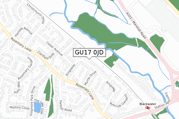
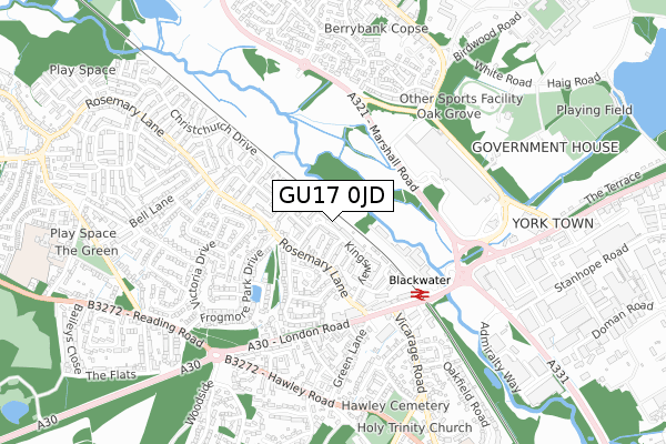
GU17 0JD lies on Kingsway in Blackwater, Camberley. GU17 0JD is located in the Blackwater and Hawley electoral ward, within the local authority district of Hart and the English Parliamentary constituency of Aldershot. The Sub Integrated Care Board (ICB) Location is NHS Frimley ICB - D4U1Y and the police force is Hampshire. This postcode has been in use since January 1980.
GU17 0JD maps


Licence: Open Government Licence (requires attribution)
Attribution: Contains OS data © Crown copyright and database right 2025
Source: Open Postcode Geo
Licence: Open Government Licence (requires attribution)
Attribution: Contains OS data © Crown copyright and database right 2025; Contains Royal Mail data © Royal Mail copyright and database right 2025; Source: Office for National Statistics licensed under the Open Government Licence v.3.0
GU17 0JD geodata
| Easting | 484991 |
| Northing | 160142 |
| Latitude | 51.334029 |
| Longitude | -0.781398 |
Where is GU17 0JD?
| Street | Kingsway |
| Locality | Blackwater |
| Town/City | Camberley |
| Country | England |
| Postcode District | GU17 |
GU17 0JD Elevation
Elevation or altitude of GU17 0JD as distance above sea level:
| Metres | Feet | |
|---|---|---|
| Elevation | 60m | 197ft |
Elevation is measured from the approximate centre of the postcode, to the nearest point on an OS contour line from OS Terrain 50, which has contour spacing of ten vertical metres.
➜ How high above sea level am I? Find the elevation of your current position using your device's GPS.
Politics
| Ward | Blackwater And Hawley |
|---|---|
| Constituency | Aldershot |
Transport
Nearest bus stops to GU17 0JD
| Parkhill Road (Rosemary Lane) | Blackwater | 207m |
| Parkhill Road (Rosemary Lane) | Blackwater | 235m |
| London Road (Rosemary Lane) | Blackwater | 316m |
| Rail Station & Po (A30 London Road) | Blackwater | 385m |
| Rosemary Lane (A30 London Road) | Blackwater | 390m |
Nearest railway stations to GU17 0JD
| Blackwater Station | 0.4km |
| Sandhurst Station | 2.2km |
| Camberley Station | 2.6km |
Broadband
Broadband access in GU17 0JD (2020 data)
| Percentage of properties with Next Generation Access | 100.0% |
| Percentage of properties with Superfast Broadband | 100.0% |
| Percentage of properties with Ultrafast Broadband | 100.0% |
| Percentage of properties with Full Fibre Broadband | 0.0% |
Superfast Broadband is between 30Mbps and 300Mbps
Ultrafast Broadband is > 300Mbps
Broadband speed in GU17 0JD (2019 data)
Download
| Median download speed | 74.2Mbps |
| Average download speed | 106.1Mbps |
| Maximum download speed | 350.00Mbps |
Upload
| Median upload speed | 5.5Mbps |
| Average upload speed | 7.1Mbps |
| Maximum upload speed | 18.21Mbps |
Broadband limitations in GU17 0JD (2020 data)
| Percentage of properties unable to receive 2Mbps | 0.0% |
| Percentage of properties unable to receive 5Mbps | 0.0% |
| Percentage of properties unable to receive 10Mbps | 0.0% |
| Percentage of properties unable to receive 30Mbps | 0.0% |
GU17 0JD gas and electricity consumption
Estimated total energy consumption in GU17 0JD by fuel type, 2015.
Gas
| Consumption (kWh) | 418,241 |
|---|---|
| Meter count | 32 |
| Mean (kWh/meter) | 13,070 |
| Median (kWh/meter) | 13,185 |
Electricity
| Consumption (kWh) | 143,583 |
|---|---|
| Meter count | 32 |
| Mean (kWh/meter) | 4,487 |
| Median (kWh/meter) | 3,681 |
- Consumption: The estimated total energy consumption, in kWh, across all meters in GU17 0JD, for 2015.
- Meter count: The total number of meters in GU17 0JD.
- Mean: The mean average consumption per meter, in kWh.
- Median: The median average consumption per meter, in kWh.
Source: Postcode level electricity estimates: 2015 (experimental)
Licence: Open Government Licence
Deprivation
9.9% of English postcodes are less deprived than GU17 0JD:Food Standards Agency
Three nearest food hygiene ratings to GU17 0JD (metres)


➜ Get more ratings from the Food Standards Agency
Nearest post box to GU17 0JD
| Last Collection | |||
|---|---|---|---|
| Location | Mon-Fri | Sat | Distance |
| Pinehill Road | 16:30 | 11:30 | 511m |
| Hawley Road | 16:00 | 12:30 | 542m |
| Fir Drive | 16:00 | 11:15 | 806m |
Environment
| Risk of GU17 0JD flooding from rivers and sea | Medium |
GU17 0JD ITL and GU17 0JD LAU
The below table lists the International Territorial Level (ITL) codes (formerly Nomenclature of Territorial Units for Statistics (NUTS) codes) and Local Administrative Units (LAU) codes for GU17 0JD:
| ITL 1 Code | Name |
|---|---|
| TLJ | South East (England) |
| ITL 2 Code | Name |
| TLJ3 | Hampshire and Isle of Wight |
| ITL 3 Code | Name |
| TLJ37 | North Hampshire |
| LAU 1 Code | Name |
| E07000089 | Hart |
GU17 0JD census areas
The below table lists the Census Output Area (OA), Lower Layer Super Output Area (LSOA), and Middle Layer Super Output Area (MSOA) for GU17 0JD:
| Code | Name | |
|---|---|---|
| OA | E00116097 | |
| LSOA | E01022848 | Hart 003C |
| MSOA | E02004753 | Hart 003 |
Nearest postcodes to GU17 0JD
| GU17 0JJ | Kingsway | 83m |
| GU17 0JL | Myrtle Drive | 116m |
| GU17 0JP | Russell Court | 155m |
| GU17 0JG | Cheriton Way | 155m |
| GU17 0JE | Cedar Avenue | 166m |
| GU17 0JN | Chestnut Close | 174m |
| GU17 0LT | Rosemary Lane | 184m |
| GU17 0JF | Cedar Avenue | 191m |
| GU17 0LZ | Parkhill Close | 195m |
| GU17 0JB | Kingsway | 204m |