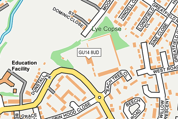
GU14 8UD is located in the Cherrywood electoral ward, within the local authority district of Rushmoor and the English Parliamentary constituency of Aldershot. The Sub Integrated Care Board (ICB) Location is NHS Frimley ICB - D4U1Y and the police force is Hampshire. This postcode has been in use since June 1981.


GetTheData
Source: OS OpenMap – Local (Ordnance Survey)
Source: OS VectorMap District (Ordnance Survey)
Licence: Open Government Licence (requires attribution)
| Easting | 486318 |
| Northing | 157525 |
| Latitude | 51.310304 |
| Longitude | -0.762988 |
GetTheData
Source: Open Postcode Geo
Licence: Open Government Licence
| Country | England |
| Postcode District | GU14 |
| ➜ GU14 open data dashboard ➜ See where GU14 is on a map ➜ Where is Farnborough? | |
GetTheData
Source: Land Registry Price Paid Data
Licence: Open Government Licence
Elevation or altitude of GU14 8UD as distance above sea level:
| Metres | Feet | |
|---|---|---|
| Elevation | 70m | 230ft |
Elevation is measured from the approximate centre of the postcode, to the nearest point on an OS contour line from OS Terrain 50, which has contour spacing of ten vertical metres.
➜ How high above sea level am I? Find the elevation of your current position using your device's GPS.
GetTheData
Source: Open Postcode Elevation
Licence: Open Government Licence
| Ward | Cherrywood |
| Constituency | Aldershot |
GetTheData
Source: ONS Postcode Database
Licence: Open Government Licence
| January 2024 | Criminal damage and arson | On or near Peach Tree Close | 143m |
| January 2024 | Criminal damage and arson | On or near Bideford Close | 377m |
| January 2024 | Theft from the person | On or near Spring Gardens | 412m |
| ➜ Get more crime data in our Crime section | |||
GetTheData
Source: data.police.uk
Licence: Open Government Licence
| Farnborough Football Club (Wren Way) | Hawley Lane | 75m |
| Grange Community Junior School (Wren Way) | Hawley Lane | 226m |
| Lulworth Close (Cherrywood Road) | Hawley Lane | 240m |
| Shopping Parade (Greatfield Close) | Hawley Lane | 309m |
| Shopping Parade (Churchill Crescent) | Hawley Lane | 319m |
| Frimley Station | 1.1km |
| Farnborough (Main) Station | 1.6km |
| Farnborough North Station | 1.7km |
GetTheData
Source: NaPTAN
Licence: Open Government Licence
GetTheData
Source: ONS Postcode Database
Licence: Open Government Licence


➜ Get more ratings from the Food Standards Agency
GetTheData
Source: Food Standards Agency
Licence: FSA terms & conditions
| Last Collection | |||
|---|---|---|---|
| Location | Mon-Fri | Sat | Distance |
| Cherrywood Road | 17:00 | 11:30 | 557m |
| Mayfield Road Post Office | 17:00 | 12:00 | 646m |
| Marston Drive | 17:00 | 11:15 | 675m |
GetTheData
Source: Dracos
Licence: Creative Commons Attribution-ShareAlike
| Facility | Distance |
|---|---|
| Farnborough Football Club Cherrywood Road, Farnborough Grass Pitches | 0m |
| The Easy As Hgv Stadium Cherrywood Road, Farnborough Grass Pitches | 5m |
| Moor Road Playing Fields Moor Road, Farnborough Grass Pitches, Cycling | 192m |
GetTheData
Source: Active Places
Licence: Open Government Licence
| School | Phase of Education | Distance |
|---|---|---|
| Farnborough Grange Nursery & Infant Community School Moor Road, Farnborough, GU14 8HW | Primary | 253m |
| Grange Community Junior School Wren Way, Prospect Estate, Farnborough, GU14 8TA | Primary | 382m |
| Cherrywood Community Primary School Mayfield Road, Farnborough, GU14 8LH | Primary | 686m |
GetTheData
Source: Edubase
Licence: Open Government Licence
The below table lists the International Territorial Level (ITL) codes (formerly Nomenclature of Territorial Units for Statistics (NUTS) codes) and Local Administrative Units (LAU) codes for GU14 8UD:
| ITL 1 Code | Name |
|---|---|
| TLJ | South East (England) |
| ITL 2 Code | Name |
| TLJ3 | Hampshire and Isle of Wight |
| ITL 3 Code | Name |
| TLJ37 | North Hampshire |
| LAU 1 Code | Name |
| E07000092 | Rushmoor |
GetTheData
Source: ONS Postcode Directory
Licence: Open Government Licence
The below table lists the Census Output Area (OA), Lower Layer Super Output Area (LSOA), and Middle Layer Super Output Area (MSOA) for GU14 8UD:
| Code | Name | |
|---|---|---|
| OA | E00117403 | |
| LSOA | E01023105 | Rushmoor 002A |
| MSOA | E02004803 | Rushmoor 002 |
GetTheData
Source: ONS Postcode Directory
Licence: Open Government Licence
| GU14 8TW | Robin Hood Close | 96m |
| GU14 8RB | St Dominic Close | 135m |
| GU14 8UU | Peach Tree Close | 139m |
| GU14 8TN | Robin Hood Close | 163m |
| GU14 8EZ | West Road | 176m |
| GU14 8HL | Hindell Close | 194m |
| GU14 8HQ | Longfield Close | 201m |
| GU14 8HN | Moor Road | 206m |
| GU14 8TR | Lulworth Close | 208m |
| GU14 8HW | Moor Road | 208m |
GetTheData
Source: Open Postcode Geo; Land Registry Price Paid Data
Licence: Open Government Licence