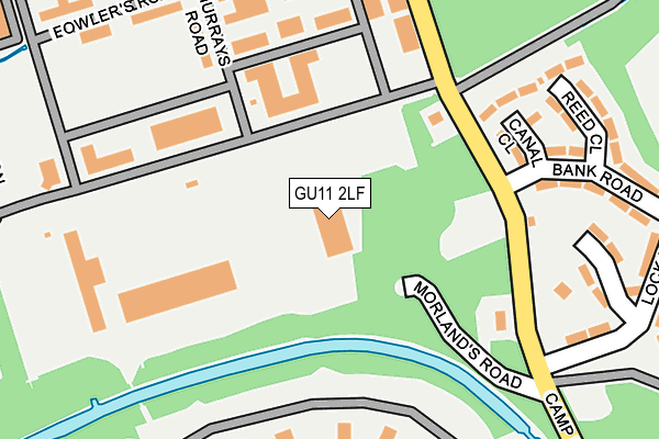
GU11 2LF is located in the St Mark's electoral ward, within the local authority district of Rushmoor and the English Parliamentary constituency of Aldershot. The Sub Integrated Care Board (ICB) Location is NHS Frimley ICB - D4U1Y and the police force is Hampshire. This postcode has been in use since May 2003.


GetTheData
Source: OS OpenMap – Local (Ordnance Survey)
Source: OS VectorMap District (Ordnance Survey)
Licence: Open Government Licence (requires attribution)
| Easting | 487684 |
| Northing | 152393 |
| Latitude | 51.263959 |
| Longitude | -0.744635 |
GetTheData
Source: Open Postcode Geo
Licence: Open Government Licence
| Country | England |
| Postcode District | GU11 |
➜ See where GU11 is on a map ➜ Where is Farnborough? | |
GetTheData
Source: Land Registry Price Paid Data
Licence: Open Government Licence
Elevation or altitude of GU11 2LF as distance above sea level:
| Metres | Feet | |
|---|---|---|
| Elevation | 80m | 262ft |
Elevation is measured from the approximate centre of the postcode, to the nearest point on an OS contour line from OS Terrain 50, which has contour spacing of ten vertical metres.
➜ How high above sea level am I? Find the elevation of your current position using your device's GPS.
GetTheData
Source: Open Postcode Elevation
Licence: Open Government Licence
| Ward | St Mark's |
| Constituency | Aldershot |
GetTheData
Source: ONS Postcode Database
Licence: Open Government Licence
| St Omar Barracks (Thornhill Road) | Thorn Hill | 521m |
| St Omar Barracks (Thornhill Road) | Thorn Hill | 529m |
| Hammersley Road (Queen's Avenue) | Aldershot | 735m |
| Hammersley Road (Queen's Avenue) | Aldershot | 770m |
| Gallwey Road (Ordnance Road) | Thorn Hill | 802m |
| North Camp Station | 1.6km |
| Ash Vale Station | 1.9km |
| Aldershot Station | 2.2km |
GetTheData
Source: NaPTAN
Licence: Open Government Licence
GetTheData
Source: ONS Postcode Database
Licence: Open Government Licence


➜ Get more ratings from the Food Standards Agency
GetTheData
Source: Food Standards Agency
Licence: FSA terms & conditions
| Last Collection | |||
|---|---|---|---|
| Location | Mon-Fri | Sat | Distance |
| Rhine Barracks | 18:00 | 11:45 | 1,080m |
| Old Farm Place | 17:30 | 11:00 | 1,101m |
| Lynchford Road | 16:45 | 11:45 | 1,288m |
GetTheData
Source: Dracos
Licence: Creative Commons Attribution-ShareAlike
The below table lists the International Territorial Level (ITL) codes (formerly Nomenclature of Territorial Units for Statistics (NUTS) codes) and Local Administrative Units (LAU) codes for GU11 2LF:
| ITL 1 Code | Name |
|---|---|
| TLJ | South East (England) |
| ITL 2 Code | Name |
| TLJ3 | Hampshire and Isle of Wight |
| ITL 3 Code | Name |
| TLJ37 | North Hampshire |
| LAU 1 Code | Name |
| E07000092 | Rushmoor |
GetTheData
Source: ONS Postcode Directory
Licence: Open Government Licence
The below table lists the Census Output Area (OA), Lower Layer Super Output Area (LSOA), and Middle Layer Super Output Area (MSOA) for GU11 2LF:
| Code | Name | |
|---|---|---|
| OA | E00117551 | |
| LSOA | E01023140 | Rushmoor 007G |
| MSOA | E02004808 | Rushmoor 007 |
GetTheData
Source: ONS Postcode Directory
Licence: Open Government Licence
| GU11 2LW | Dukes Park | 440m |
| GU11 2PX | Hollybush Lane | 767m |
| GU11 2PU | Government Road | 780m |
| GU11 2PT | Government Road | 1007m |
| GU12 5AL | Wellington Place | 1072m |
| GU12 5SX | Whittle Close | 1105m |
| GU12 5SR | Derry Close | 1123m |
| GU12 5SF | Old Farm Place | 1138m |
| GU12 4BU | Sheeling Close | 1155m |
| GU12 5SJ | Cody Close | 1159m |
GetTheData
Source: Open Postcode Geo; Land Registry Price Paid Data
Licence: Open Government Licence