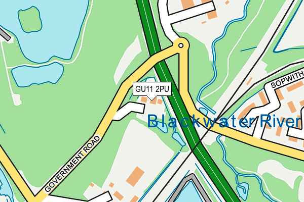
GU11 2PU lies on Government Road in Aldershot. GU11 2PU is located in the Wellington electoral ward, within the local authority district of Rushmoor and the English Parliamentary constituency of Aldershot. The Sub Integrated Care Board (ICB) Location is NHS Frimley ICB - D4U1Y and the police force is Hampshire. This postcode has been in use since January 1980.


GetTheData
Source: OS OpenMap – Local (Ordnance Survey)
Source: OS VectorMap District (Ordnance Survey)
Licence: Open Government Licence (requires attribution)
| Easting | 488348 |
| Northing | 151984 |
| Latitude | 51.260179 |
| Longitude | -0.735221 |
GetTheData
Source: Open Postcode Geo
Licence: Open Government Licence
| Street | Government Road |
| Town/City | Aldershot |
| Country | England |
| Postcode District | GU11 |
➜ See where GU11 is on a map | |
GetTheData
Source: Land Registry Price Paid Data
Licence: Open Government Licence
Elevation or altitude of GU11 2PU as distance above sea level:
| Metres | Feet | |
|---|---|---|
| Elevation | 70m | 230ft |
Elevation is measured from the approximate centre of the postcode, to the nearest point on an OS contour line from OS Terrain 50, which has contour spacing of ten vertical metres.
➜ How high above sea level am I? Find the elevation of your current position using your device's GPS.
GetTheData
Source: Open Postcode Elevation
Licence: Open Government Licence
| Ward | Wellington |
| Constituency | Aldershot |
GetTheData
Source: ONS Postcode Database
Licence: Open Government Licence
| St Omar Barracks (Thornhill Road) | Thorn Hill | 639m |
| St Omar Barracks (Thornhill Road) | Thorn Hill | 646m |
| Gallwey Road (Ordnance Road) | Thorn Hill | 664m |
| Gallwey Road (Ordnance Road) | Thorn Hill | 734m |
| Field Way (Farm Road) | North Town | 813m |
| Ash Vale Station | 1.6km |
| North Camp Station | 1.8km |
| Ash Station | 2km |
GetTheData
Source: NaPTAN
Licence: Open Government Licence
| Percentage of properties with Next Generation Access | 100.0% |
| Percentage of properties with Superfast Broadband | 100.0% |
| Percentage of properties with Ultrafast Broadband | 0.0% |
| Percentage of properties with Full Fibre Broadband | 0.0% |
Superfast Broadband is between 30Mbps and 300Mbps
Ultrafast Broadband is > 300Mbps
| Percentage of properties unable to receive 2Mbps | 0.0% |
| Percentage of properties unable to receive 5Mbps | 0.0% |
| Percentage of properties unable to receive 10Mbps | 0.0% |
| Percentage of properties unable to receive 30Mbps | 0.0% |
GetTheData
Source: Ofcom
Licence: Ofcom Terms of Use (requires attribution)
GetTheData
Source: ONS Postcode Database
Licence: Open Government Licence


➜ Get more ratings from the Food Standards Agency
GetTheData
Source: Food Standards Agency
Licence: FSA terms & conditions
| Last Collection | |||
|---|---|---|---|
| Location | Mon-Fri | Sat | Distance |
| Old Farm Place | 17:30 | 11:00 | 516m |
| Derwent Avenue | 17:30 | 11:15 | 552m |
| Prospect Road | 17:00 | 12:00 | 1,142m |
GetTheData
Source: Dracos
Licence: Creative Commons Attribution-ShareAlike
The below table lists the International Territorial Level (ITL) codes (formerly Nomenclature of Territorial Units for Statistics (NUTS) codes) and Local Administrative Units (LAU) codes for GU11 2PU:
| ITL 1 Code | Name |
|---|---|
| TLJ | South East (England) |
| ITL 2 Code | Name |
| TLJ3 | Hampshire and Isle of Wight |
| ITL 3 Code | Name |
| TLJ37 | North Hampshire |
| LAU 1 Code | Name |
| E07000092 | Rushmoor |
GetTheData
Source: ONS Postcode Directory
Licence: Open Government Licence
The below table lists the Census Output Area (OA), Lower Layer Super Output Area (LSOA), and Middle Layer Super Output Area (MSOA) for GU11 2PU:
| Code | Name | |
|---|---|---|
| OA | E00167936 | |
| LSOA | E01023141 | Rushmoor 008A |
| MSOA | E02004809 | Rushmoor 008 |
GetTheData
Source: ONS Postcode Directory
Licence: Open Government Licence
| GU12 5AL | Wellington Place | 311m |
| GU11 2PT | Government Road | 359m |
| GU11 2PX | Hollybush Lane | 397m |
| GU12 5AF | Ashurst Road | 452m |
| GU12 5SR | Derry Close | 457m |
| GU12 5AA | Lakeside Road | 500m |
| GU12 5SL | Hawker Road | 541m |
| GU12 5SJ | Cody Close | 542m |
| GU12 5SX | Whittle Close | 544m |
| GU12 5SS | Gloster Close | 563m |
GetTheData
Source: Open Postcode Geo; Land Registry Price Paid Data
Licence: Open Government Licence