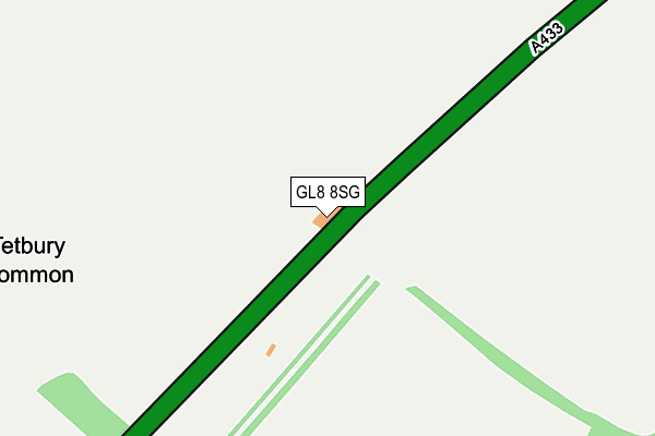
GL8 8SG is located in the Grumbolds Ash with Avening electoral ward, within the local authority district of Cotswold and the English Parliamentary constituency of The Cotswolds. The Sub Integrated Care Board (ICB) Location is NHS Gloucestershire ICB - 11M and the police force is Gloucestershire. This postcode has been in use since January 1980.


GetTheData
Source: OS OpenMap – Local (Ordnance Survey)
Source: OS VectorMap District (Ordnance Survey)
Licence: Open Government Licence (requires attribution)
| Easting | 391370 |
| Northing | 195395 |
| Latitude | 51.657273 |
| Longitude | -2.126153 |
GetTheData
Source: Open Postcode Geo
Licence: Open Government Licence
| Country | England |
| Postcode District | GL8 |
| ➜ GL8 open data dashboard ➜ See where GL8 is on a map | |
GetTheData
Source: Land Registry Price Paid Data
Licence: Open Government Licence
Elevation or altitude of GL8 8SG as distance above sea level:
| Metres | Feet | |
|---|---|---|
| Elevation | 130m | 427ft |
Elevation is measured from the approximate centre of the postcode, to the nearest point on an OS contour line from OS Terrain 50, which has contour spacing of ten vertical metres.
➜ How high above sea level am I? Find the elevation of your current position using your device's GPS.
GetTheData
Source: Open Postcode Elevation
Licence: Open Government Licence
| Ward | Grumbolds Ash With Avening |
| Constituency | The Cotswolds |
GetTheData
Source: ONS Postcode Database
Licence: Open Government Licence
| Trouble House Inn (A433) | Tetbury | 18m |
| Trouble House Inn (A433) | Tetbury | 22m |
| Ilsom House (London Road) | Tetbury | 1,567m |
| Ilsom House (London Road) | Tetbury | 1,587m |
| Trull Turn (A433) | Culkerton | 1,642m |
GetTheData
Source: NaPTAN
Licence: Open Government Licence
GetTheData
Source: ONS Postcode Database
Licence: Open Government Licence


➜ Get more ratings from the Food Standards Agency
GetTheData
Source: Food Standards Agency
Licence: FSA terms & conditions
| Last Collection | |||
|---|---|---|---|
| Location | Mon-Fri | Sat | Distance |
| Northfield | 17:00 | 11:45 | 2,581m |
| Conygar Road | 17:00 | 11:45 | 2,589m |
| Lowfield Road | 17:00 | 12:00 | 3,045m |
GetTheData
Source: Dracos
Licence: Creative Commons Attribution-ShareAlike
| Facility | Distance |
|---|---|
| Tetbury Town Fc Cirencester Road, Tetbury Grass Pitches | 2.2km |
| Swr Leisure Lowfield Road, Tetbury Sports Hall, Swimming Pool, Health and Fitness Gym, Grass Pitches, Outdoor Tennis Courts | 2.7km |
| Priory Gym (Closed) Priory Industrial Estate, Tetbury Health and Fitness Gym | 2.8km |
GetTheData
Source: Active Places
Licence: Open Government Licence
| School | Phase of Education | Distance |
|---|---|---|
| Sir William Romney's School Lowfield Road, Tetbury, GL8 8AE | Secondary | 2.7km |
| St Mary's Church of England Primary School St Mary's Road, Tetbury, GL8 8BW | Primary | 2.8km |
| Rodmarton Primary School Rodmarton, Cirencester, GL7 6PE | Primary | 4.1km |
GetTheData
Source: Edubase
Licence: Open Government Licence
The below table lists the International Territorial Level (ITL) codes (formerly Nomenclature of Territorial Units for Statistics (NUTS) codes) and Local Administrative Units (LAU) codes for GL8 8SG:
| ITL 1 Code | Name |
|---|---|
| TLK | South West (England) |
| ITL 2 Code | Name |
| TLK1 | Gloucestershire, Wiltshire and Bath/Bristol area |
| ITL 3 Code | Name |
| TLK13 | Gloucestershire CC |
| LAU 1 Code | Name |
| E07000079 | Cotswold |
GetTheData
Source: ONS Postcode Directory
Licence: Open Government Licence
The below table lists the Census Output Area (OA), Lower Layer Super Output Area (LSOA), and Middle Layer Super Output Area (MSOA) for GL8 8SG:
| Code | Name | |
|---|---|---|
| OA | E00168935 | |
| LSOA | E01022176 | Cotswold 011A |
| MSOA | E02004625 | Cotswold 011 |
GetTheData
Source: ONS Postcode Directory
Licence: Open Government Licence
| GL8 8SY | 1340m | |
| GL8 8RX | Ilsom Court Cottages | 1455m |
| GL8 8RU | 1525m | |
| GL8 8SE | 1582m | |
| GL8 8SS | 1698m | |
| GL8 8SQ | 1785m | |
| GL8 8ST | Manor Farm Cottages | 1826m |
| GL8 8SX | 1976m | |
| GL8 8SD | 2179m | |
| GL8 8GW | London Road | 2329m |
GetTheData
Source: Open Postcode Geo; Land Registry Price Paid Data
Licence: Open Government Licence