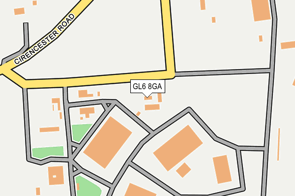
GL6 8GA is located in the Minchinhampton electoral ward, within the local authority district of Stroud and the English Parliamentary constituency of The Cotswolds. The Sub Integrated Care Board (ICB) Location is NHS Gloucestershire ICB - 11M and the police force is Gloucestershire. This postcode has been in use since August 2002.


GetTheData
Source: OS OpenMap – Local (Ordnance Survey)
Source: OS VectorMap District (Ordnance Survey)
Licence: Open Government Licence (requires attribution)
| Easting | 390721 |
| Northing | 201407 |
| Latitude | 51.711322 |
| Longitude | -2.135691 |
GetTheData
Source: Open Postcode Geo
Licence: Open Government Licence
| Country | England |
| Postcode District | GL6 |
| ➜ GL6 open data dashboard ➜ See where GL6 is on a map | |
GetTheData
Source: Land Registry Price Paid Data
Licence: Open Government Licence
Elevation or altitude of GL6 8GA as distance above sea level:
| Metres | Feet | |
|---|---|---|
| Elevation | 180m | 591ft |
Elevation is measured from the approximate centre of the postcode, to the nearest point on an OS contour line from OS Terrain 50, which has contour spacing of ten vertical metres.
➜ How high above sea level am I? Find the elevation of your current position using your device's GPS.
GetTheData
Source: Open Postcode Elevation
Licence: Open Government Licence
| Ward | Minchinhampton |
| Constituency | The Cotswolds |
GetTheData
Source: ONS Postcode Database
Licence: Open Government Licence
| August 2021 | Anti-social behaviour | On or near Sports/Recreation Area | 309m |
| March 2021 | Anti-social behaviour | On or near Sports/Recreation Area | 309m |
| ➜ Get more crime data in our Crime section | |||
GetTheData
Source: data.police.uk
Licence: Open Government Licence
| Industrial Estate (Cirencester Road) | Aston Down | 290m |
| Industrial Estate | Aston Down | 320m |
| Westley Farm (Cowcombe Hill) | Aston Down | 849m |
| Westley Farm (Cowcombe Hill) | Aston Down | 859m |
| Hampton Stone Works (Cirencester Road) | Aston Down | 1,397m |
GetTheData
Source: NaPTAN
Licence: Open Government Licence
GetTheData
Source: ONS Postcode Database
Licence: Open Government Licence


➜ Get more ratings from the Food Standards Agency
GetTheData
Source: Food Standards Agency
Licence: FSA terms & conditions
| Last Collection | |||
|---|---|---|---|
| Location | Mon-Fri | Sat | Distance |
| Cowcombe Lane | 16:30 | 08:00 | 317m |
| Chalford Valley | 16:45 | 10:00 | 1,193m |
| Randalls Green Chalford | 16:45 | 10:15 | 1,693m |
GetTheData
Source: Dracos
Licence: Creative Commons Attribution-ShareAlike
| Facility | Distance |
|---|---|
| Cirencester Park Polo Club (Aston Down) Cirencester Road, Chalford, Stroud Grass Pitches | 622m |
| Chalford Hill Primary School Sports Field Burcombe Way, Chalford Hill, Stroud Grass Pitches | 2.1km |
| Chalford Sports And Social Club France Lynch, Stroud Grass Pitches, Outdoor Tennis Courts | 2.2km |
GetTheData
Source: Active Places
Licence: Open Government Licence
| School | Phase of Education | Distance |
|---|---|---|
| Chalford Hill Primary School Chalford Hill, Stroud, GL6 8LG | Primary | 1.7km |
| Oakridge Parochial School Oakridge Lynch, Stroud, GL6 7NR | Primary | 2.1km |
| Bussage Church of England Primary School The Ridgeway, Bussage, Stroud, GL6 8FW | Primary | 3km |
GetTheData
Source: Edubase
Licence: Open Government Licence
The below table lists the International Territorial Level (ITL) codes (formerly Nomenclature of Territorial Units for Statistics (NUTS) codes) and Local Administrative Units (LAU) codes for GL6 8GA:
| ITL 1 Code | Name |
|---|---|
| TLK | South West (England) |
| ITL 2 Code | Name |
| TLK1 | Gloucestershire, Wiltshire and Bath/Bristol area |
| ITL 3 Code | Name |
| TLK13 | Gloucestershire CC |
| LAU 1 Code | Name |
| E07000082 | Stroud |
GetTheData
Source: ONS Postcode Directory
Licence: Open Government Licence
The below table lists the Census Output Area (OA), Lower Layer Super Output Area (LSOA), and Middle Layer Super Output Area (MSOA) for GL6 8GA:
| Code | Name | |
|---|---|---|
| OA | E00113780 | |
| LSOA | E01022384 | Stroud 010D |
| MSOA | E02004660 | Stroud 010 |
GetTheData
Source: ONS Postcode Directory
Licence: Open Government Licence
| GL6 8HR | Cowcombe Lane | 306m |
| GL6 8HS | 452m | |
| GL6 8HX | 785m | |
| GL6 8HP | Cowcombe Hill | 867m |
| GL6 8HW | Cowcombe Hill | 964m |
| GL6 8JX | Downs Mill | 1025m |
| GL6 8DX | The Valley | 1171m |
| GL6 8DU | 1184m | |
| GL6 8DS | High Street | 1217m |
| GL6 8DY | Coppice Hill | 1229m |
GetTheData
Source: Open Postcode Geo; Land Registry Price Paid Data
Licence: Open Government Licence