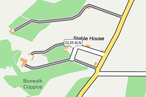
GL55 6LN is located in the Campden & Vale electoral ward, within the local authority district of Cotswold and the English Parliamentary constituency of The Cotswolds. The Sub Integrated Care Board (ICB) Location is NHS Gloucestershire ICB - 11M and the police force is Gloucestershire. This postcode has been in use since January 1980.


GetTheData
Source: OS OpenMap – Local (Ordnance Survey)
Source: OS VectorMap District (Ordnance Survey)
Licence: Open Government Licence (requires attribution)
| Easting | 417241 |
| Northing | 243135 |
| Latitude | 52.086302 |
| Longitude | -1.749795 |
GetTheData
Source: Open Postcode Geo
Licence: Open Government Licence
| Country | England |
| Postcode District | GL55 |
| ➜ GL55 open data dashboard ➜ See where GL55 is on a map | |
GetTheData
Source: Land Registry Price Paid Data
Licence: Open Government Licence
Elevation or altitude of GL55 6LN as distance above sea level:
| Metres | Feet | |
|---|---|---|
| Elevation | 170m | 558ft |
Elevation is measured from the approximate centre of the postcode, to the nearest point on an OS contour line from OS Terrain 50, which has contour spacing of ten vertical metres.
➜ How high above sea level am I? Find the elevation of your current position using your device's GPS.
GetTheData
Source: Open Postcode Elevation
Licence: Open Government Licence
| Ward | Campden & Vale |
| Constituency | The Cotswolds |
GetTheData
Source: ONS Postcode Database
Licence: Open Government Licence
| Kiftsgate Court School Stop | Hidcote Bartrim | 125m |
| Kiftsgate Court School Stop | Hidcote Bartrim | 133m |
| Hidcote Manor | Hidcote Bartrim | 490m |
| Lower Farm (Mickleton Road) | Hidcote Boyce | 1,163m |
| Lower Farm (Mickleton Road) | Hidcote Boyce | 1,170m |
GetTheData
Source: NaPTAN
Licence: Open Government Licence
➜ Broadband speed and availability dashboard for GL55 6LN
| Percentage of properties with Next Generation Access | 100.0% |
| Percentage of properties with Superfast Broadband | 0.0% |
| Percentage of properties with Ultrafast Broadband | 0.0% |
| Percentage of properties with Full Fibre Broadband | 0.0% |
Superfast Broadband is between 30Mbps and 300Mbps
Ultrafast Broadband is > 300Mbps
| Median download speed | 12.8Mbps |
| Average download speed | 12.0Mbps |
| Maximum download speed | 13.81Mbps |
| Median upload speed | 1.1Mbps |
| Average upload speed | 1.1Mbps |
| Maximum upload speed | 1.17Mbps |
| Percentage of properties unable to receive 2Mbps | 0.0% |
| Percentage of properties unable to receive 5Mbps | 0.0% |
| Percentage of properties unable to receive 10Mbps | 0.0% |
| Percentage of properties unable to receive 30Mbps | 100.0% |
➜ Broadband speed and availability dashboard for GL55 6LN
GetTheData
Source: Ofcom
Licence: Ofcom Terms of Use (requires attribution)
GetTheData
Source: ONS Postcode Database
Licence: Open Government Licence


➜ Get more ratings from the Food Standards Agency
GetTheData
Source: Food Standards Agency
Licence: FSA terms & conditions
| Last Collection | |||
|---|---|---|---|
| Location | Mon-Fri | Sat | Distance |
| Little Hidcote | 16:15 | 08:45 | 503m |
| The Butts | 16:30 | 10:30 | 1,255m |
| Mickleton P.o. | 16:30 | 10:30 | 1,271m |
GetTheData
Source: Dracos
Licence: Creative Commons Attribution-ShareAlike
| Facility | Distance |
|---|---|
| Mickleton Sports Club Stratford Road, Mickleton Grass Pitches | 2.3km |
| Ebrington Playing Fields Hidcote Road, Ebrington, Chipping Campden Grass Pitches | 2.9km |
| Ebrington Cricket Club Campden Road, Ebrington, Chipping Campden Grass Pitches | 3.2km |
GetTheData
Source: Active Places
Licence: Open Government Licence
| School | Phase of Education | Distance |
|---|---|---|
| Mickleton Primary School Broadmarston Lane, Mickleton, Chipping Campden, GL55 6SJ | Primary | 1.5km |
| Ilmington CofE Primary School Back Street, Ilmington, Shipston-on-Stour, CV36 4LJ | Primary | 3.8km |
| Tudor Grange Primary Academy Meon Vale Bailey Avenue, Meon Vale, Stratford-upon-Avon, CV37 8QR | Primary | 3.8km |
GetTheData
Source: Edubase
Licence: Open Government Licence
The below table lists the International Territorial Level (ITL) codes (formerly Nomenclature of Territorial Units for Statistics (NUTS) codes) and Local Administrative Units (LAU) codes for GL55 6LN:
| ITL 1 Code | Name |
|---|---|
| TLK | South West (England) |
| ITL 2 Code | Name |
| TLK1 | Gloucestershire, Wiltshire and Bath/Bristol area |
| ITL 3 Code | Name |
| TLK13 | Gloucestershire CC |
| LAU 1 Code | Name |
| E07000079 | Cotswold |
GetTheData
Source: ONS Postcode Directory
Licence: Open Government Licence
The below table lists the Census Output Area (OA), Lower Layer Super Output Area (LSOA), and Middle Layer Super Output Area (MSOA) for GL55 6LN:
| Code | Name | |
|---|---|---|
| OA | E00112742 | |
| LSOA | E01022184 | Cotswold 001D |
| MSOA | E02004615 | Cotswold 001 |
GetTheData
Source: ONS Postcode Directory
Licence: Open Government Licence
| GL55 6SZ | Cedar Road | 1038m |
| GL55 6TF | Granbrook Lane | 1101m |
| GL55 6LT | 1106m | |
| GL55 6TE | Granbrook Lane | 1124m |
| GL55 6SY | Cedar Road | 1154m |
| GL55 6TQ | 1158m | |
| GL55 6RZ | Church Lane | 1169m |
| GL55 6LX | 1182m | |
| GL55 6TX | Nursery Close | 1198m |
| GL55 6SX | Granbrook Lane | 1209m |
GetTheData
Source: Open Postcode Geo; Land Registry Price Paid Data
Licence: Open Government Licence