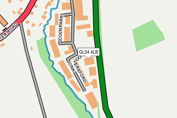
GL54 4LB lies on Coln Park in Andoversford, Cheltenham. GL54 4LB is located in the Sandywell electoral ward, within the local authority district of Cotswold and the English Parliamentary constituency of The Cotswolds. The Sub Integrated Care Board (ICB) Location is NHS Gloucestershire ICB - 11M and the police force is Gloucestershire. This postcode has been in use since January 1980.


GetTheData
Source: OS OpenMap – Local (Ordnance Survey)
Source: OS VectorMap District (Ordnance Survey)
Licence: Open Government Licence (requires attribution)
| Easting | 402525 |
| Northing | 219293 |
| Latitude | 51.872212 |
| Longitude | -1.964722 |
GetTheData
Source: Open Postcode Geo
Licence: Open Government Licence
| Street | Coln Park |
| Locality | Andoversford |
| Town/City | Cheltenham |
| Country | England |
| Postcode District | GL54 |
| ➜ GL54 open data dashboard ➜ See where GL54 is on a map ➜ Where is Andoversford? | |
GetTheData
Source: Land Registry Price Paid Data
Licence: Open Government Licence
Elevation or altitude of GL54 4LB as distance above sea level:
| Metres | Feet | |
|---|---|---|
| Elevation | 170m | 558ft |
Elevation is measured from the approximate centre of the postcode, to the nearest point on an OS contour line from OS Terrain 50, which has contour spacing of ten vertical metres.
➜ How high above sea level am I? Find the elevation of your current position using your device's GPS.
GetTheData
Source: Open Postcode Elevation
Licence: Open Government Licence
| Ward | Sandywell |
| Constituency | The Cotswolds |
GetTheData
Source: ONS Postcode Database
Licence: Open Government Licence
| June 2022 | Burglary | On or near Coln Rise | 254m |
| June 2022 | Burglary | On or near Huntsmans Meet | 495m |
| April 2022 | Other theft | On or near Coln Park | 134m |
| ➜ Coln Park crime map and outcomes | |||
GetTheData
Source: data.police.uk
Licence: Open Government Licence
| Station Road (Gloucester Road) | Andoversford | 305m |
| Station Road (Gloucester Road) | Andoversford | 312m |
| Templefields & Crossfields (Gloucester Road) | Andoversford | 420m |
| Templefields & Crossfields (Gloucester Road) | Andoversford | 430m |
| Primary School | Andoversford | 489m |
GetTheData
Source: NaPTAN
Licence: Open Government Licence
| Median download speed | 79.5Mbps |
| Average download speed | 72.4Mbps |
| Maximum download speed | 80.00Mbps |
| Median upload speed | 20.0Mbps |
| Average upload speed | 17.9Mbps |
| Maximum upload speed | 20.00Mbps |
GetTheData
Source: Ofcom
Licence: Ofcom Terms of Use (requires attribution)
GetTheData
Source: ONS Postcode Database
Licence: Open Government Licence


➜ Get more ratings from the Food Standards Agency
GetTheData
Source: Food Standards Agency
Licence: FSA terms & conditions
| Last Collection | |||
|---|---|---|---|
| Location | Mon-Fri | Sat | Distance |
| Foxcote | 17:00 | 09:00 | 1,592m |
| Kilkenny | 17:00 | 08:30 | 1,816m |
| Withington(Church) | 16:15 | 10:30 | 3,781m |
GetTheData
Source: Dracos
Licence: Creative Commons Attribution-ShareAlike
| Facility | Distance |
|---|---|
| Andoversford Sports And Social Club Crossfields Estate, Andoversford, Cheltenham Grass Pitches | 494m |
| Shipton Golf Course Shipton Oliffe, Cheltenham Golf | 973m |
| Charlton Rovers Afc (Shipton Playing Fields) Square Ditch, Square Ditch, Shipton Oliffe Grass Pitches | 1km |
GetTheData
Source: Active Places
Licence: Open Government Licence
| School | Phase of Education | Distance |
|---|---|---|
| Andoversford Primary School Old Gloucester Road, Andoversford, Cheltenham, GL54 4HR | Primary | 322m |
| Withington Church of England Primary School High Street, Withington, Cheltenham, GL54 4BQ | Primary | 3.8km |
GetTheData
Source: Edubase
Licence: Open Government Licence
The below table lists the International Territorial Level (ITL) codes (formerly Nomenclature of Territorial Units for Statistics (NUTS) codes) and Local Administrative Units (LAU) codes for GL54 4LB:
| ITL 1 Code | Name |
|---|---|
| TLK | South West (England) |
| ITL 2 Code | Name |
| TLK1 | Gloucestershire, Wiltshire and Bath/Bristol area |
| ITL 3 Code | Name |
| TLK13 | Gloucestershire CC |
| LAU 1 Code | Name |
| E07000079 | Cotswold |
GetTheData
Source: ONS Postcode Directory
Licence: Open Government Licence
The below table lists the Census Output Area (OA), Lower Layer Super Output Area (LSOA), and Middle Layer Super Output Area (MSOA) for GL54 4LB:
| Code | Name | |
|---|---|---|
| OA | E00112921 | |
| LSOA | E01022216 | Cotswold 004D |
| MSOA | E02004618 | Cotswold 004 |
GetTheData
Source: ONS Postcode Directory
Licence: Open Government Licence
| GL54 4HL | Coln Rise | 229m |
| GL54 4HR | Gloucester Road | 277m |
| GL54 4LG | Waterside Close | 350m |
| GL54 4NB | Coln Gardens | 411m |
| GL54 4HN | Station Road | 413m |
| GL54 4LE | Crossfields Estate | 483m |
| GL54 4JR | Huntsmans Meet | 486m |
| GL54 4AY | The Old Marketplace | 493m |
| GL54 4JY | Templefields Close | 507m |
| GL54 4LA | Station Road | 528m |
GetTheData
Source: Open Postcode Geo; Land Registry Price Paid Data
Licence: Open Government Licence