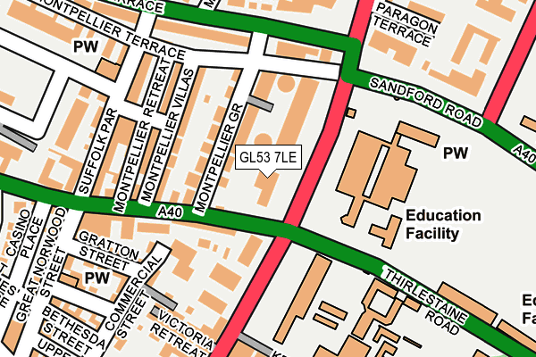
GL53 7LE is located in the College electoral ward, within the local authority district of Cheltenham and the English Parliamentary constituency of Cheltenham. The Sub Integrated Care Board (ICB) Location is NHS Gloucestershire ICB - 11M and the police force is Gloucestershire. This postcode has been in use since January 1980.


GetTheData
Source: OS OpenMap – Local (Ordnance Survey)
Source: OS VectorMap District (Ordnance Survey)
Licence: Open Government Licence (requires attribution)
| Easting | 394759 |
| Northing | 221486 |
| Latitude | 51.891901 |
| Longitude | -2.077564 |
GetTheData
Source: Open Postcode Geo
Licence: Open Government Licence
| Country | England |
| Postcode District | GL53 |
| ➜ GL53 open data dashboard ➜ See where GL53 is on a map ➜ Where is Cheltenham? | |
GetTheData
Source: Land Registry Price Paid Data
Licence: Open Government Licence
Elevation or altitude of GL53 7LE as distance above sea level:
| Metres | Feet | |
|---|---|---|
| Elevation | 70m | 230ft |
Elevation is measured from the approximate centre of the postcode, to the nearest point on an OS contour line from OS Terrain 50, which has contour spacing of ten vertical metres.
➜ How high above sea level am I? Find the elevation of your current position using your device's GPS.
GetTheData
Source: Open Postcode Elevation
Licence: Open Government Licence
| Ward | College |
| Constituency | Cheltenham |
GetTheData
Source: ONS Postcode Database
Licence: Open Government Licence
| January 2024 | Burglary | On or near Suffolk Parade | 192m |
| January 2024 | Other theft | On or near Suffolk Parade | 192m |
| January 2024 | Violence and sexual offences | On or near Suffolk Parade | 192m |
| ➜ Get more crime data in our Crime section | |||
GetTheData
Source: data.police.uk
Licence: Open Government Licence
| College Entrance | Cheltenham | 69m |
| College Entrance | Cheltenham | 86m |
| Thirlestaine Road (Bath Road) | Cheltenham | 114m |
| Thirlestaine Road (Bath Road) | Cheltenham | 118m |
| Suffolk Arms (School Stop) | Cheltenham | 121m |
| Cheltenham Spa Station | 1.6km |
GetTheData
Source: NaPTAN
Licence: Open Government Licence
GetTheData
Source: ONS Postcode Database
Licence: Open Government Licence


➜ Get more ratings from the Food Standards Agency
GetTheData
Source: Food Standards Agency
Licence: FSA terms & conditions
| Last Collection | |||
|---|---|---|---|
| Location | Mon-Fri | Sat | Distance |
| Upper Bath Road | 17:45 | 12:15 | 172m |
| Suffolk Road P.o. | 17:30 | 12:15 | 215m |
| Montpellier Parade | 17:45 | 12:30 | 320m |
GetTheData
Source: Dracos
Licence: Creative Commons Attribution-ShareAlike
| Facility | Distance |
|---|---|
| Montpellier Gardens Montpellier Walk, Cheltenham Outdoor Tennis Courts | 337m |
| Cheltenham College Thirlestaine Road, Cheltenham Sports Hall, Swimming Pool, Health and Fitness Gym, Grass Pitches, Squash Courts, Outdoor Tennis Courts, Artificial Grass Pitch | 451m |
| Ymca (Cheltenham Vittoria Walk) Vittoria Walk, Cheltenham Sports Hall, Squash Courts, Studio | 482m |
GetTheData
Source: Active Places
Licence: Open Government Licence
| School | Phase of Education | Distance |
|---|---|---|
| Cheltenham College Bath Road, Cheltenham, GL53 7LD | Not applicable | 111m |
| Cheltenham Ladies' College Bayshill Road, Cheltenham, GL50 3EP | Not applicable | 640m |
| Naunton Park Primary School Naunton Lane, Cheltenham, GL53 7BT | Primary | 822m |
GetTheData
Source: Edubase
Licence: Open Government Licence
The below table lists the International Territorial Level (ITL) codes (formerly Nomenclature of Territorial Units for Statistics (NUTS) codes) and Local Administrative Units (LAU) codes for GL53 7LE:
| ITL 1 Code | Name |
|---|---|
| TLK | South West (England) |
| ITL 2 Code | Name |
| TLK1 | Gloucestershire, Wiltshire and Bath/Bristol area |
| ITL 3 Code | Name |
| TLK13 | Gloucestershire CC |
| LAU 1 Code | Name |
| E07000078 | Cheltenham |
GetTheData
Source: ONS Postcode Directory
Licence: Open Government Licence
The below table lists the Census Output Area (OA), Lower Layer Super Output Area (LSOA), and Middle Layer Super Output Area (MSOA) for GL53 7LE:
| Code | Name | |
|---|---|---|
| OA | E00112401 | |
| LSOA | E01022117 | Cheltenham 009B |
| MSOA | E02004608 | Cheltenham 009 |
GetTheData
Source: ONS Postcode Directory
Licence: Open Government Licence
| GL50 2XR | Century Court | 69m |
| GL50 2XB | Montpellier Grove | 86m |
| GL50 2XE | Montpellier Villas | 110m |
| GL50 2AG | Suffolk Road | 121m |
| GL50 2AJ | Commercial Street | 128m |
| GL50 2AX | Suffolk Villas | 143m |
| GL50 2XF | Montpellier Villas | 144m |
| GL50 2XQ | Montpellier Villas | 148m |
| GL50 1XA | Montpellier Terrace | 153m |
| GL50 2XG | Montpellier Retreat | 160m |
GetTheData
Source: Open Postcode Geo; Land Registry Price Paid Data
Licence: Open Government Licence