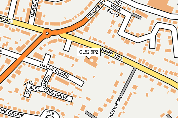
GL52 6PZ is located in the Battledown electoral ward, within the local authority district of Cheltenham and the English Parliamentary constituency of Cheltenham. The Sub Integrated Care Board (ICB) Location is NHS Gloucestershire ICB - 11M and the police force is Gloucestershire. This postcode has been in use since June 1996.


GetTheData
Source: OS OpenMap – Local (Ordnance Survey)
Source: OS VectorMap District (Ordnance Survey)
Licence: Open Government Licence (requires attribution)
| Easting | 396487 |
| Northing | 222387 |
| Latitude | 51.900016 |
| Longitude | -2.052464 |
GetTheData
Source: Open Postcode Geo
Licence: Open Government Licence
| Country | England |
| Postcode District | GL52 |
| ➜ GL52 open data dashboard ➜ See where GL52 is on a map ➜ Where is Cheltenham? | |
GetTheData
Source: Land Registry Price Paid Data
Licence: Open Government Licence
Elevation or altitude of GL52 6PZ as distance above sea level:
| Metres | Feet | |
|---|---|---|
| Elevation | 80m | 262ft |
Elevation is measured from the approximate centre of the postcode, to the nearest point on an OS contour line from OS Terrain 50, which has contour spacing of ten vertical metres.
➜ How high above sea level am I? Find the elevation of your current position using your device's GPS.
GetTheData
Source: Open Postcode Elevation
Licence: Open Government Licence
| Ward | Battledown |
| Constituency | Cheltenham |
GetTheData
Source: ONS Postcode Database
Licence: Open Government Licence
| January 2024 | Violence and sexual offences | On or near Wessex Drive | 204m |
| December 2023 | Other theft | On or near Wessex Drive | 204m |
| November 2023 | Burglary | On or near Wessex Drive | 204m |
| ➜ Get more crime data in our Crime section | |||
GetTheData
Source: data.police.uk
Licence: Open Government Licence
| Harp Hill (Hale's Road) | Battledown | 167m |
| Harp Hill (Hales Road) | Battledown | 188m |
| Tesco Superstop School Stop (Hewlett Road) | Whaddon | 211m |
| Sainsbury's (Redmarley Road) | Whaddon | 341m |
| The Grove (Hale's Road) | Battledown | 361m |
| Cheltenham Spa Station | 3.3km |
GetTheData
Source: NaPTAN
Licence: Open Government Licence
GetTheData
Source: ONS Postcode Database
Licence: Open Government Licence


➜ Get more ratings from the Food Standards Agency
GetTheData
Source: Food Standards Agency
Licence: FSA terms & conditions
| Last Collection | |||
|---|---|---|---|
| Location | Mon-Fri | Sat | Distance |
| Battledown | 17:30 | 12:45 | 180m |
| Priors Estate | 17:15 | 13:00 | 406m |
| Pittville Circus Road | 17:30 | 12:30 | 510m |
GetTheData
Source: Dracos
Licence: Creative Commons Attribution-ShareAlike
| Facility | Distance |
|---|---|
| Holy Apostles Church Of England Primary School Battledown Approach, Cheltenham Grass Pitches | 480m |
| Clyde Crescent Recreation Ground Clyde Crescent, Cheltenham Grass Pitches | 596m |
| Cheltenham Cricket Club Princes Street, Cheltenham Grass Pitches | 681m |
GetTheData
Source: Active Places
Licence: Open Government Licence
| School | Phase of Education | Distance |
|---|---|---|
| Battledown Centre for Children and Families Harp Hill, Battledown, Cheltenham, GL52 6PZ | Not applicable | 0m |
| Holy Apostles' Church of England Primary School Battledown Approach, Charlton Kings, Cheltenham, GL52 6QZ | Primary | 459m |
| Berkhampstead School Pittville Circus Road, Cheltenham, GL52 2QA | Not applicable | 527m |
GetTheData
Source: Edubase
Licence: Open Government Licence
The below table lists the International Territorial Level (ITL) codes (formerly Nomenclature of Territorial Units for Statistics (NUTS) codes) and Local Administrative Units (LAU) codes for GL52 6PZ:
| ITL 1 Code | Name |
|---|---|
| TLK | South West (England) |
| ITL 2 Code | Name |
| TLK1 | Gloucestershire, Wiltshire and Bath/Bristol area |
| ITL 3 Code | Name |
| TLK13 | Gloucestershire CC |
| LAU 1 Code | Name |
| E07000078 | Cheltenham |
GetTheData
Source: ONS Postcode Directory
Licence: Open Government Licence
The below table lists the Census Output Area (OA), Lower Layer Super Output Area (LSOA), and Middle Layer Super Output Area (MSOA) for GL52 6PZ:
| Code | Name | |
|---|---|---|
| OA | E00112319 | |
| LSOA | E01022103 | Cheltenham 012A |
| MSOA | E02004611 | Cheltenham 012 |
GetTheData
Source: ONS Postcode Directory
Licence: Open Government Licence
| GL52 6PY | Harp Hill | 36m |
| GL52 6TF | Hales Close | 67m |
| GL52 6QG | Harp Hill | 73m |
| GL52 6QA | Battledown Mead | 75m |
| GL52 6QF | Harp Hill | 88m |
| GL52 6QB | Harp Hill | 103m |
| GL52 6TG | Richmond Drive | 130m |
| GL52 6TE | Hales Close | 131m |
| GL52 5AB | Priors Road | 141m |
| GL52 6TQ | Foxgrove Drive | 153m |
GetTheData
Source: Open Postcode Geo; Land Registry Price Paid Data
Licence: Open Government Licence