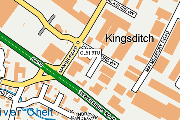
GL51 9TU is located in the Swindon Village electoral ward, within the local authority district of Cheltenham and the English Parliamentary constituency of Tewkesbury. The Sub Integrated Care Board (ICB) Location is NHS Gloucestershire ICB - 11M and the police force is Gloucestershire. This postcode has been in use since October 1985.


GetTheData
Source: OS OpenMap – Local (Ordnance Survey)
Source: OS VectorMap District (Ordnance Survey)
Licence: Open Government Licence (requires attribution)
| Easting | 393102 |
| Northing | 224272 |
| Latitude | 51.916939 |
| Longitude | -2.101692 |
GetTheData
Source: Open Postcode Geo
Licence: Open Government Licence
| Country | England |
| Postcode District | GL51 |
| ➜ GL51 open data dashboard ➜ See where GL51 is on a map ➜ Where is Cheltenham? | |
GetTheData
Source: Land Registry Price Paid Data
Licence: Open Government Licence
Elevation or altitude of GL51 9TU as distance above sea level:
| Metres | Feet | |
|---|---|---|
| Elevation | 40m | 131ft |
Elevation is measured from the approximate centre of the postcode, to the nearest point on an OS contour line from OS Terrain 50, which has contour spacing of ten vertical metres.
➜ How high above sea level am I? Find the elevation of your current position using your device's GPS.
GetTheData
Source: Open Postcode Elevation
Licence: Open Government Licence
| Ward | Swindon Village |
| Constituency | Tewkesbury |
GetTheData
Source: ONS Postcode Database
Licence: Open Government Licence
| January 2024 | Shoplifting | On or near Parking Area | 138m |
| January 2024 | Shoplifting | On or near Parking Area | 138m |
| December 2023 | Shoplifting | On or near Parking Area | 138m |
| ➜ Get more crime data in our Crime section | |||
GetTheData
Source: data.police.uk
Licence: Open Government Licence
| Gallagher Retail Park (Manor Road) | Kingsditch | 132m |
| Gallagher Retail Park (Manor Road) | Kingsditch | 135m |
| Hayden Road (Tewkesbury Road) | Kingsditch | 177m |
| Retail Park (Tewkesbury Road) | Kingsditch | 260m |
| Retail Park (Tewkesbury Road) | Kingsditch | 286m |
| Cheltenham Spa Station | 2.2km |
GetTheData
Source: NaPTAN
Licence: Open Government Licence
GetTheData
Source: ONS Postcode Database
Licence: Open Government Licence


➜ Get more ratings from the Food Standards Agency
GetTheData
Source: Food Standards Agency
Licence: FSA terms & conditions
| Last Collection | |||
|---|---|---|---|
| Location | Mon-Fri | Sat | Distance |
| Village Road | 17:00 | 12:30 | 304m |
| Sainsbury's Tewkeabury Road | 18:30 | 12:30 | 338m |
| Huntscote Road | 18:30 | 12:30 | 352m |
GetTheData
Source: Dracos
Licence: Creative Commons Attribution-ShareAlike
| Facility | Distance |
|---|---|
| Xtreme Csc Ltd (Cheltenham) (Closed) Malmesbury Road, Cheltenham Health and Fitness Gym | 160m |
| Simply Gym (Cheltenham) Wymans Lane, Swindon Village, Cheltenham Health and Fitness Gym, Studio | 583m |
| Sports Direct Fitness (Cheltenham) (Closed) Tewkesbury Road, Uckington, Cheltenham Swimming Pool, Health and Fitness Gym, Studio | 604m |
GetTheData
Source: Active Places
Licence: Open Government Licence
| School | Phase of Education | Distance |
|---|---|---|
| All Saints' Academy, Cheltenham Blaisdon Way, Cheltenham, GL51 0WH | Secondary | 666m |
| Hesters Way Primary School Dill Avenue, Cheltenham, GL51 0ES | Primary | 976m |
| Swindon Village Primary School Church Road, Swindon Village, Cheltenham, GL51 9QP | Primary | 1.1km |
GetTheData
Source: Edubase
Licence: Open Government Licence
The below table lists the International Territorial Level (ITL) codes (formerly Nomenclature of Territorial Units for Statistics (NUTS) codes) and Local Administrative Units (LAU) codes for GL51 9TU:
| ITL 1 Code | Name |
|---|---|
| TLK | South West (England) |
| ITL 2 Code | Name |
| TLK1 | Gloucestershire, Wiltshire and Bath/Bristol area |
| ITL 3 Code | Name |
| TLK13 | Gloucestershire CC |
| LAU 1 Code | Name |
| E07000078 | Cheltenham |
GetTheData
Source: ONS Postcode Directory
Licence: Open Government Licence
The below table lists the Census Output Area (OA), Lower Layer Super Output Area (LSOA), and Middle Layer Super Output Area (MSOA) for GL51 9TU:
| Code | Name | |
|---|---|---|
| OA | E00112637 | |
| LSOA | E01022165 | Cheltenham 001C |
| MSOA | E02004600 | Cheltenham 001 |
GetTheData
Source: ONS Postcode Directory
Licence: Open Government Licence
| GL51 9PL | Malmesbury Road | 160m |
| GL51 9TX | Mackenzie Way | 183m |
| GL51 9SG | Tewkesbury Road | 211m |
| GL51 0UN | Summerfield Close | 215m |
| GL51 0BZ | Glynbridge Gardens | 231m |
| GL51 0UL | Patterdale Close | 244m |
| GL51 0AF | Riverview Way | 284m |
| GL51 9TW | Gara Close | 287m |
| GL51 9DU | Tewkesbury Road | 332m |
| GL51 0US | Carter Road | 341m |
GetTheData
Source: Open Postcode Geo; Land Registry Price Paid Data
Licence: Open Government Licence