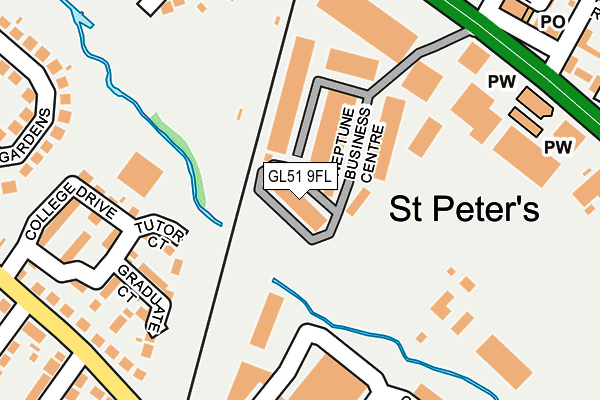
GL51 9FL is located in the St Peter's electoral ward, within the local authority district of Cheltenham and the English Parliamentary constituency of Cheltenham. The Sub Integrated Care Board (ICB) Location is NHS Gloucestershire ICB - 11M and the police force is Gloucestershire. This postcode has been in use since October 2008.


GetTheData
Source: OS OpenMap – Local (Ordnance Survey)
Source: OS VectorMap District (Ordnance Survey)
Licence: Open Government Licence (requires attribution)
| Easting | 393617 |
| Northing | 223266 |
| Latitude | 51.907892 |
| Longitude | -2.094192 |
GetTheData
Source: Open Postcode Geo
Licence: Open Government Licence
| Country | England |
| Postcode District | GL51 |
| ➜ GL51 open data dashboard ➜ See where GL51 is on a map ➜ Where is Cheltenham? | |
GetTheData
Source: Land Registry Price Paid Data
Licence: Open Government Licence
Elevation or altitude of GL51 9FL as distance above sea level:
| Metres | Feet | |
|---|---|---|
| Elevation | 50m | 164ft |
Elevation is measured from the approximate centre of the postcode, to the nearest point on an OS contour line from OS Terrain 50, which has contour spacing of ten vertical metres.
➜ How high above sea level am I? Find the elevation of your current position using your device's GPS.
GetTheData
Source: Open Postcode Elevation
Licence: Open Government Licence
| Ward | St Peter's |
| Constituency | Cheltenham |
GetTheData
Source: ONS Postcode Database
Licence: Open Government Licence
| November 2023 | Anti-social behaviour | On or near Arle Road | 268m |
| July 2023 | Burglary | On or near Arle Road | 268m |
| May 2023 | Anti-social behaviour | On or near Arle Road | 268m |
| ➜ Get more crime data in our Crime section | |||
GetTheData
Source: data.police.uk
Licence: Open Government Licence
| The Range (Tewkesbury Road) | Cheltenham | 239m |
| Saxon Quarter (Arle Road) | Arle | 257m |
| The Range (Tewkesbury Road) | Cheltenham | 277m |
| Saxon Quarter (Arle Road) | Arle | 278m |
| Cheltenham Trade Park (Arle Road) | Alstone | 324m |
| Cheltenham Spa Station | 1.2km |
GetTheData
Source: NaPTAN
Licence: Open Government Licence
| Median download speed | 60.2Mbps |
| Average download speed | 49.5Mbps |
| Maximum download speed | 80.00Mbps |
| Median upload speed | 10.0Mbps |
| Average upload speed | 11.3Mbps |
| Maximum upload speed | 20.00Mbps |
GetTheData
Source: Ofcom
Licence: Ofcom Terms of Use (requires attribution)
GetTheData
Source: ONS Postcode Database
Licence: Open Government Licence


➜ Get more ratings from the Food Standards Agency
GetTheData
Source: Food Standards Agency
Licence: FSA terms & conditions
| Last Collection | |||
|---|---|---|---|
| Location | Mon-Fri | Sat | Distance |
| Rewkesbury Road P.o. | 17:00 | 12:15 | 281m |
| Arle Road | 17:30 | 12:30 | 351m |
| Moors Estate | 17:15 | 12:30 | 525m |
GetTheData
Source: Dracos
Licence: Creative Commons Attribution-ShareAlike
| Facility | Distance |
|---|---|
| Petersfield Park St. Peters Close, Cheltenham Grass Pitches | 156m |
| Ymca Cheltenham Sports Centre College Drive, Cheltenham Sports Hall, Artificial Grass Pitch, Health and Fitness Gym | 195m |
| The Gym Group (Cheltenham) Tewkesbury Road, Cheltenham Health and Fitness Gym | 410m |
GetTheData
Source: Active Places
Licence: Open Government Licence
| School | Phase of Education | Distance |
|---|---|---|
| Gloucester Road Primary School Gloucester Road, Cheltenham, GL51 8PB | Primary | 424m |
| Gardners Lane Primary School Gardners Lane, Swindon Road, Cheltenham, GL51 9JW | Primary | 555m |
| Rowanfield Infant School Alstone Lane, Cheltenham, GL51 8HY | Primary | 650m |
GetTheData
Source: Edubase
Licence: Open Government Licence
The below table lists the International Territorial Level (ITL) codes (formerly Nomenclature of Territorial Units for Statistics (NUTS) codes) and Local Administrative Units (LAU) codes for GL51 9FL:
| ITL 1 Code | Name |
|---|---|
| TLK | South West (England) |
| ITL 2 Code | Name |
| TLK1 | Gloucestershire, Wiltshire and Bath/Bristol area |
| ITL 3 Code | Name |
| TLK13 | Gloucestershire CC |
| LAU 1 Code | Name |
| E07000078 | Cheltenham |
GetTheData
Source: ONS Postcode Directory
Licence: Open Government Licence
The below table lists the Census Output Area (OA), Lower Layer Super Output Area (LSOA), and Middle Layer Super Output Area (MSOA) for GL51 9FL:
| Code | Name | |
|---|---|---|
| OA | E00112583 | |
| LSOA | E01022155 | Cheltenham 007D |
| MSOA | E02004606 | Cheltenham 007 |
GetTheData
Source: ONS Postcode Directory
Licence: Open Government Licence
| GL51 8PE | Gloucester Road | 188m |
| GL51 9AH | Tewkesbury Road | 191m |
| GL51 9AA | Tewkesbury Road | 192m |
| GL51 8NY | College Drive | 223m |
| GL51 9DX | St Peters Close | 255m |
| GL51 9DN | Tewkesbury Road | 270m |
| GL51 8LB | Arle Road | 283m |
| GL51 9DY | St Peters Close | 291m |
| GL51 9BZ | Elm Close | 296m |
| GL51 9DL | Elm Street | 298m |
GetTheData
Source: Open Postcode Geo; Land Registry Price Paid Data
Licence: Open Government Licence