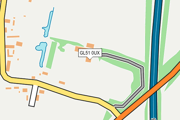
GL51 0UX is located in the Badgeworth electoral ward, within the local authority district of Tewkesbury and the English Parliamentary constituency of Tewkesbury. The Sub Integrated Care Board (ICB) Location is NHS Gloucestershire ICB - 11M and the police force is Gloucestershire. This postcode has been in use since April 1987.


GetTheData
Source: OS OpenMap – Local (Ordnance Survey)
Source: OS VectorMap District (Ordnance Survey)
Licence: Open Government Licence (requires attribution)
| Easting | 389444 |
| Northing | 223226 |
| Latitude | 51.907468 |
| Longitude | -2.154851 |
GetTheData
Source: Open Postcode Geo
Licence: Open Government Licence
| Country | England |
| Postcode District | GL51 |
| ➜ GL51 open data dashboard ➜ See where GL51 is on a map ➜ Where is Staverton? | |
GetTheData
Source: Land Registry Price Paid Data
Licence: Open Government Licence
Elevation or altitude of GL51 0UX as distance above sea level:
| Metres | Feet | |
|---|---|---|
| Elevation | 30m | 98ft |
Elevation is measured from the approximate centre of the postcode, to the nearest point on an OS contour line from OS Terrain 50, which has contour spacing of ten vertical metres.
➜ How high above sea level am I? Find the elevation of your current position using your device's GPS.
GetTheData
Source: Open Postcode Elevation
Licence: Open Government Licence
| Ward | Badgeworth |
| Constituency | Tewkesbury |
GetTheData
Source: ONS Postcode Database
Licence: Open Government Licence
| March 2022 | Violence and sexual offences | On or near Old Gloucester Road | 238m |
| March 2022 | Anti-social behaviour | On or near Old Gloucester Road | 238m |
| February 2022 | Violence and sexual offences | On or near Old Gloucester Road | 238m |
| ➜ Get more crime data in our Crime section | |||
GetTheData
Source: data.police.uk
Licence: Open Government Licence
| Staverton Court Farm (Main Street) | Staverton | 252m |
| Staverton Court Farm (Main Street) | Staverton | 275m |
| The Old School (Main Street) | Staverton | 368m |
| The Old School (Main Street) | Staverton | 377m |
| St Catherine's Church (Brock Farm Lane) | Staverton | 588m |
| Cheltenham Spa Station | 4km |
GetTheData
Source: NaPTAN
Licence: Open Government Licence
GetTheData
Source: ONS Postcode Database
Licence: Open Government Licence


➜ Get more ratings from the Food Standards Agency
GetTheData
Source: Food Standards Agency
Licence: FSA terms & conditions
| Last Collection | |||
|---|---|---|---|
| Location | Mon-Fri | Sat | Distance |
| Plough, Staverton | 16:30 | 08:15 | 886m |
| Hayden Elm | 16:30 | 09:15 | 948m |
| Hayden | 16:30 | 08:00 | 1,099m |
GetTheData
Source: Dracos
Licence: Creative Commons Attribution-ShareAlike
| Facility | Distance |
|---|---|
| Dowty Sports And Social Club Ltd Down Hatherley Lane, Staverton, Gloucester, Gloucester Grass Pitches, Squash Courts, Outdoor Tennis Courts, Studio | 1.5km |
| Juvenate (Cheltenham) Gloucester Road, Cheltenham Health and Fitness Gym, Swimming Pool, Studio, Outdoor Tennis Courts | 2.1km |
| Springbank Primary Academy Springbank Road, Cheltenham Grass Pitches, Sports Hall | 2.3km |
GetTheData
Source: Active Places
Licence: Open Government Licence
| School | Phase of Education | Distance |
|---|---|---|
| Springbank Primary Academy Springbank Road, Cheltenham, GL51 0PH | Primary | 2.3km |
| St Thomas More Catholic Primary School Lewis Road, Cheltenham, GL51 0HZ | Primary | 2.4km |
| Gloucestershire College Cheltenham Campus, Princess Elizabeth Way, Cheltenham, GL51 7SJ | 16 plus | 2.6km |
GetTheData
Source: Edubase
Licence: Open Government Licence
The below table lists the International Territorial Level (ITL) codes (formerly Nomenclature of Territorial Units for Statistics (NUTS) codes) and Local Administrative Units (LAU) codes for GL51 0UX:
| ITL 1 Code | Name |
|---|---|
| TLK | South West (England) |
| ITL 2 Code | Name |
| TLK1 | Gloucestershire, Wiltshire and Bath/Bristol area |
| ITL 3 Code | Name |
| TLK13 | Gloucestershire CC |
| LAU 1 Code | Name |
| E07000083 | Tewkesbury |
GetTheData
Source: ONS Postcode Directory
Licence: Open Government Licence
The below table lists the Census Output Area (OA), Lower Layer Super Output Area (LSOA), and Middle Layer Super Output Area (MSOA) for GL51 0UX:
| Code | Name | |
|---|---|---|
| OA | E00113981 | |
| LSOA | E01022420 | Tewkesbury 008A |
| MSOA | E02004673 | Tewkesbury 008 |
GetTheData
Source: ONS Postcode Directory
Licence: Open Government Licence
| GL51 0TW | 289m | |
| GL51 0TN | Boddington Road | 439m |
| GL51 0TR | Cherry Orchard | 492m |
| GL51 0TG | Old Gloucester Road | 719m |
| GL51 0TF | Gloucester Road | 820m |
| GL51 0SR | Hayden Lane | 930m |
| GL51 6TQ | Herrick Way | 952m |
| GL51 0SP | Hayden Lane | 996m |
| GL51 6SX | Bamfurlong Industrial Park | 1070m |
| GL51 0SS | Gloucester Road | 1137m |
GetTheData
Source: Open Postcode Geo; Land Registry Price Paid Data
Licence: Open Government Licence