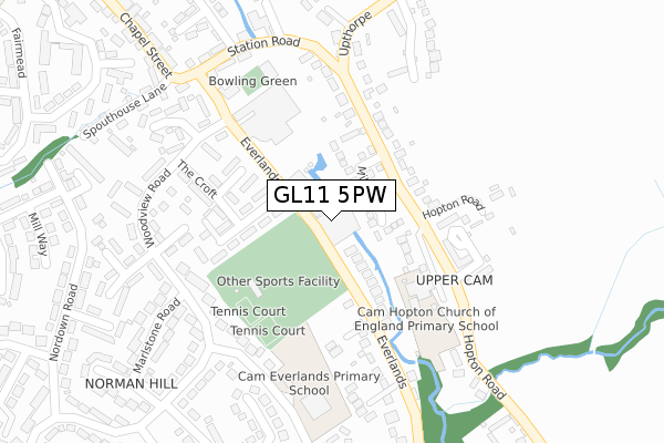
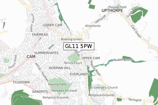
GL11 5PW is located in the Cam East electoral ward, within the local authority district of Stroud and the English Parliamentary constituency of Stroud. The Sub Integrated Care Board (ICB) Location is NHS Gloucestershire ICB - 11M and the police force is Gloucestershire. This postcode has been in use since June 1981.


GetTheData
Source: OS Open Zoomstack (Ordnance Survey)
Licence: Open Government Licence (requires attribution)
Attribution: Contains OS data © Crown copyright and database right 2024
Source: Open Postcode Geo
Licence: Open Government Licence (requires attribution)
Attribution: Contains OS data © Crown copyright and database right 2024; Contains Royal Mail data © Royal Mail copyright and database right 2024; Source: Office for National Statistics licensed under the Open Government Licence v.3.0
| Easting | 375258 |
| Northing | 200080 |
| Latitude | 51.698918 |
| Longitude | -2.359396 |
GetTheData
Source: Open Postcode Geo
Licence: Open Government Licence
| Country | England |
| Postcode District | GL11 |
| ➜ GL11 open data dashboard ➜ See where GL11 is on a map ➜ Where is Cam? | |
GetTheData
Source: Land Registry Price Paid Data
Licence: Open Government Licence
Elevation or altitude of GL11 5PW as distance above sea level:
| Metres | Feet | |
|---|---|---|
| Elevation | 40m | 131ft |
Elevation is measured from the approximate centre of the postcode, to the nearest point on an OS contour line from OS Terrain 50, which has contour spacing of ten vertical metres.
➜ How high above sea level am I? Find the elevation of your current position using your device's GPS.
GetTheData
Source: Open Postcode Elevation
Licence: Open Government Licence
| Ward | Cam East |
| Constituency | Stroud |
GetTheData
Source: ONS Postcode Database
Licence: Open Government Licence
| June 2022 | Violence and sexual offences | On or near Station Road | 104m |
| June 2022 | Other crime | On or near Station Road | 104m |
| June 2022 | Violence and sexual offences | On or near Station Road | 104m |
| ➜ Get more crime data in our Crime section | |||
GetTheData
Source: data.police.uk
Licence: Open Government Licence
| Cam Mills (Everlands) | Lower Cam | 67m |
| Cam Mills (Everlands) | Lower Cam | 86m |
| Station Road (Hopton Road) | Upper Cam | 114m |
| The Croft (Everlands) | Lower Cam | 124m |
| Station Road (Hopton Road) | Upper Cam | 134m |
| Cam & Dursley Station | 2.1km |
GetTheData
Source: NaPTAN
Licence: Open Government Licence
GetTheData
Source: ONS Postcode Database
Licence: Open Government Licence


➜ Get more ratings from the Food Standards Agency
GetTheData
Source: Food Standards Agency
Licence: FSA terms & conditions
| Last Collection | |||
|---|---|---|---|
| Location | Mon-Fri | Sat | Distance |
| The Croft | 17:00 | 09:15 | 170m |
| Cam P.o. | 18:00 | 11:45 | 409m |
| Northend | 17:15 | 08:30 | 803m |
GetTheData
Source: Dracos
Licence: Creative Commons Attribution-ShareAlike
| Facility | Distance |
|---|---|
| Cam Sports Club Everlands, Cam, Dursley Grass Pitches, Outdoor Tennis Courts | 274m |
| Rednock School Playing Fields Tilsdown, Dursley Grass Pitches | 752m |
| Cam Jubilee Playing Fields Everside Lane, Cam Grass Pitches | 1.3km |
GetTheData
Source: Active Places
Licence: Open Government Licence
| School | Phase of Education | Distance |
|---|---|---|
| Cam Hopton Church of England Primary School Hopton Road, Upper Cam, Dursley, GL11 5PA | Primary | 355m |
| Cam Everlands Primary School Birch Road, Cam, Dursley, GL11 5SF | Primary | 443m |
| Cam Woodfield Junior School Elstub Lane, Cam, Dursley, GL11 6JJ | Primary | 1.2km |
GetTheData
Source: Edubase
Licence: Open Government Licence
The below table lists the International Territorial Level (ITL) codes (formerly Nomenclature of Territorial Units for Statistics (NUTS) codes) and Local Administrative Units (LAU) codes for GL11 5PW:
| ITL 1 Code | Name |
|---|---|
| TLK | South West (England) |
| ITL 2 Code | Name |
| TLK1 | Gloucestershire, Wiltshire and Bath/Bristol area |
| ITL 3 Code | Name |
| TLK13 | Gloucestershire CC |
| LAU 1 Code | Name |
| E07000082 | Stroud |
GetTheData
Source: ONS Postcode Directory
Licence: Open Government Licence
The below table lists the Census Output Area (OA), Lower Layer Super Output Area (LSOA), and Middle Layer Super Output Area (MSOA) for GL11 5PW:
| Code | Name | |
|---|---|---|
| OA | E00113663 | |
| LSOA | E01022360 | Stroud 011B |
| MSOA | E02004661 | Stroud 011 |
GetTheData
Source: ONS Postcode Directory
Licence: Open Government Licence
| GL11 5NR | Station Road | 96m |
| GL11 5NY | Hopton Road | 99m |
| GL11 5NP | Station Road | 127m |
| GL11 5NS | Station Road | 135m |
| GL11 5PT | Millbank | 174m |
| GL11 5NW | The Croft | 177m |
| GL11 5NZ | Hopton Road | 192m |
| GL11 5NX | Chapel Street | 216m |
| GL11 5JP | Spouthouse Lane | 230m |
| GL11 5NT | Rowley | 235m |
GetTheData
Source: Open Postcode Geo; Land Registry Price Paid Data
Licence: Open Government Licence