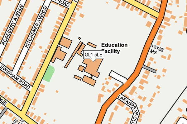
GL1 5LE is located in the Moreland electoral ward, within the local authority district of Gloucester and the English Parliamentary constituency of Gloucester. The Sub Integrated Care Board (ICB) Location is NHS Gloucestershire ICB - 11M and the police force is Gloucestershire. This postcode has been in use since January 1980.


GetTheData
Source: OS OpenMap – Local (Ordnance Survey)
Source: OS VectorMap District (Ordnance Survey)
Licence: Open Government Licence (requires attribution)
| Easting | 383314 |
| Northing | 216414 |
| Latitude | 51.846072 |
| Longitude | -2.243625 |
GetTheData
Source: Open Postcode Geo
Licence: Open Government Licence
| Country | England |
| Postcode District | GL1 |
| ➜ GL1 open data dashboard ➜ See where GL1 is on a map ➜ Where is Gloucester? | |
GetTheData
Source: Land Registry Price Paid Data
Licence: Open Government Licence
Elevation or altitude of GL1 5LE as distance above sea level:
| Metres | Feet | |
|---|---|---|
| Elevation | 20m | 66ft |
Elevation is measured from the approximate centre of the postcode, to the nearest point on an OS contour line from OS Terrain 50, which has contour spacing of ten vertical metres.
➜ How high above sea level am I? Find the elevation of your current position using your device's GPS.
GetTheData
Source: Open Postcode Elevation
Licence: Open Government Licence
| Ward | Moreland |
| Constituency | Gloucester |
GetTheData
Source: ONS Postcode Database
Licence: Open Government Licence
| October 2023 | Burglary | On or near Lime Tree Court | 321m |
| October 2023 | Anti-social behaviour | On or near Lime Tree Court | 321m |
| September 2023 | Anti-social behaviour | On or near Lime Tree Court | 321m |
| ➜ Get more crime data in our Crime section | |||
GetTheData
Source: data.police.uk
Licence: Open Government Licence
| Ladysmith Road (Calton Road) | Linden | 174m |
| Ladysmith Road (Calton Road) | Linden | 180m |
| Lewisham Road | Linden | 196m |
| Lewisham Road (Calton Road) | Linden | 206m |
| Ribston Hall School (Stroud Road) | Gloucester | 209m |
| Gloucester Station | 2.2km |
GetTheData
Source: NaPTAN
Licence: Open Government Licence
GetTheData
Source: ONS Postcode Database
Licence: Open Government Licence


➜ Get more ratings from the Food Standards Agency
GetTheData
Source: Food Standards Agency
Licence: FSA terms & conditions
| Last Collection | |||
|---|---|---|---|
| Location | Mon-Fri | Sat | Distance |
| Stroud Road Bridge | 17:45 | 12:15 | 359m |
| Roseberry Avenue | 17:30 | 13:00 | 369m |
| Sports Ground | 17:30 | 12:45 | 376m |
GetTheData
Source: Dracos
Licence: Creative Commons Attribution-ShareAlike
| Facility | Distance |
|---|---|
| Ribston Hall High School Stroud Road, Gloucester Health and Fitness Gym, Grass Pitches, Sports Hall, Swimming Pool, Studio | 0m |
| Old Cryptians Rfc Tuffley Avenue, Tuffley Avenue, Gloucester Grass Pitches | 376m |
| The Oval The Oval, Gloucester Outdoor Tennis Courts | 418m |
GetTheData
Source: Active Places
Licence: Open Government Licence
| School | Phase of Education | Distance |
|---|---|---|
| Ribston Hall High School Stroud Road, Gloucester, GL1 5LE | Secondary | 19m |
| Calton Primary School Calton Road, Gloucester, GL1 5ET | Primary | 101m |
| Linden Primary School Linden Road, Gloucester, GL1 5HU | Primary | 605m |
GetTheData
Source: Edubase
Licence: Open Government Licence
The below table lists the International Territorial Level (ITL) codes (formerly Nomenclature of Territorial Units for Statistics (NUTS) codes) and Local Administrative Units (LAU) codes for GL1 5LE:
| ITL 1 Code | Name |
|---|---|
| TLK | South West (England) |
| ITL 2 Code | Name |
| TLK1 | Gloucestershire, Wiltshire and Bath/Bristol area |
| ITL 3 Code | Name |
| TLK13 | Gloucestershire CC |
| LAU 1 Code | Name |
| E07000081 | Gloucester |
GetTheData
Source: ONS Postcode Directory
Licence: Open Government Licence
The below table lists the Census Output Area (OA), Lower Layer Super Output Area (LSOA), and Middle Layer Super Output Area (MSOA) for GL1 5LE:
| Code | Name | |
|---|---|---|
| OA | E00113508 | |
| LSOA | E01022329 | Gloucester 008E |
| MSOA | E02004643 | Gloucester 008 |
GetTheData
Source: ONS Postcode Directory
Licence: Open Government Licence
| GL1 5EU | Ribston Mews | 80m |
| GL1 5ER | Calton Road | 153m |
| GL1 5LB | Stroud Road | 171m |
| GL1 5EN | Kitchener Avenue | 205m |
| GL1 5DT | Calton Road | 207m |
| GL1 5ES | Calton Road | 218m |
| GL1 5LR | Morelands Grove | 220m |
| GL1 5LN | Larkspear Close | 223m |
| GL1 5EP | Ladysmith Road | 224m |
| GL1 5NG | Willowtree Court | 227m |
GetTheData
Source: Open Postcode Geo; Land Registry Price Paid Data
Licence: Open Government Licence