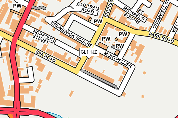
GL1 1JZ is located in the Westgate electoral ward, within the local authority district of Gloucester and the English Parliamentary constituency of Gloucester. The Sub Integrated Care Board (ICB) Location is NHS Gloucestershire ICB - 11M and the police force is Gloucestershire. This postcode has been in use since January 1980.


GetTheData
Source: OS OpenMap – Local (Ordnance Survey)
Source: OS VectorMap District (Ordnance Survey)
Licence: Open Government Licence (requires attribution)
| Easting | 383077 |
| Northing | 217977 |
| Latitude | 51.860117 |
| Longitude | -2.247142 |
GetTheData
Source: Open Postcode Geo
Licence: Open Government Licence
| Country | England |
| Postcode District | GL1 |
➜ See where GL1 is on a map ➜ Where is Gloucester? | |
GetTheData
Source: Land Registry Price Paid Data
Licence: Open Government Licence
Elevation or altitude of GL1 1JZ as distance above sea level:
| Metres | Feet | |
|---|---|---|
| Elevation | 20m | 66ft |
Elevation is measured from the approximate centre of the postcode, to the nearest point on an OS contour line from OS Terrain 50, which has contour spacing of ten vertical metres.
➜ How high above sea level am I? Find the elevation of your current position using your device's GPS.
GetTheData
Source: Open Postcode Elevation
Licence: Open Government Licence
| Ward | Westgate |
| Constituency | Gloucester |
GetTheData
Source: ONS Postcode Database
Licence: Open Government Licence
| Spa Road (Southgate Street) | Gloucester | 255m |
| Spa Road (Southgate Street) | Gloucester | 262m |
| The Warehouse (Parliament Street) | Gloucester | 288m |
| The Warehouse (Parliament Street) | Gloucester | 290m |
| The Docks (Southgate Street) | Gloucester | 294m |
| Gloucester Station | 0.8km |
GetTheData
Source: NaPTAN
Licence: Open Government Licence
GetTheData
Source: ONS Postcode Database
Licence: Open Government Licence


➜ Get more ratings from the Food Standards Agency
GetTheData
Source: Food Standards Agency
Licence: FSA terms & conditions
| Last Collection | |||
|---|---|---|---|
| Location | Mon-Fri | Sat | Distance |
| Brunswick Road | 136m | ||
| Brunswick Road | 18:45 | 12:30 | 173m |
| Brunswick Rd Double#2 | 18:45 | 12:30 | 174m |
GetTheData
Source: Dracos
Licence: Creative Commons Attribution-ShareAlike
| Risk of GL1 1JZ flooding from rivers and sea | Medium |
| ➜ GL1 1JZ flood map | |
GetTheData
Source: Open Flood Risk by Postcode
Licence: Open Government Licence
The below table lists the International Territorial Level (ITL) codes (formerly Nomenclature of Territorial Units for Statistics (NUTS) codes) and Local Administrative Units (LAU) codes for GL1 1JZ:
| ITL 1 Code | Name |
|---|---|
| TLK | South West (England) |
| ITL 2 Code | Name |
| TLK1 | Gloucestershire, Wiltshire and Bath/Bristol area |
| ITL 3 Code | Name |
| TLK13 | Gloucestershire CC |
| LAU 1 Code | Name |
| E07000081 | Gloucester |
GetTheData
Source: ONS Postcode Directory
Licence: Open Government Licence
The below table lists the Census Output Area (OA), Lower Layer Super Output Area (LSOA), and Middle Layer Super Output Area (MSOA) for GL1 1JZ:
| Code | Name | |
|---|---|---|
| OA | E00113605 | |
| LSOA | E01022347 | Gloucester 004B |
| MSOA | E02004639 | Gloucester 004 |
GetTheData
Source: ONS Postcode Directory
Licence: Open Government Licence
| GL1 1AE | Spa Road | 83m |
| GL1 1LD | North Villas | 93m |
| GL1 1UN | Brunswick Square | 98m |
| GL1 1LF | Montpellier Mews | 100m |
| GL1 1JS | Brunswick Road | 104m |
| GL1 1LB | Spa Villas | 123m |
| GL1 1LT | Montpellier | 129m |
| GL1 1LQ | Park Road | 138m |
| GL1 1UY | Spa Road | 141m |
| GL1 1JJ | Brunswick Road | 152m |
GetTheData
Source: Open Postcode Geo; Land Registry Price Paid Data
Licence: Open Government Licence