FY6 7EF maps, stats, and open data
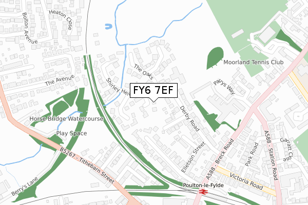
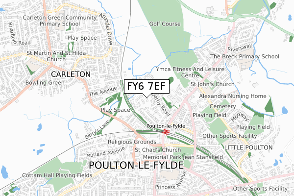
FY6 7EF lies on Minstrel Walk in Poulton-le-fylde. FY6 7EF is located in the Breck electoral ward, within the local authority district of Wyre and the English Parliamentary constituency of Wyre and Preston North. The Sub Integrated Care Board (ICB) Location is NHS Lancashire and South Cumbria ICB - 02M and the police force is Lancashire. This postcode has been in use since October 1985.
FY6 7EF maps


Licence: Open Government Licence (requires attribution)
Attribution: Contains OS data © Crown copyright and database right 2025
Source: Open Postcode Geo
Licence: Open Government Licence (requires attribution)
Attribution: Contains OS data © Crown copyright and database right 2025; Contains Royal Mail data © Royal Mail copyright and database right 2025; Source: Office for National Statistics licensed under the Open Government Licence v.3.0
FY6 7EF geodata
| Easting | 334748 |
| Northing | 439888 |
| Latitude | 53.851107 |
| Longitude | -2.993394 |
Where is FY6 7EF?
| Street | Minstrel Walk |
| Town/City | Poulton-le-fylde |
| Country | England |
| Postcode District | FY6 |
FY6 7EF Elevation
Elevation or altitude of FY6 7EF as distance above sea level:
| Metres | Feet | |
|---|---|---|
| Elevation | 10m | 33ft |
Elevation is measured from the approximate centre of the postcode, to the nearest point on an OS contour line from OS Terrain 50, which has contour spacing of ten vertical metres.
➜ How high above sea level am I? Find the elevation of your current position using your device's GPS.
Politics
| Ward | Breck |
|---|---|
| Constituency | Wyre And Preston North |
Transport
Nearest bus stops to FY6 7EF
| Tithebarn Place (Tithebarn Street) | Poulton-le-fylde | 280m |
| Tithebarn Place (Tithebarn Street) | Poulton-le-fylde | 290m |
| Rail Station (Breck Road) | Poulton-le-fylde | 322m |
| St Chads Church (Church Street) | Poulton-le-fylde | 413m |
| Moorland Road End (Breck Road) | Poulton-le-fylde | 419m |
Nearest railway stations to FY6 7EF
| Poulton-le-Fylde Station | 0.3km |
| Layton (Lancs) Station | 3km |
| Blackpool North Station | 4.9km |
Broadband
Broadband access in FY6 7EF (2020 data)
| Percentage of properties with Next Generation Access | 100.0% |
| Percentage of properties with Superfast Broadband | 100.0% |
| Percentage of properties with Ultrafast Broadband | 0.0% |
| Percentage of properties with Full Fibre Broadband | 0.0% |
Superfast Broadband is between 30Mbps and 300Mbps
Ultrafast Broadband is > 300Mbps
Broadband limitations in FY6 7EF (2020 data)
| Percentage of properties unable to receive 2Mbps | 0.0% |
| Percentage of properties unable to receive 5Mbps | 0.0% |
| Percentage of properties unable to receive 10Mbps | 0.0% |
| Percentage of properties unable to receive 30Mbps | 0.0% |
Deprivation
15.6% of English postcodes are less deprived than FY6 7EF:Food Standards Agency
Three nearest food hygiene ratings to FY6 7EF (metres)


➜ Get more ratings from the Food Standards Agency
Nearest post box to FY6 7EF
| Last Collection | |||
|---|---|---|---|
| Location | Mon-Fri | Sat | Distance |
| Lockwood Avenue | 17:15 | 12:30 | 306m |
| Teanlowe Post Office | 17:15 | 12:00 | 471m |
| Teanlowe Post Office | 17:15 | 12:00 | 472m |
Environment
| Risk of FY6 7EF flooding from rivers and sea | Low |
FY6 7EF ITL and FY6 7EF LAU
The below table lists the International Territorial Level (ITL) codes (formerly Nomenclature of Territorial Units for Statistics (NUTS) codes) and Local Administrative Units (LAU) codes for FY6 7EF:
| ITL 1 Code | Name |
|---|---|
| TLD | North West (England) |
| ITL 2 Code | Name |
| TLD4 | Lancashire |
| ITL 3 Code | Name |
| TLD44 | Lancaster and Wyre |
| LAU 1 Code | Name |
| E07000128 | Wyre |
FY6 7EF census areas
The below table lists the Census Output Area (OA), Lower Layer Super Output Area (LSOA), and Middle Layer Super Output Area (MSOA) for FY6 7EF:
| Code | Name | |
|---|---|---|
| OA | E00129624 | |
| LSOA | E01025545 | Wyre 013A |
| MSOA | E02005331 | Wyre 013 |
Nearest postcodes to FY6 7EF
| FY6 7AG | Beech Avenue | 106m |
| FY6 7AH | Grosvenor Close | 107m |
| FY6 7AF | Derby Road | 117m |
| FY6 7EG | The Downs | 126m |
| FY6 7HG | The Oaks | 144m |
| FY6 7HQ | Furlong Lane | 149m |
| FY6 7AD | The Lanterns | 157m |
| FY6 7ES | Shirley Heights | 168m |
| FY6 7AB | Lockwood Avenue | 182m |
| FY6 7BZ | Tithebarn Place | 222m |