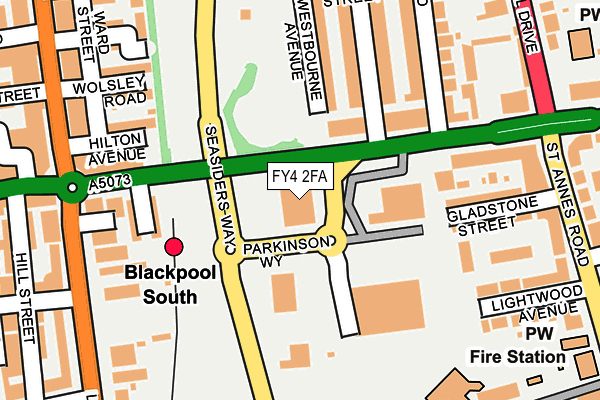
FY4 2FA is located in the Victoria electoral ward, within the unitary authority of Blackpool and the English Parliamentary constituency of Blackpool South. The Sub Integrated Care Board (ICB) Location is NHS Lancashire and South Cumbria ICB - 00R and the police force is Lancashire. This postcode has been in use since October 2006.


GetTheData
Source: OS OpenMap – Local (Ordnance Survey)
Source: OS VectorMap District (Ordnance Survey)
Licence: Open Government Licence (requires attribution)
| Easting | 331136 |
| Northing | 434113 |
| Latitude | 53.798758 |
| Longitude | -3.046992 |
GetTheData
Source: Open Postcode Geo
Licence: Open Government Licence
| Country | England |
| Postcode District | FY4 |
| ➜ FY4 open data dashboard ➜ See where FY4 is on a map ➜ Where is Blackpool? | |
GetTheData
Source: Land Registry Price Paid Data
Licence: Open Government Licence
Elevation or altitude of FY4 2FA as distance above sea level:
| Metres | Feet | |
|---|---|---|
| Elevation | 10m | 33ft |
Elevation is measured from the approximate centre of the postcode, to the nearest point on an OS contour line from OS Terrain 50, which has contour spacing of ten vertical metres.
➜ How high above sea level am I? Find the elevation of your current position using your device's GPS.
GetTheData
Source: Open Postcode Elevation
Licence: Open Government Licence
| Ward | Victoria |
| Constituency | Blackpool South |
GetTheData
Source: ONS Postcode Database
Licence: Open Government Licence
| January 2024 | Anti-social behaviour | On or near St Bede'S Avenue | 364m |
| January 2024 | Anti-social behaviour | On or near St Bede'S Avenue | 364m |
| January 2024 | Shoplifting | On or near St Bede'S Avenue | 364m |
| ➜ Get more crime data in our Crime section | |||
GetTheData
Source: data.police.uk
Licence: Open Government Licence
| Waterloo Hotel (Waterloo Road) | South Shore | 176m |
| Royal Oak (Waterloo Road) | Royal Oak | 184m |
| Royal Oak (Waterloo Road) | Royal Oak | 186m |
| Royal Oak (Lytham Road) | Royal Oak | 218m |
| Lido Pool (Lytham Road) | Bloomfield | 232m |
| Waterloo Road (Blackpool Tramway) (Waterloo Road) | Bloomfield | 587m |
| South Pier (Blackpool Tramway) (Promenade) | South Shore | 697m |
| St Chad's (Blackpool Tramway) (St Chads Road) | Bloomfield | 699m |
| Pleasure Beach (Blackpool Tramway) (Promenade) | South Shore | 879m |
| Manchester Square (Blackpool Tramway) (Promenade) | Bloomfield | 1,188m |
| Blackpool South Station | 0.1km |
| Blackpool Pleasure Beach Station | 1.3km |
| Squires Gate Station | 2.4km |
GetTheData
Source: NaPTAN
Licence: Open Government Licence
GetTheData
Source: ONS Postcode Database
Licence: Open Government Licence


➜ Get more ratings from the Food Standards Agency
GetTheData
Source: Food Standards Agency
Licence: FSA terms & conditions
| Last Collection | |||
|---|---|---|---|
| Location | Mon-Fri | Sat | Distance |
| Pembroke Hotel | 17:15 | 11:00 | 278m |
| Waterloo Road | 17:15 | 11:30 | 278m |
| Baron Road | 17:00 | 11:30 | 328m |
GetTheData
Source: Dracos
Licence: Creative Commons Attribution-ShareAlike
| Facility | Distance |
|---|---|
| St Cuthbert's Catholic Academy Lightwood Avenue, Blackpool Grass Pitches | 250m |
| Lido Swimming Pool (Closed) Lytham Road, Blackpool Swimming Pool, Health and Fitness Gym | 271m |
| Blackpool Gateway Academy Seymour Road, Blackpool Grass Pitches | 343m |
GetTheData
Source: Active Places
Licence: Open Government Licence
| School | Phase of Education | Distance |
|---|---|---|
| St Cuthbert's Catholic Academy Lightwood Avenue, Blackpool, FY4 2AU | Primary | 250m |
| South Shore Academy St Anne's Road, Blackpool, FY4 2AR | Secondary | 417m |
| Blackpool Gateway Academy Seymour Road, Blackpool, FY1 6JH | Primary | 484m |
GetTheData
Source: Edubase
Licence: Open Government Licence
The below table lists the International Territorial Level (ITL) codes (formerly Nomenclature of Territorial Units for Statistics (NUTS) codes) and Local Administrative Units (LAU) codes for FY4 2FA:
| ITL 1 Code | Name |
|---|---|
| TLD | North West (England) |
| ITL 2 Code | Name |
| TLD4 | Lancashire |
| ITL 3 Code | Name |
| TLD42 | Blackpool |
| LAU 1 Code | Name |
| E06000009 | Blackpool |
GetTheData
Source: ONS Postcode Directory
Licence: Open Government Licence
The below table lists the Census Output Area (OA), Lower Layer Super Output Area (LSOA), and Middle Layer Super Output Area (MSOA) for FY4 2FA:
| Code | Name | |
|---|---|---|
| OA | E00064273 | |
| LSOA | E01012745 | Blackpool 015D |
| MSOA | E02002647 | Blackpool 015 |
GetTheData
Source: ONS Postcode Directory
Licence: Open Government Licence
| FY4 2AF | Waterloo Road | 133m |
| FY1 6JA | Westbourne Avenue | 145m |
| FY4 2AD | Garden Terrace | 167m |
| FY4 2AE | Waterloo Road | 175m |
| FY1 6HF | Hilton Avenue | 190m |
| FY4 2AL | Gladstone Street | 192m |
| FY1 6JD | St Heliers Road | 194m |
| FY1 6JS | Saville Road | 216m |
| FY1 6HG | Wolsley Road | 221m |
| FY1 6JB | Stansfield Street | 230m |
GetTheData
Source: Open Postcode Geo; Land Registry Price Paid Data
Licence: Open Government Licence