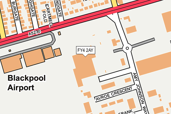
FY4 2AY is located in the Kilgrimol electoral ward, within the local authority district of Fylde and the English Parliamentary constituency of Fylde. The Sub Integrated Care Board (ICB) Location is NHS Lancashire and South Cumbria ICB - 02M and the police force is Lancashire. This postcode has been in use since January 1993.


GetTheData
Source: OS OpenMap – Local (Ordnance Survey)
Source: OS VectorMap District (Ordnance Survey)
Licence: Open Government Licence (requires attribution)
| Easting | 331868 |
| Northing | 431909 |
| Latitude | 53.779033 |
| Longitude | -3.035396 |
GetTheData
Source: Open Postcode Geo
Licence: Open Government Licence
| Country | England |
| Postcode District | FY4 |
| ➜ FY4 open data dashboard ➜ See where FY4 is on a map ➜ Where is Blackpool? | |
GetTheData
Source: Land Registry Price Paid Data
Licence: Open Government Licence
Elevation or altitude of FY4 2AY as distance above sea level:
| Metres | Feet | |
|---|---|---|
| Elevation | 10m | 33ft |
Elevation is measured from the approximate centre of the postcode, to the nearest point on an OS contour line from OS Terrain 50, which has contour spacing of ten vertical metres.
➜ How high above sea level am I? Find the elevation of your current position using your device's GPS.
GetTheData
Source: Open Postcode Elevation
Licence: Open Government Licence
| Ward | Kilgrimol |
| Constituency | Fylde |
GetTheData
Source: ONS Postcode Database
Licence: Open Government Licence
| November 2023 | Shoplifting | On or near Petrol Station | 131m |
| November 2023 | Other theft | On or near Petrol Station | 131m |
| November 2023 | Other theft | On or near Petrol Station | 131m |
| ➜ Get more crime data in our Crime section | |||
GetTheData
Source: data.police.uk
Licence: Open Government Licence
| Morrisons | Squires Gate | 51m |
| Morrisons Superstore (Squires Gate Lane) | Squires Gate | 147m |
| Halfway House (St Annes Road) | Halfway House | 235m |
| Abbey Road (Squires Gate Lane) | Squires Gate | 248m |
| Halfway House (St Annes Road) | Halfway House | 252m |
| Starr Gate (Blackpool Tramway) (A584 Clifton Drive) | Squires Gate | 1,366m |
| Harrow Place (Blackpool Tramway) (Harrow Place) | Squires Gate | 1,541m |
| Burlington Road West (Blackpool Tramway) (Burlington Road West) | South Shore | 1,765m |
| Squires Gate Station | 1km |
| Blackpool Pleasure Beach Station | 1.6km |
| Blackpool South Station | 2.4km |
GetTheData
Source: NaPTAN
Licence: Open Government Licence
GetTheData
Source: ONS Postcode Database
Licence: Open Government Licence


➜ Get more ratings from the Food Standards Agency
GetTheData
Source: Food Standards Agency
Licence: FSA terms & conditions
| Last Collection | |||
|---|---|---|---|
| Location | Mon-Fri | Sat | Distance |
| Morrisons | 16:30 | 12:15 | 23m |
| Squires Gate Airport | 17:00 | 12:30 | 142m |
| Amy Johnson Way | 17:30 | 12:00 | 246m |
GetTheData
Source: Dracos
Licence: Creative Commons Attribution-ShareAlike
| Facility | Distance |
|---|---|
| Blackpool Fc (Squires Gate) Martin Avenue, Lytham St. Annes Grass Pitches | 874m |
| Our Lady Of The Assumption Catholic Primary School Common Edge Road, Blackpool Grass Pitches | 973m |
| Afc Blackpool Jepson Way, Blackpool Grass Pitches | 1km |
GetTheData
Source: Active Places
Licence: Open Government Licence
| School | Phase of Education | Distance |
|---|---|---|
| Roseacre Primary Academy Stonycroft Avenue, Blackpool, FY4 2PF | Primary | 638m |
| Our Lady of the Assumption Catholic Primary School Common Edge Road, Blackpool, FY4 5DF | Primary | 975m |
| Highfield Leadership Academy Highfield Road, Blackpool, FY4 3JZ | Secondary | 1.1km |
GetTheData
Source: Edubase
Licence: Open Government Licence
The below table lists the International Territorial Level (ITL) codes (formerly Nomenclature of Territorial Units for Statistics (NUTS) codes) and Local Administrative Units (LAU) codes for FY4 2AY:
| ITL 1 Code | Name |
|---|---|
| TLD | North West (England) |
| ITL 2 Code | Name |
| TLD4 | Lancashire |
| ITL 3 Code | Name |
| TLD45 | Mid Lancashire |
| LAU 1 Code | Name |
| E07000119 | Fylde |
GetTheData
Source: ONS Postcode Directory
Licence: Open Government Licence
The below table lists the Census Output Area (OA), Lower Layer Super Output Area (LSOA), and Middle Layer Super Output Area (MSOA) for FY4 2AY:
| Code | Name | |
|---|---|---|
| OA | E00127014 | |
| LSOA | E01025024 | Fylde 004D |
| MSOA | E02005206 | Fylde 004 |
GetTheData
Source: ONS Postcode Directory
Licence: Open Government Licence
| FY4 2NH | Squires Gate Lane | 171m |
| FY4 2QG | Squires Gate Lane | 197m |
| FY4 2NJ | Lawn Tennis Court | 201m |
| FY4 2NL | Cartmell Fold | 215m |
| FY4 2NG | Sandgate | 268m |
| FY4 2QJ | Highgate | 276m |
| FY4 2QL | St Annes Road | 279m |
| FY4 2NQ | Waltham Avenue | 286m |
| FY4 2QH | Burgate | 303m |
| FY4 2NF | Tewkesbury Avenue | 323m |
GetTheData
Source: Open Postcode Geo; Land Registry Price Paid Data
Licence: Open Government Licence