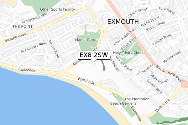
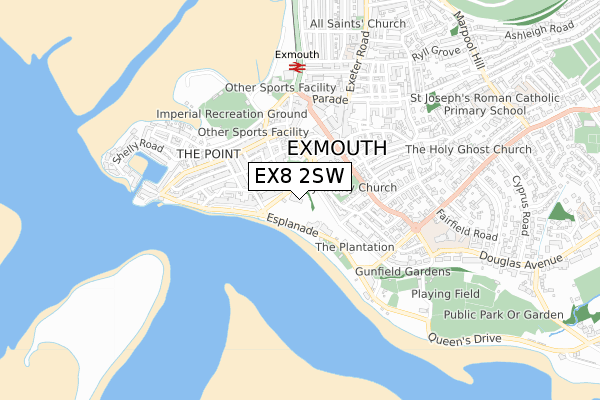
EX8 2SW is located in the Exmouth Town electoral ward, within the local authority district of East Devon and the English Parliamentary constituency of East Devon. The Sub Integrated Care Board (ICB) Location is NHS Devon ICB - 15N and the police force is Devon & Cornwall. This postcode has been in use since January 1980.


GetTheData
Source: OS Open Zoomstack (Ordnance Survey)
Licence: Open Government Licence (requires attribution)
Attribution: Contains OS data © Crown copyright and database right 2024
Source: Open Postcode Geo
Licence: Open Government Licence (requires attribution)
Attribution: Contains OS data © Crown copyright and database right 2024; Contains Royal Mail data © Royal Mail copyright and database right 2024; Source: Office for National Statistics licensed under the Open Government Licence v.3.0
| Easting | 300021 |
| Northing | 80625 |
| Latitude | 50.616737 |
| Longitude | -3.414556 |
GetTheData
Source: Open Postcode Geo
Licence: Open Government Licence
| Country | England |
| Postcode District | EX8 |
| ➜ EX8 open data dashboard ➜ See where EX8 is on a map ➜ Where is Exmouth? | |
GetTheData
Source: Land Registry Price Paid Data
Licence: Open Government Licence
Elevation or altitude of EX8 2SW as distance above sea level:
| Metres | Feet | |
|---|---|---|
| Elevation | 10m | 33ft |
Elevation is measured from the approximate centre of the postcode, to the nearest point on an OS contour line from OS Terrain 50, which has contour spacing of ten vertical metres.
➜ How high above sea level am I? Find the elevation of your current position using your device's GPS.
GetTheData
Source: Open Postcode Elevation
Licence: Open Government Licence
| Ward | Exmouth Town |
| Constituency | East Devon |
GetTheData
Source: ONS Postcode Database
Licence: Open Government Licence
| June 2022 | Violence and sexual offences | On or near Alexandra Terrace | 80m |
| June 2022 | Anti-social behaviour | On or near Alexandra Terrace | 80m |
| June 2022 | Violence and sexual offences | On or near The Beacon | 106m |
| ➜ Get more crime data in our Crime section | |||
GetTheData
Source: data.police.uk
Licence: Open Government Licence
| Imperial Hotel (Esplanade) | Exmouth | 117m |
| Imperial Hotel (Esplanade) | Exmouth | 129m |
| Holy Trinity Church (Rolle Road) | Exmouth | 255m |
| Holy Trinity Church (Rolle Road) | Exmouth | 273m |
| Pavilion (Esplanade) | Exmouth | 277m |
| Exmouth Station | 0.5km |
| Starcross Station | 2.6km |
| Dawlish Warren Station | 2.9km |
GetTheData
Source: NaPTAN
Licence: Open Government Licence
GetTheData
Source: ONS Postcode Database
Licence: Open Government Licence


➜ Get more ratings from the Food Standards Agency
GetTheData
Source: Food Standards Agency
Licence: FSA terms & conditions
| Last Collection | |||
|---|---|---|---|
| Location | Mon-Fri | Sat | Distance |
| St Andrews Road | 17:45 | 12:00 | 260m |
| The Strand | 18:00 | 12:45 | 310m |
| Exmouth Delivery Office | 18:45 | 12:30 | 335m |
GetTheData
Source: Dracos
Licence: Creative Commons Attribution-ShareAlike
| Facility | Distance |
|---|---|
| Bodywise Parade, Exmouth Health and Fitness Gym | 472m |
| Exmouth Leisure Centre Royal Avenue, Exmouth Sports Hall, Swimming Pool, Health and Fitness Gym, Studio, Squash Courts | 496m |
| Imperial Recreation Ground Imperial Road, Exmouth Athletics, Grass Pitches | 519m |
GetTheData
Source: Active Places
Licence: Open Government Licence
| School | Phase of Education | Distance |
|---|---|---|
| The Beacon Church of England (VA) Primary School 1 Beacon Place, Exmouth, EX8 2SR | Primary | 167m |
| Exeter Royal Academy for Deaf Education 1 Douglas Avenue, Exmouth, EX8 2AU | Not applicable | 614m |
| Exeter Royal Academy for Deaf Education 1 Douglas Avenue, Exmouth, EX8 2AU | Not applicable | 632m |
GetTheData
Source: Edubase
Licence: Open Government Licence
The below table lists the International Territorial Level (ITL) codes (formerly Nomenclature of Territorial Units for Statistics (NUTS) codes) and Local Administrative Units (LAU) codes for EX8 2SW:
| ITL 1 Code | Name |
|---|---|
| TLK | South West (England) |
| ITL 2 Code | Name |
| TLK4 | Devon |
| ITL 3 Code | Name |
| TLK43 | Devon CC |
| LAU 1 Code | Name |
| E07000040 | East Devon |
GetTheData
Source: ONS Postcode Directory
Licence: Open Government Licence
The below table lists the Census Output Area (OA), Lower Layer Super Output Area (LSOA), and Middle Layer Super Output Area (MSOA) for EX8 2SW:
| Code | Name | |
|---|---|---|
| OA | E00100806 | |
| LSOA | E01019918 | East Devon 019C |
| MSOA | E02004147 | East Devon 019 |
GetTheData
Source: ONS Postcode Directory
Licence: Open Government Licence
| EX8 2AG | The Beacon | 98m |
| EX8 1BB | Alexandra Terrace | 113m |
| EX8 2SJ | Church Mews | 125m |
| EX8 1BD | Alexandra Terrace | 141m |
| EX8 2AF | The Beacon | 141m |
| EX8 1PB | Beacon Hill | 145m |
| EX8 1NS | Chapel Hill | 147m |
| EX8 1AX | Imperial Road | 151m |
| EX8 1AY | Clinton Square | 163m |
| EX8 2AZ | Esplanade | 183m |
GetTheData
Source: Open Postcode Geo; Land Registry Price Paid Data
Licence: Open Government Licence