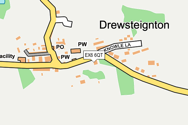
EX6 6QT is in Drewsteignton, Exeter. EX6 6QT is located in the Drewsteignton electoral ward, within the local authority district of West Devon and the English Parliamentary constituency of Central Devon. The Sub Integrated Care Board (ICB) Location is NHS Devon ICB - 15N and the police force is Devon & Cornwall. This postcode has been in use since January 1980.


GetTheData
Source: OS OpenMap – Local (Ordnance Survey)
Source: OS VectorMap District (Ordnance Survey)
Licence: Open Government Licence (requires attribution)
| Easting | 273696 |
| Northing | 90812 |
| Latitude | 50.703190 |
| Longitude | -3.789963 |
GetTheData
Source: Open Postcode Geo
Licence: Open Government Licence
| Locality | Drewsteignton |
| Town/City | Exeter |
| Country | England |
| Postcode District | EX6 |
| ➜ EX6 open data dashboard ➜ See where EX6 is on a map ➜ Where is Drewsteignton? | |
GetTheData
Source: Land Registry Price Paid Data
Licence: Open Government Licence
Elevation or altitude of EX6 6QT as distance above sea level:
| Metres | Feet | |
|---|---|---|
| Elevation | 200m | 656ft |
Elevation is measured from the approximate centre of the postcode, to the nearest point on an OS contour line from OS Terrain 50, which has contour spacing of ten vertical metres.
➜ How high above sea level am I? Find the elevation of your current position using your device's GPS.
GetTheData
Source: Open Postcode Elevation
Licence: Open Government Licence
| Ward | Drewsteignton |
| Constituency | Central Devon |
GetTheData
Source: ONS Postcode Database
Licence: Open Government Licence
| June 2022 | Violence and sexual offences | On or near Knowle Lane | 193m |
| June 2022 | Violence and sexual offences | On or near Knowle Lane | 193m |
| May 2022 | Violence and sexual offences | On or near Lamb Park | 169m |
| ➜ Get more crime data in our Crime section | |||
GetTheData
Source: data.police.uk
Licence: Open Government Licence
| Square | Drewsteignton | 143m |
| Square | Drewsteignton | 145m |
| Castle Drogo Drive | Drewsteignton | 1,140m |
| Castle Drogo Drive | Drewsteignton | 1,149m |
GetTheData
Source: NaPTAN
Licence: Open Government Licence
| Percentage of properties with Next Generation Access | 100.0% |
| Percentage of properties with Superfast Broadband | 100.0% |
| Percentage of properties with Ultrafast Broadband | 0.0% |
| Percentage of properties with Full Fibre Broadband | 0.0% |
Superfast Broadband is between 30Mbps and 300Mbps
Ultrafast Broadband is > 300Mbps
| Percentage of properties unable to receive 2Mbps | 0.0% |
| Percentage of properties unable to receive 5Mbps | 0.0% |
| Percentage of properties unable to receive 10Mbps | 0.0% |
| Percentage of properties unable to receive 30Mbps | 0.0% |
GetTheData
Source: Ofcom
Licence: Ofcom Terms of Use (requires attribution)
GetTheData
Source: ONS Postcode Database
Licence: Open Government Licence
| Last Collection | |||
|---|---|---|---|
| Location | Mon-Fri | Sat | Distance |
| Greystone | 15:45 | 09:45 | 1,481m |
| Crockernwell | 15:30 | 09:45 | 2,286m |
| Sandy Park | 16:45 | 09:30 | 2,776m |
GetTheData
Source: Dracos
Licence: Creative Commons Attribution-ShareAlike
| Facility | Distance |
|---|---|
| Chagford C Of E Primary School Lower Street, Chagford, Newton Abbot Grass Pitches | 4.5km |
| Tedburn St Mary Recreation Ground Dunsford Bridleway 1, Dunsford Grass Pitches, Outdoor Tennis Courts | 4.8km |
| Moretonhampstead Swimming Pool Court Street, Moretonhampstead, Newton Abbot Swimming Pool | 4.9km |
GetTheData
Source: Active Places
Licence: Open Government Licence
| School | Phase of Education | Distance |
|---|---|---|
| Running Deer School Butterdon Wood, Willingstone, Moretonhampstead, TQ13 8PY | Not applicable | 2.7km |
| Chagford Church of England Primary School Lower Street, Chagford, Newton Abbot, TQ13 8BZ | Primary | 4.5km |
| Cheriton Bishop Community Primary School Church Lane, Cheriton Bishop, Exeter, EX6 6HY | Primary | 4.5km |
GetTheData
Source: Edubase
Licence: Open Government Licence
The below table lists the International Territorial Level (ITL) codes (formerly Nomenclature of Territorial Units for Statistics (NUTS) codes) and Local Administrative Units (LAU) codes for EX6 6QT:
| ITL 1 Code | Name |
|---|---|
| TLK | South West (England) |
| ITL 2 Code | Name |
| TLK4 | Devon |
| ITL 3 Code | Name |
| TLK43 | Devon CC |
| LAU 1 Code | Name |
| E07000047 | West Devon |
GetTheData
Source: ONS Postcode Directory
Licence: Open Government Licence
The below table lists the Census Output Area (OA), Lower Layer Super Output Area (LSOA), and Middle Layer Super Output Area (MSOA) for EX6 6QT:
| Code | Name | |
|---|---|---|
| OA | E00102940 | |
| LSOA | E01020319 | West Devon 003B |
| MSOA | E02004231 | West Devon 003 |
GetTheData
Source: ONS Postcode Directory
Licence: Open Government Licence
| EX6 6QU | Churchgate Cottages | 67m |
| EX6 6QX | 82m | |
| EX6 6QP | 148m | |
| EX6 6QY | Knowle Lane | 166m |
| EX6 6QS | Netherton Hill | 171m |
| EX6 6QW | 179m | |
| EX6 6QR | 181m | |
| EX6 6PN | Lamb Park | 196m |
| EX6 6QZ | 295m | |
| EX6 6RB | 333m |
GetTheData
Source: Open Postcode Geo; Land Registry Price Paid Data
Licence: Open Government Licence