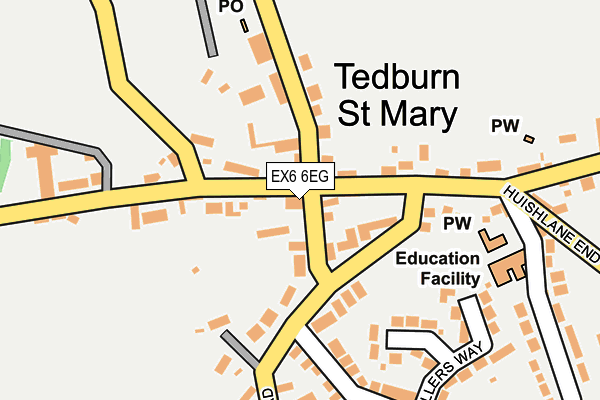
EX6 6EG is located in the Teign Valley electoral ward, within the local authority district of Teignbridge and the English Parliamentary constituency of Central Devon. The Sub Integrated Care Board (ICB) Location is NHS Devon ICB - 15N and the police force is Devon & Cornwall. This postcode has been in use since January 1980.


GetTheData
Source: OS OpenMap – Local (Ordnance Survey)
Source: OS VectorMap District (Ordnance Survey)
Licence: Open Government Licence (requires attribution)
| Easting | 281446 |
| Northing | 94145 |
| Latitude | 50.734774 |
| Longitude | -3.681356 |
GetTheData
Source: Open Postcode Geo
Licence: Open Government Licence
| Country | England |
| Postcode District | EX6 |
| ➜ EX6 open data dashboard ➜ See where EX6 is on a map ➜ Where is Tedburn St Mary? | |
GetTheData
Source: Land Registry Price Paid Data
Licence: Open Government Licence
Elevation or altitude of EX6 6EG as distance above sea level:
| Metres | Feet | |
|---|---|---|
| Elevation | 130m | 427ft |
Elevation is measured from the approximate centre of the postcode, to the nearest point on an OS contour line from OS Terrain 50, which has contour spacing of ten vertical metres.
➜ How high above sea level am I? Find the elevation of your current position using your device's GPS.
GetTheData
Source: Open Postcode Elevation
Licence: Open Government Licence
| Ward | Teign Valley |
| Constituency | Central Devon |
GetTheData
Source: ONS Postcode Database
Licence: Open Government Licence
| June 2022 | Anti-social behaviour | On or near Millers Way | 207m |
| June 2022 | Vehicle crime | On or near Four Oaks Road | 454m |
| May 2022 | Anti-social behaviour | On or near Tremletts Close | 71m |
| ➜ Get more crime data in our Crime section | |||
GetTheData
Source: data.police.uk
Licence: Open Government Licence
| Garage (Huishlane End) | Tedburn St Mary | 82m |
| Garage (Huishlane End) | Tedburn St Mary | 89m |
| Four Oaks Road | Tedburn St Mary | 458m |
| Golds Cross (Goldscross Hill) | Town Barton | 1,190m |
| Golds Cross (Goldscross Hill) | Town Barton | 1,200m |
| Yeoford Station | 5.7km |
GetTheData
Source: NaPTAN
Licence: Open Government Licence
GetTheData
Source: ONS Postcode Database
Licence: Open Government Licence


➜ Get more ratings from the Food Standards Agency
GetTheData
Source: Food Standards Agency
Licence: FSA terms & conditions
| Last Collection | |||
|---|---|---|---|
| Location | Mon-Fri | Sat | Distance |
| Cheriton Bishop Post Office | 17:00 | 10:45 | 4,351m |
| Dunsford Post Office | 17:45 | 10:15 | 4,978m |
| Culver Lodge | 18:10 | 10:20 | 5,154m |
GetTheData
Source: Dracos
Licence: Creative Commons Attribution-ShareAlike
| Facility | Distance |
|---|---|
| Tedburn St Mary School School Lane, Tedburn St. Mary, Exeter Swimming Pool, Grass Pitches | 214m |
| Barley Park Road From Fingle Glen To Chapel Cottage, Tedburn St Mary Grass Pitches | 2km |
| Fingle Glen Golf Course Tedburn St. Mary, Exeter Golf | 2.4km |
GetTheData
Source: Active Places
Licence: Open Government Licence
| School | Phase of Education | Distance |
|---|---|---|
| Tedburn St Mary School School Lane, Tedburn St Mary, Exeter, EX6 6AA | Primary | 217m |
| Cheriton Bishop Community Primary School Church Lane, Cheriton Bishop, Exeter, EX6 6HY | Primary | 4.2km |
| Dunsford Community Academy Dunsford, Exeter, EX6 7DD | Primary | 5km |
GetTheData
Source: Edubase
Licence: Open Government Licence
The below table lists the International Territorial Level (ITL) codes (formerly Nomenclature of Territorial Units for Statistics (NUTS) codes) and Local Administrative Units (LAU) codes for EX6 6EG:
| ITL 1 Code | Name |
|---|---|
| TLK | South West (England) |
| ITL 2 Code | Name |
| TLK4 | Devon |
| ITL 3 Code | Name |
| TLK43 | Devon CC |
| LAU 1 Code | Name |
| E07000045 | Teignbridge |
GetTheData
Source: ONS Postcode Directory
Licence: Open Government Licence
The below table lists the Census Output Area (OA), Lower Layer Super Output Area (LSOA), and Middle Layer Super Output Area (MSOA) for EX6 6EG:
| Code | Name | |
|---|---|---|
| OA | E00102625 | |
| LSOA | E01020263 | Teignbridge 001C |
| MSOA | E02004201 | Teignbridge 001 |
GetTheData
Source: ONS Postcode Directory
Licence: Open Government Licence
| EX6 6EQ | 59m | |
| EX6 6DJ | 97m | |
| EX6 6RL | North Park Road | 108m |
| EX6 6EB | 111m | |
| EX6 6DZ | 137m | |
| EX6 6DL | 147m | |
| EX6 6RU | St Marys Close | 147m |
| EX6 6RS | Millers Way | 214m |
| EX6 6EH | 235m | |
| EX6 6DN | 244m |
GetTheData
Source: Open Postcode Geo; Land Registry Price Paid Data
Licence: Open Government Licence