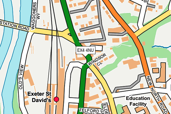
EX4 4NU is located in the St David's electoral ward, within the local authority district of Exeter and the English Parliamentary constituency of Exeter. The Sub Integrated Care Board (ICB) Location is NHS Devon ICB - 15N and the police force is Devon & Cornwall. This postcode has been in use since January 1980.


GetTheData
Source: OS OpenMap – Local (Ordnance Survey)
Source: OS VectorMap District (Ordnance Survey)
Licence: Open Government Licence (requires attribution)
| Easting | 291261 |
| Northing | 93459 |
| Latitude | 50.730539 |
| Longitude | -3.542109 |
GetTheData
Source: Open Postcode Geo
Licence: Open Government Licence
| Country | England |
| Postcode District | EX4 |
➜ See where EX4 is on a map ➜ Where is Exeter? | |
GetTheData
Source: Land Registry Price Paid Data
Licence: Open Government Licence
Elevation or altitude of EX4 4NU as distance above sea level:
| Metres | Feet | |
|---|---|---|
| Elevation | 20m | 66ft |
Elevation is measured from the approximate centre of the postcode, to the nearest point on an OS contour line from OS Terrain 50, which has contour spacing of ten vertical metres.
➜ How high above sea level am I? Find the elevation of your current position using your device's GPS.
GetTheData
Source: Open Postcode Elevation
Licence: Open Government Licence
| Ward | St David's |
| Constituency | Exeter |
GetTheData
Source: ONS Postcode Database
Licence: Open Government Licence
| Jolly Porter (St Davids Hill) | St Davids | 77m |
| Jolly Porter (St Davids Hill) | St Davids | 89m |
| St Davids Station | Exeter | 120m |
| St Davids Station | Exeter | 137m |
| Streatham Drive (New North Road) | Pennsylvania | 179m |
| Exeter St Davids Station | 0.2km |
| Exeter Central Station | 0.8km |
| St James Park (Devon) Station | 1.4km |
GetTheData
Source: NaPTAN
Licence: Open Government Licence
GetTheData
Source: ONS Postcode Database
Licence: Open Government Licence


➜ Get more ratings from the Food Standards Agency
GetTheData
Source: Food Standards Agency
Licence: FSA terms & conditions
| Last Collection | |||
|---|---|---|---|
| Location | Mon-Fri | Sat | Distance |
| Red Cow Post Office | 19:00 | 12:00 | 17m |
| St David's Station | 19:30 | 12:00 | 174m |
| St Davids Station | 18:30 | 12:00 | 174m |
GetTheData
Source: Dracos
Licence: Creative Commons Attribution-ShareAlike
| Risk of EX4 4NU flooding from rivers and sea | Low |
| ➜ EX4 4NU flood map | |
GetTheData
Source: Open Flood Risk by Postcode
Licence: Open Government Licence
The below table lists the International Territorial Level (ITL) codes (formerly Nomenclature of Territorial Units for Statistics (NUTS) codes) and Local Administrative Units (LAU) codes for EX4 4NU:
| ITL 1 Code | Name |
|---|---|
| TLK | South West (England) |
| ITL 2 Code | Name |
| TLK4 | Devon |
| ITL 3 Code | Name |
| TLK43 | Devon CC |
| LAU 1 Code | Name |
| E07000041 | Exeter |
GetTheData
Source: ONS Postcode Directory
Licence: Open Government Licence
The below table lists the Census Output Area (OA), Lower Layer Super Output Area (LSOA), and Middle Layer Super Output Area (MSOA) for EX4 4NU:
| Code | Name | |
|---|---|---|
| OA | E00171930 | |
| LSOA | E01020017 | Exeter 008D |
| MSOA | E02004156 | Exeter 008 |
GetTheData
Source: ONS Postcode Directory
Licence: Open Government Licence
| EX4 4AZ | Red Cow Village | 21m |
| EX4 4GB | Cowley Bridge Road | 26m |
| EX4 4AU | St Davids Place | 28m |
| EX4 4GS | Cowley Bridge Road | 53m |
| EX4 4AY | Taddiforde Road | 57m |
| EX4 4BB | St Davids Hill | 57m |
| EX4 4BS | St Davids Hill | 65m |
| EX4 4BA | Windsor Close | 70m |
| EX4 4BE | St Davids Hill | 138m |
| EX4 4AR | Taddyforde Court | 141m |
GetTheData
Source: Open Postcode Geo; Land Registry Price Paid Data
Licence: Open Government Licence