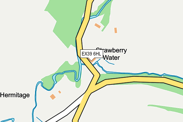
EX39 6HL is in Welcombe, Bideford. EX39 6HL is located in the Hartland electoral ward, within the local authority district of Torridge and the English Parliamentary constituency of Torridge and West Devon. The Sub Integrated Care Board (ICB) Location is NHS Devon ICB - 15N and the police force is Devon & Cornwall. This postcode has been in use since January 1980.


GetTheData
Source: OS OpenMap – Local (Ordnance Survey)
Source: OS VectorMap District (Ordnance Survey)
Licence: Open Government Licence (requires attribution)
| Easting | 221726 |
| Northing | 118380 |
| Latitude | 50.937234 |
| Longitude | -4.538694 |
GetTheData
Source: Open Postcode Geo
Licence: Open Government Licence
| Locality | Welcombe |
| Town/City | Bideford |
| Country | England |
| Postcode District | EX39 |
| ➜ EX39 open data dashboard ➜ See where EX39 is on a map | |
GetTheData
Source: Land Registry Price Paid Data
Licence: Open Government Licence
Elevation or altitude of EX39 6HL as distance above sea level:
| Metres | Feet | |
|---|---|---|
| Elevation | 30m | 98ft |
Elevation is measured from the approximate centre of the postcode, to the nearest point on an OS contour line from OS Terrain 50, which has contour spacing of ten vertical metres.
➜ How high above sea level am I? Find the elevation of your current position using your device's GPS.
GetTheData
Source: Open Postcode Elevation
Licence: Open Government Licence
| Ward | Hartland |
| Constituency | Torridge And West Devon |
GetTheData
Source: ONS Postcode Database
Licence: Open Government Licence
GetTheData
Source: ONS Postcode Database
Licence: Open Government Licence


➜ Get more ratings from the Food Standards Agency
GetTheData
Source: Food Standards Agency
Licence: FSA terms & conditions
| Last Collection | |||
|---|---|---|---|
| Location | Mon-Fri | Sat | Distance |
| Cross Town | 11:15 | 11:15 | 3,402m |
| Darracott Post Office | 15:15 | 10:45 | 3,518m |
| Edistone | 14:55 | 12:00 | 5,115m |
GetTheData
Source: Dracos
Licence: Creative Commons Attribution-ShareAlike
| Facility | Distance |
|---|---|
| St Marks C Of E Primary School Shop, Morwenstow, Bude Grass Pitches, Sports Hall | 3.6km |
| Shop Playing Field Shop, Morwenstow, Bude Grass Pitches | 3.8km |
GetTheData
Source: Active Places
Licence: Open Government Licence
| School | Phase of Education | Distance |
|---|---|---|
| St Mark's CofE Academy Shop, Morwenstow, Bude, EX23 9PE | Primary | 3.6km |
GetTheData
Source: Edubase
Licence: Open Government Licence
The below table lists the International Territorial Level (ITL) codes (formerly Nomenclature of Territorial Units for Statistics (NUTS) codes) and Local Administrative Units (LAU) codes for EX39 6HL:
| ITL 1 Code | Name |
|---|---|
| TLK | South West (England) |
| ITL 2 Code | Name |
| TLK4 | Devon |
| ITL 3 Code | Name |
| TLK43 | Devon CC |
| LAU 1 Code | Name |
| E07000046 | Torridge |
GetTheData
Source: ONS Postcode Directory
Licence: Open Government Licence
The below table lists the Census Output Area (OA), Lower Layer Super Output Area (LSOA), and Middle Layer Super Output Area (MSOA) for EX39 6HL:
| Code | Name | |
|---|---|---|
| OA | E00102796 | |
| LSOA | E01020291 | Torridge 008A |
| MSOA | E02004227 | Torridge 008 |
GetTheData
Source: ONS Postcode Directory
Licence: Open Government Licence
| EX39 6HJ | 404m | |
| EX39 6HQ | 753m | |
| EX39 6HH | 1042m | |
| EX39 6HF | 1359m | |
| EX39 6HG | 1448m | |
| EX23 9ST | 1611m | |
| EX39 6HW | 1658m | |
| EX23 9PQ | 1829m | |
| EX23 9PG | 2353m | |
| EX39 6ER | 2474m |
GetTheData
Source: Open Postcode Geo; Land Registry Price Paid Data
Licence: Open Government Licence