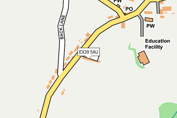
EX39 5AU is in Abbotsham, Bideford. EX39 5AU is located in the Monkleigh & Putford electoral ward, within the local authority district of Torridge and the English Parliamentary constituency of Torridge and West Devon. The Sub Integrated Care Board (ICB) Location is NHS Devon ICB - 15N and the police force is Devon & Cornwall. This postcode has been in use since January 1980.


GetTheData
Source: OS OpenMap – Local (Ordnance Survey)
Source: OS VectorMap District (Ordnance Survey)
Licence: Open Government Licence (requires attribution)
| Easting | 242252 |
| Northing | 126284 |
| Latitude | 51.014241 |
| Longitude | -4.250214 |
GetTheData
Source: Open Postcode Geo
Licence: Open Government Licence
| Locality | Abbotsham |
| Town/City | Bideford |
| Country | England |
| Postcode District | EX39 |
| ➜ EX39 open data dashboard ➜ See where EX39 is on a map ➜ Where is Abbotsham? | |
GetTheData
Source: Land Registry Price Paid Data
Licence: Open Government Licence
Elevation or altitude of EX39 5AU as distance above sea level:
| Metres | Feet | |
|---|---|---|
| Elevation | 90m | 295ft |
Elevation is measured from the approximate centre of the postcode, to the nearest point on an OS contour line from OS Terrain 50, which has contour spacing of ten vertical metres.
➜ How high above sea level am I? Find the elevation of your current position using your device's GPS.
GetTheData
Source: Open Postcode Elevation
Licence: Open Government Licence
| Ward | Monkleigh & Putford |
| Constituency | Torridge And West Devon |
GetTheData
Source: ONS Postcode Database
Licence: Open Government Licence
HILL HOUSE, ABBOTSHAM, BIDEFORD, EX39 5AU 2002 22 MAY £289,000 |
GetTheData
Source: HM Land Registry Price Paid Data
Licence: Contains HM Land Registry data © Crown copyright and database right 2024. This data is licensed under the Open Government Licence v3.0.
| June 2022 | Violence and sexual offences | On or near Back Lane | 145m |
| June 2022 | Criminal damage and arson | On or near Pump Lane | 375m |
| June 2022 | Criminal damage and arson | On or near Pump Lane | 375m |
| ➜ Get more crime data in our Crime section | |||
GetTheData
Source: data.police.uk
Licence: Open Government Licence
| Church | Abbotsham | 292m |
| Church | Abbotsham | 303m |
| The Big Sheep | Abbotsham | 516m |
| Atlantic Village | Bideford | 1,070m |
| Clovelly Road Industrial Estate (Clovelly Road) | Bideford | 1,404m |
GetTheData
Source: NaPTAN
Licence: Open Government Licence
| Percentage of properties with Next Generation Access | 100.0% |
| Percentage of properties with Superfast Broadband | 0.0% |
| Percentage of properties with Ultrafast Broadband | 0.0% |
| Percentage of properties with Full Fibre Broadband | 0.0% |
Superfast Broadband is between 30Mbps and 300Mbps
Ultrafast Broadband is > 300Mbps
| Percentage of properties unable to receive 2Mbps | 0.0% |
| Percentage of properties unable to receive 5Mbps | 0.0% |
| Percentage of properties unable to receive 10Mbps | 25.0% |
| Percentage of properties unable to receive 30Mbps | 100.0% |
GetTheData
Source: Ofcom
Licence: Ofcom Terms of Use (requires attribution)
GetTheData
Source: ONS Postcode Database
Licence: Open Government Licence


➜ Get more ratings from the Food Standards Agency
GetTheData
Source: Food Standards Agency
Licence: FSA terms & conditions
| Last Collection | |||
|---|---|---|---|
| Location | Mon-Fri | Sat | Distance |
| Atlantic Village | 17:30 | 12:15 | 1,131m |
| Hunestone Street | 17:45 | 12:00 | 2,820m |
| Market Place | 18:15 | 12:30 | 3,037m |
GetTheData
Source: Dracos
Licence: Creative Commons Attribution-ShareAlike
| Facility | Distance |
|---|---|
| Abbotsham Village Playing Field Road From Whitehouse Cross To Abbotsham Cross, Abbotsham Grass Pitches | 164m |
| St Helens School Abbotsham, Bideford Sports Hall, Outdoor Tennis Courts | 189m |
| G4 Gym Clovelly Road Industrial Estate, Bideford Health and Fitness Gym, Studio | 1.1km |
GetTheData
Source: Active Places
Licence: Open Government Licence
| School | Phase of Education | Distance |
|---|---|---|
| St Helen's Church of England School Abbotsham, Bideford, EX39 5AP | Primary | 270m |
| Bideford College Abbotsham Road, Bideford, EX39 3AR | Secondary | 2.1km |
| Kingsley School Northdown Road, Bideford, EX39 3LY | Not applicable | 2.3km |
GetTheData
Source: Edubase
Licence: Open Government Licence
The below table lists the International Territorial Level (ITL) codes (formerly Nomenclature of Territorial Units for Statistics (NUTS) codes) and Local Administrative Units (LAU) codes for EX39 5AU:
| ITL 1 Code | Name |
|---|---|
| TLK | South West (England) |
| ITL 2 Code | Name |
| TLK4 | Devon |
| ITL 3 Code | Name |
| TLK43 | Devon CC |
| LAU 1 Code | Name |
| E07000046 | Torridge |
GetTheData
Source: ONS Postcode Directory
Licence: Open Government Licence
The below table lists the Census Output Area (OA), Lower Layer Super Output Area (LSOA), and Middle Layer Super Output Area (MSOA) for EX39 5AU:
| Code | Name | |
|---|---|---|
| OA | E00102809 | |
| LSOA | E01020295 | Torridge 005C |
| MSOA | E02004224 | Torridge 005 |
GetTheData
Source: ONS Postcode Directory
Licence: Open Government Licence
| EX39 5AS | 62m | |
| EX39 5AT | 135m | |
| EX39 5AP | 253m | |
| EX39 5BR | St Helens | 344m |
| EX39 5AY | Pump Lane | 393m |
| EX39 5AZ | Pump Lane | 407m |
| EX39 5BA | 429m | |
| EX39 5BP | Shepherds Meadow | 434m |
| EX39 5AX | 450m | |
| EX39 5AN | Arthurs Lea | 528m |
GetTheData
Source: Open Postcode Geo; Land Registry Price Paid Data
Licence: Open Government Licence