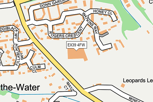
EX39 4FW is located in the Bideford East electoral ward, within the local authority district of Torridge and the English Parliamentary constituency of Torridge and West Devon. The Sub Integrated Care Board (ICB) Location is NHS Devon ICB - 15N and the police force is Devon & Cornwall. This postcode has been in use since August 2010.


GetTheData
Source: OS OpenMap – Local (Ordnance Survey)
Source: OS VectorMap District (Ordnance Survey)
Licence: Open Government Licence (requires attribution)
| Easting | 246580 |
| Northing | 126580 |
| Latitude | 51.018068 |
| Longitude | -4.188713 |
GetTheData
Source: Open Postcode Geo
Licence: Open Government Licence
| Country | England |
| Postcode District | EX39 |
| ➜ EX39 open data dashboard ➜ See where EX39 is on a map ➜ Where is Bideford? | |
GetTheData
Source: Land Registry Price Paid Data
Licence: Open Government Licence
Elevation or altitude of EX39 4FW as distance above sea level:
| Metres | Feet | |
|---|---|---|
| Elevation | 30m | 98ft |
Elevation is measured from the approximate centre of the postcode, to the nearest point on an OS contour line from OS Terrain 50, which has contour spacing of ten vertical metres.
➜ How high above sea level am I? Find the elevation of your current position using your device's GPS.
GetTheData
Source: Open Postcode Elevation
Licence: Open Government Licence
| Ward | Bideford East |
| Constituency | Torridge And West Devon |
GetTheData
Source: ONS Postcode Database
Licence: Open Government Licence
| June 2022 | Shoplifting | On or near Rogers Crescent | 97m |
| June 2022 | Shoplifting | On or near Rogers Crescent | 97m |
| June 2022 | Violence and sexual offences | On or near Culm Close | 187m |
| ➜ Get more crime data in our Crime section | |||
GetTheData
Source: data.police.uk
Licence: Open Government Licence
| Tesco (Manteo Way) | East-the-water | 115m |
| Biddiblack Way (Manteo Way) | East-the-water | 190m |
| South Avenue (Broadlands) | East-the-water | 350m |
| Primary School (Mines Road) | East-the-water | 407m |
| Sentry Corner (Gammaton Road) | East-the-water | 504m |
GetTheData
Source: NaPTAN
Licence: Open Government Licence
GetTheData
Source: ONS Postcode Database
Licence: Open Government Licence


➜ Get more ratings from the Food Standards Agency
GetTheData
Source: Food Standards Agency
Licence: FSA terms & conditions
| Last Collection | |||
|---|---|---|---|
| Location | Mon-Fri | Sat | Distance |
| East-the-water | 18:00 | 12:00 | 825m |
| Bideford Delivery Office | 18:30 | 13:00 | 1,110m |
| Market Place | 18:15 | 12:30 | 1,302m |
GetTheData
Source: Dracos
Licence: Creative Commons Attribution-ShareAlike
| Facility | Distance |
|---|---|
| Pollyfield (Sham Siro) East The Water, Bideford Grass Pitches, Cycling | 723m |
| Bideford Youth Centre Kingsley Road, Bideford Sports Hall | 1.2km |
| Victoria Park (Bideford) Kingsley Road, Bideford Grass Pitches | 1.2km |
GetTheData
Source: Active Places
Licence: Open Government Licence
| School | Phase of Education | Distance |
|---|---|---|
| East-the-Water Community Primary School Mines Road, Bideford, EX39 4BZ | Primary | 408m |
| St Mary's Church of England Primary School Chanters Road, Bideford, EX39 2QN | Primary | 1.5km |
| West Croft School Coronation Road, Bideford, EX39 3DE | Primary | 1.8km |
GetTheData
Source: Edubase
Licence: Open Government Licence
The below table lists the International Territorial Level (ITL) codes (formerly Nomenclature of Territorial Units for Statistics (NUTS) codes) and Local Administrative Units (LAU) codes for EX39 4FW:
| ITL 1 Code | Name |
|---|---|
| TLK | South West (England) |
| ITL 2 Code | Name |
| TLK4 | Devon |
| ITL 3 Code | Name |
| TLK43 | Devon CC |
| LAU 1 Code | Name |
| E07000046 | Torridge |
GetTheData
Source: ONS Postcode Directory
Licence: Open Government Licence
The below table lists the Census Output Area (OA), Lower Layer Super Output Area (LSOA), and Middle Layer Super Output Area (MSOA) for EX39 4FW:
| Code | Name | |
|---|---|---|
| OA | E00165931 | |
| LSOA | E01020279 | Torridge 004C |
| MSOA | E02004223 | Torridge 004 |
GetTheData
Source: ONS Postcode Directory
Licence: Open Government Licence
| EX39 4FT | Rogers Crescent | 78m |
| EX39 4FP | Watkins Way | 110m |
| EX39 4FA | May Court | 139m |
| EX39 4PJ | Mines Road | 156m |
| EX39 4FN | Watkins Way | 165m |
| EX39 4FS | Honey Close | 178m |
| EX39 4AX | Culm Close | 181m |
| EX39 4FR | Donn Gardens | 201m |
| EX39 4AB | Fillablack Road | 217m |
| EX39 4BA | Mines Road | 231m |
GetTheData
Source: Open Postcode Geo; Land Registry Price Paid Data
Licence: Open Government Licence