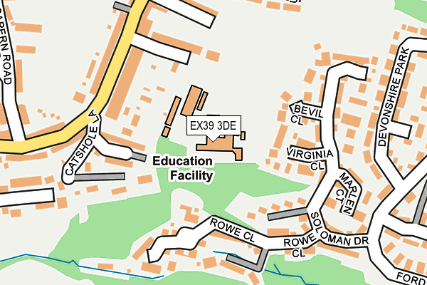
EX39 3DE is located in the Bideford South electoral ward, within the local authority district of Torridge and the English Parliamentary constituency of Torridge and West Devon. The Sub Integrated Care Board (ICB) Location is NHS Devon ICB - 15N and the police force is Devon & Cornwall. This postcode has been in use since January 1980.


GetTheData
Source: OS OpenMap – Local (Ordnance Survey)
Source: OS VectorMap District (Ordnance Survey)
Licence: Open Government Licence (requires attribution)
| Easting | 244874 |
| Northing | 126084 |
| Latitude | 51.013153 |
| Longitude | -4.212804 |
GetTheData
Source: Open Postcode Geo
Licence: Open Government Licence
| Country | England |
| Postcode District | EX39 |
| ➜ EX39 open data dashboard ➜ See where EX39 is on a map ➜ Where is Bideford? | |
GetTheData
Source: Land Registry Price Paid Data
Licence: Open Government Licence
Elevation or altitude of EX39 3DE as distance above sea level:
| Metres | Feet | |
|---|---|---|
| Elevation | 60m | 197ft |
Elevation is measured from the approximate centre of the postcode, to the nearest point on an OS contour line from OS Terrain 50, which has contour spacing of ten vertical metres.
➜ How high above sea level am I? Find the elevation of your current position using your device's GPS.
GetTheData
Source: Open Postcode Elevation
Licence: Open Government Licence
| Ward | Bideford South |
| Constituency | Torridge And West Devon |
GetTheData
Source: ONS Postcode Database
Licence: Open Government Licence
| October 2022 | Violence and sexual offences | On or near Montague Place | 230m |
| October 2022 | Vehicle crime | On or near New Road | 479m |
| September 2022 | Violence and sexual offences | On or near Devonshire Park | 310m |
| ➜ Get more crime data in our Crime section | |||
GetTheData
Source: data.police.uk
Licence: Open Government Licence
| First In Last Out (Clovelly Road) | Bideford | 135m |
| Marland Terrace (Clovelly Road) | Bideford | 143m |
| Twinaways (Clovelly Gardens South) | Bideford | 164m |
| Twinaways (Clovelly Gardens South) | Bideford | 176m |
| Clovelly Road | Bideford | 237m |
GetTheData
Source: NaPTAN
Licence: Open Government Licence
GetTheData
Source: ONS Postcode Database
Licence: Open Government Licence


➜ Get more ratings from the Food Standards Agency
GetTheData
Source: Food Standards Agency
Licence: FSA terms & conditions
| Last Collection | |||
|---|---|---|---|
| Location | Mon-Fri | Sat | Distance |
| Hunestone Street | 17:45 | 12:00 | 478m |
| Market Place | 18:15 | 12:30 | 591m |
| East-the-water | 18:00 | 12:00 | 971m |
GetTheData
Source: Dracos
Licence: Creative Commons Attribution-ShareAlike
| Facility | Distance |
|---|---|
| West Croft School Coronation Road, Bideford Grass Pitches, Sports Hall | 66m |
| Bideford College (Closed) Abbotsham Road, Bideford Sports Hall | 514m |
| Bideford College Abbotsham Road, Bideford Health and Fitness Gym, Artificial Grass Pitch, Sports Hall, Studio, Outdoor Tennis Courts, Grass Pitches | 606m |
GetTheData
Source: Active Places
Licence: Open Government Licence
| School | Phase of Education | Distance |
|---|---|---|
| West Croft School Coronation Road, Bideford, EX39 3DE | Primary | 65m |
| Bideford College Abbotsham Road, Bideford, EX39 3AR | Secondary | 602m |
| Kingsley School Northdown Road, Bideford, EX39 3LY | Not applicable | 937m |
GetTheData
Source: Edubase
Licence: Open Government Licence
The below table lists the International Territorial Level (ITL) codes (formerly Nomenclature of Territorial Units for Statistics (NUTS) codes) and Local Administrative Units (LAU) codes for EX39 3DE:
| ITL 1 Code | Name |
|---|---|
| TLK | South West (England) |
| ITL 2 Code | Name |
| TLK4 | Devon |
| ITL 3 Code | Name |
| TLK43 | Devon CC |
| LAU 1 Code | Name |
| E07000046 | Torridge |
GetTheData
Source: ONS Postcode Directory
Licence: Open Government Licence
The below table lists the Census Output Area (OA), Lower Layer Super Output Area (LSOA), and Middle Layer Super Output Area (MSOA) for EX39 3DE:
| Code | Name | |
|---|---|---|
| OA | E00102749 | |
| LSOA | E01020284 | Torridge 004E |
| MSOA | E02004223 | Torridge 004 |
GetTheData
Source: ONS Postcode Directory
Licence: Open Government Licence
| EX39 3FF | Landolfi Close | 55m |
| EX39 3DA | Coronation Road | 83m |
| EX39 3DF | Clovelly Road | 102m |
| EX39 3BZ | Marland Terrace | 136m |
| EX39 3DQ | Catshole Lane | 144m |
| EX39 5XN | Bevil Close | 152m |
| EX39 5XW | Virginia Close | 162m |
| EX39 3BY | Clovelly Road | 171m |
| EX39 5XU | Speedwell Close | 189m |
| EX39 5XY | Soloman Drive | 195m |
GetTheData
Source: Open Postcode Geo; Land Registry Price Paid Data
Licence: Open Government Licence