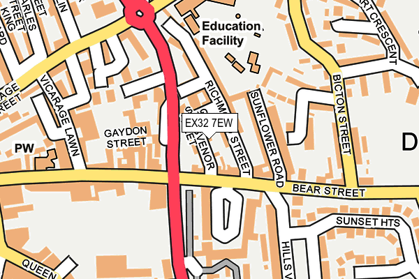
EX32 7EW is located in the Barnstaple with Westacott electoral ward, within the local authority district of North Devon and the English Parliamentary constituency of North Devon. The Sub Integrated Care Board (ICB) Location is NHS Devon ICB - 15N and the police force is Devon & Cornwall. This postcode has been in use since June 2000.


GetTheData
Source: OS OpenMap – Local (Ordnance Survey)
Source: OS VectorMap District (Ordnance Survey)
Licence: Open Government Licence (requires attribution)
| Easting | 256232 |
| Northing | 133380 |
| Latitude | 51.081676 |
| Longitude | -4.053879 |
GetTheData
Source: Open Postcode Geo
Licence: Open Government Licence
| Country | England |
| Postcode District | EX32 |
| ➜ EX32 open data dashboard ➜ See where EX32 is on a map ➜ Where is Barnstaple? | |
GetTheData
Source: Land Registry Price Paid Data
Licence: Open Government Licence
Elevation or altitude of EX32 7EW as distance above sea level:
| Metres | Feet | |
|---|---|---|
| Elevation | 10m | 33ft |
Elevation is measured from the approximate centre of the postcode, to the nearest point on an OS contour line from OS Terrain 50, which has contour spacing of ten vertical metres.
➜ How high above sea level am I? Find the elevation of your current position using your device's GPS.
GetTheData
Source: Open Postcode Elevation
Licence: Open Government Licence
| Ward | Barnstaple With Westacott |
| Constituency | North Devon |
GetTheData
Source: ONS Postcode Database
Licence: Open Government Licence
| October 2022 | Criminal damage and arson | On or near Vicarage Street | 256m |
| October 2022 | Criminal damage and arson | On or near Vicarage Street | 256m |
| October 2022 | Violence and sexual offences | On or near Vicarage Street | 256m |
| ➜ Get more crime data in our Crime section | |||
GetTheData
Source: data.police.uk
Licence: Open Government Licence
| Hills View (Bear Street) | Barnstaple | 96m |
| Sunflower Road (Bear Street) | Barnstaple | 149m |
| Bear Street | Barnstaple | 155m |
| Bear Street | Barnstaple | 181m |
| Sunset Heights | Barnstaple | 185m |
| Barnstaple Station | 1.1km |
GetTheData
Source: NaPTAN
Licence: Open Government Licence
| Percentage of properties with Next Generation Access | 100.0% |
| Percentage of properties with Superfast Broadband | 100.0% |
| Percentage of properties with Ultrafast Broadband | 0.0% |
| Percentage of properties with Full Fibre Broadband | 0.0% |
Superfast Broadband is between 30Mbps and 300Mbps
Ultrafast Broadband is > 300Mbps
| Percentage of properties unable to receive 2Mbps | 0.0% |
| Percentage of properties unable to receive 5Mbps | 0.0% |
| Percentage of properties unable to receive 10Mbps | 0.0% |
| Percentage of properties unable to receive 30Mbps | 0.0% |
GetTheData
Source: Ofcom
Licence: Ofcom Terms of Use (requires attribution)
GetTheData
Source: ONS Postcode Database
Licence: Open Government Licence

➜ Get more ratings from the Food Standards Agency
GetTheData
Source: Food Standards Agency
Licence: FSA terms & conditions
| Last Collection | |||
|---|---|---|---|
| Location | Mon-Fri | Sat | Distance |
| Barnstaple Delivery Office | 19:00 | 13:00 | 269m |
| Barnstaple Post Office | 18:30 | 13:00 | 328m |
| Green Lanes Shopping Centre | 17:30 | 12:00 | 408m |
GetTheData
Source: Dracos
Licence: Creative Commons Attribution-ShareAlike
| Facility | Distance |
|---|---|
| Floor One Fitness (Closed) Gammon Walk, Barnstaple Health and Fitness Gym, Studio | 577m |
| North Devon Leisure Centre (Closed) Seven Brethren Bank, Sticklepath, Barnstaple Sports Hall, Indoor Bowls, Swimming Pool, Health and Fitness Gym, Studio, Squash Courts | 753m |
| Tm Fitness Rolle Street, Barnstaple Health and Fitness Gym, Studio | 806m |
GetTheData
Source: Active Places
Licence: Open Government Licence
| School | Phase of Education | Distance |
|---|---|---|
| Yeo Valley Primary School Derby Road, Barnstaple, EX32 7HB | Primary | 205m |
| Ashleigh CofE Primary School Bevan Road, Barnstaple, EX32 8LJ | Primary | 295m |
| Our Lady's Catholic Primary School, Barnstaple Chanters Hill, Barnstaple, EX32 8DN | Primary | 379m |
GetTheData
Source: Edubase
Licence: Open Government Licence
The below table lists the International Territorial Level (ITL) codes (formerly Nomenclature of Territorial Units for Statistics (NUTS) codes) and Local Administrative Units (LAU) codes for EX32 7EW:
| ITL 1 Code | Name |
|---|---|
| TLK | South West (England) |
| ITL 2 Code | Name |
| TLK4 | Devon |
| ITL 3 Code | Name |
| TLK43 | Devon CC |
| LAU 1 Code | Name |
| E07000043 | North Devon |
GetTheData
Source: ONS Postcode Directory
Licence: Open Government Licence
The below table lists the Census Output Area (OA), Lower Layer Super Output Area (LSOA), and Middle Layer Super Output Area (MSOA) for EX32 7EW:
| Code | Name | |
|---|---|---|
| OA | E00101765 | |
| LSOA | E01020095 | North Devon 008B |
| MSOA | E02004182 | North Devon 008 |
GetTheData
Source: ONS Postcode Directory
Licence: Open Government Licence
| EX32 7DT | Grosvenor Street | 29m |
| EX32 7DL | Ebberley Terrace | 45m |
| EX32 7DS | Grosvenor Terrace | 54m |
| EX32 7DP | Richmond Street | 70m |
| EX32 7DU | Sunflower Road | 73m |
| EX32 7DR | Richmond Terrace | 78m |
| EX32 7DN | Gaydon Street | 85m |
| EX32 7DW | Lower Gaydon Street | 86m |
| EX32 7DJ | Ebberley Lawn | 109m |
| EX32 7BX | Bear Street | 134m |
GetTheData
Source: Open Postcode Geo; Land Registry Price Paid Data
Licence: Open Government Licence