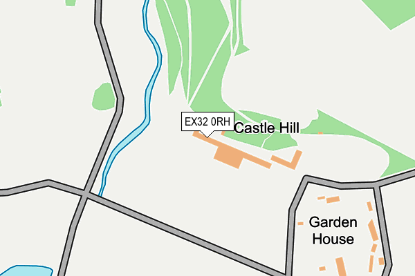
EX32 0RH is located in the Chittlehampton electoral ward, within the local authority district of North Devon and the English Parliamentary constituency of North Devon. The Sub Integrated Care Board (ICB) Location is NHS Devon ICB - 15N and the police force is Devon & Cornwall. This postcode has been in use since January 1980.


GetTheData
Source: OS OpenMap – Local (Ordnance Survey)
Source: OS VectorMap District (Ordnance Survey)
Licence: Open Government Licence (requires attribution)
| Easting | 267081 |
| Northing | 128485 |
| Latitude | 51.040302 |
| Longitude | -3.897289 |
GetTheData
Source: Open Postcode Geo
Licence: Open Government Licence
| Country | England |
| Postcode District | EX32 |
| ➜ EX32 open data dashboard ➜ See where EX32 is on a map | |
GetTheData
Source: Land Registry Price Paid Data
Licence: Open Government Licence
Elevation or altitude of EX32 0RH as distance above sea level:
| Metres | Feet | |
|---|---|---|
| Elevation | 100m | 328ft |
Elevation is measured from the approximate centre of the postcode, to the nearest point on an OS contour line from OS Terrain 50, which has contour spacing of ten vertical metres.
➜ How high above sea level am I? Find the elevation of your current position using your device's GPS.
GetTheData
Source: Open Postcode Elevation
Licence: Open Government Licence
| Ward | Chittlehampton |
| Constituency | North Devon |
GetTheData
Source: ONS Postcode Database
Licence: Open Government Licence
| Community Primary School | Filleigh | 666m |
| Community Primary School | Filleigh | 690m |
| Sawmills Cross | Stag's Head | 767m |
| Sawmills Cross | Stag's Head | 771m |
| Old Railway Station | Filleigh | 907m |
GetTheData
Source: NaPTAN
Licence: Open Government Licence
GetTheData
Source: ONS Postcode Database
Licence: Open Government Licence


➜ Get more ratings from the Food Standards Agency
GetTheData
Source: Food Standards Agency
Licence: FSA terms & conditions
| Last Collection | |||
|---|---|---|---|
| Location | Mon-Fri | Sat | Distance |
| Old Filliegh Post Office | 16:00 | 12:45 | 774m |
| Heddon | 16:00 | 13:00 | 2,620m |
| East Buckland | 16:15 | 09:30 | 2,826m |
GetTheData
Source: Dracos
Licence: Creative Commons Attribution-ShareAlike
| Facility | Distance |
|---|---|
| Deer Park (Filleigh) Road From Shallowford Bridge To Aller Cross, Filleigh Grass Pitches | 919m |
| West Buckland School West Buckland, Barnstaple Sports Hall, Health and Fitness Gym, Artificial Grass Pitch, Grass Pitches, Swimming Pool, Golf, Squash Courts | 3.1km |
| South Molton Recreation Ground (Closed) North Road, South Molton Grass Pitches | 4.6km |
GetTheData
Source: Active Places
Licence: Open Government Licence
| School | Phase of Education | Distance |
|---|---|---|
| Filleigh Community Primary School Castle Hill, Filleigh, Barnstaple, EX32 0RS | Primary | 687m |
| West Buckland School West Buckland, Barnstaple, EX32 0SS | Not applicable | 3.1km |
| South Molton Community Primary School North Road, South Molton, EX36 3BA | Primary | 4.6km |
GetTheData
Source: Edubase
Licence: Open Government Licence
The below table lists the International Territorial Level (ITL) codes (formerly Nomenclature of Territorial Units for Statistics (NUTS) codes) and Local Administrative Units (LAU) codes for EX32 0RH:
| ITL 1 Code | Name |
|---|---|
| TLK | South West (England) |
| ITL 2 Code | Name |
| TLK4 | Devon |
| ITL 3 Code | Name |
| TLK43 | Devon CC |
| LAU 1 Code | Name |
| E07000043 | North Devon |
GetTheData
Source: ONS Postcode Directory
Licence: Open Government Licence
The below table lists the Census Output Area (OA), Lower Layer Super Output Area (LSOA), and Middle Layer Super Output Area (MSOA) for EX32 0RH:
| Code | Name | |
|---|---|---|
| OA | E00101775 | |
| LSOA | E01020097 | North Devon 013A |
| MSOA | E02004187 | North Devon 013 |
GetTheData
Source: ONS Postcode Directory
Licence: Open Government Licence
| EX32 0RT | Barton Close | 786m |
| EX32 0RN | 887m | |
| EX32 0RE | 927m | |
| EX32 0RU | 1089m | |
| EX32 0SD | Rectory Close | 1170m |
| EX32 0RL | 1204m | |
| EX32 0TJ | 1342m | |
| EX32 0RZ | Albert Villas | 1892m |
| EX37 9RE | 2253m | |
| EX32 0RY | Heddon Cottages | 2263m |
GetTheData
Source: Open Postcode Geo; Land Registry Price Paid Data
Licence: Open Government Licence