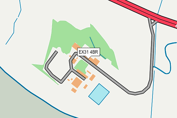
EX31 4BR is located in the Heanton Punchardon electoral ward, within the local authority district of North Devon and the English Parliamentary constituency of North Devon. The Sub Integrated Care Board (ICB) Location is NHS Devon ICB - 15N and the police force is Devon & Cornwall. This postcode has been in use since January 1980.


GetTheData
Source: OS OpenMap – Local (Ordnance Survey)
Source: OS VectorMap District (Ordnance Survey)
Licence: Open Government Licence (requires attribution)
| Easting | 253380 |
| Northing | 134284 |
| Latitude | 51.089077 |
| Longitude | -4.094934 |
GetTheData
Source: Open Postcode Geo
Licence: Open Government Licence
| Country | England |
| Postcode District | EX31 |
| ➜ EX31 open data dashboard ➜ See where EX31 is on a map | |
GetTheData
Source: Land Registry Price Paid Data
Licence: Open Government Licence
Elevation or altitude of EX31 4BR as distance above sea level:
| Metres | Feet | |
|---|---|---|
| Elevation | 10m | 33ft |
Elevation is measured from the approximate centre of the postcode, to the nearest point on an OS contour line from OS Terrain 50, which has contour spacing of ten vertical metres.
➜ How high above sea level am I? Find the elevation of your current position using your device's GPS.
GetTheData
Source: Open Postcode Elevation
Licence: Open Government Licence
| Ward | Heanton Punchardon |
| Constituency | North Devon |
GetTheData
Source: ONS Postcode Database
Licence: Open Government Licence
| November 2021 | Public order | On or near A361 | 460m |
| October 2021 | Anti-social behaviour | On or near A361 | 460m |
| July 2021 | Violence and sexual offences | On or near A361 | 460m |
| ➜ Get more crime data in our Crime section | |||
GetTheData
Source: data.police.uk
Licence: Open Government Licence
| Midland Caravan Park (A361) | Ashford | 326m |
| Midland Caravan Park (A361) | Ashford | 382m |
| Garden Centre (A361) | Ashford | 832m |
| Garden Centre (A361) | Ashford | 851m |
| Meadowside (Strand Lane) | Ashford | 961m |
| Barnstaple Station | 2.8km |
GetTheData
Source: NaPTAN
Licence: Open Government Licence
GetTheData
Source: ONS Postcode Database
Licence: Open Government Licence


➜ Get more ratings from the Food Standards Agency
GetTheData
Source: Food Standards Agency
Licence: FSA terms & conditions
| Last Collection | |||
|---|---|---|---|
| Location | Mon-Fri | Sat | Distance |
| Ashford Meadowside | 17:15 | 13:00 | 864m |
| Pottington Est | 17:15 | 12:00 | 1,581m |
| Bradiford | 17:15 | 12:15 | 1,757m |
GetTheData
Source: Dracos
Licence: Creative Commons Attribution-ShareAlike
| Facility | Distance |
|---|---|
| Platform Gym Riverside Road, Pottington Business Park, Barnstaple Studio, Health and Fitness Gym | 768m |
| Barnstaple Hotel Health & Leisure Club Braunton Road, Barnstaple Health and Fitness Gym, Swimming Pool | 1.4km |
| Pilton Community College Chaddiford Lane, Barnstaple Sports Hall, Grass Pitches, Health and Fitness Gym, Artificial Grass Pitch | 1.8km |
GetTheData
Source: Active Places
Licence: Open Government Licence
| School | Phase of Education | Distance |
|---|---|---|
| Pilton Community College Chaddiford Lane, Barnstaple, EX31 1RB | Secondary | 1.8km |
| Sticklepath Community Primary Academy Woodville Estate, Barnstaple, EX31 2HH | Primary | 2km |
| Pathfield School Abbey Road, Pilton, Barnstaple, EX31 1JU | Not applicable | 2km |
GetTheData
Source: Edubase
Licence: Open Government Licence
The below table lists the International Territorial Level (ITL) codes (formerly Nomenclature of Territorial Units for Statistics (NUTS) codes) and Local Administrative Units (LAU) codes for EX31 4BR:
| ITL 1 Code | Name |
|---|---|
| TLK | South West (England) |
| ITL 2 Code | Name |
| TLK4 | Devon |
| ITL 3 Code | Name |
| TLK43 | Devon CC |
| LAU 1 Code | Name |
| E07000043 | North Devon |
GetTheData
Source: ONS Postcode Directory
Licence: Open Government Licence
The below table lists the Census Output Area (OA), Lower Layer Super Output Area (LSOA), and Middle Layer Super Output Area (MSOA) for EX31 4BR:
| Code | Name | |
|---|---|---|
| OA | E00101837 | |
| LSOA | E01020110 | North Devon 005E |
| MSOA | E02004179 | North Devon 005 |
GetTheData
Source: ONS Postcode Directory
Licence: Open Government Licence
| EX31 4AU | Braunton Road | 578m |
| EX31 4BS | Meadowside | 880m |
| EX31 4BW | Strand Lane | 917m |
| EX31 4BT | 949m | |
| EX31 4BP | Ashfield Close | 1028m |
| EX31 4AE | Strand Close | 1032m |
| EX31 1HN | Upcott Avenue | 1078m |
| EX31 4BY | Ashfield Lane | 1098m |
| EX31 4BZ | 1170m | |
| EX31 4DR | 1197m |
GetTheData
Source: Open Postcode Geo; Land Registry Price Paid Data
Licence: Open Government Licence